Natural landmarks · Scottish Highlands
Dùn da Ghaoithe
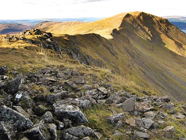
Dùn da Ghaoithe — 766m high mountain in Argyll and Bute, Scotland, UK.

Wikimedia Commons contributors — see linked file page for photographer and licence licence
Plan your visit
- Typical visit
- 1 h–2 h
- Free entry
- Dog-friendly
About
Dùn da Ghaoithe is a named natural landmark in the United Kingdom. Wikidata describes it as: "766m high mountain in Argyll and Bute, Scotland, UK". Coordinates: 56.4604°, -5.7795°.
Photo gallery
From the Wikipedia article
Dùn da Ghaoithe (Scottish Gaelic: Dùn da Ghaoithe, meaning "fort of the two winds") is the second highest mountain on the Isle of Mull, western Scotland, and the island's only Corbett. It reaches 766 metres (2,513 ft) high, but "its long ridge and deep corries make it seem far higher". It boasts sea views "in almost every direction", and is the main mountain seen by visitors to the island on leaving the Caledonian MacBrayne ferry from Oban at Craignure.
Excerpt from Wikipedia under CC BY-SA 4.0. See the source article linked in Sources below.
- Coordinates
- 56.4604, -5.7795
- Address
- Argyll and Bute, Scotland
Sources
- wikidata: Q5320418 (CC0)
- wikipedia: Dùn da Ghaoithe (CC BY-SA 4.0)
- commons: Southern ridge of Dun da Ghaoithe.jpg (CC BY-SA 4.0)
Other places nearby
Loading nearby places…
Nearby
 📷 3
📷 3Mountains & hills · Scottish Highlands
Dùn da Ghaoithe
Dùn da Ghaoithe — Named summit at 766 m.
 📷 3
📷 3Mountains & hills · Scottish Highlands
Mainnir nam Fiadh
Mainnir nam Fiadh — a mountain in scotland-highlands, United Kingdom.
 📷 3
📷 3Mountains & hills · Scottish Highlands
Beinn Thunicaraidh
Beinn Thunicaraidh — a mountain in scotland-highlands, United Kingdom.
 📷 2
📷 2Mountains & hills · Scottish Highlands
Beinn Mheadhon
Beinn Mheadhon — a mountain in scotland-highlands, United Kingdom.
 📷 4
📷 4Mountains & hills · Scottish Islands
Torosay transmitting station
Torosay transmitting station in Scotland Islands, United Kingdom.
 📷 3
📷 3Archaeological sites · Scottish Highlands
Scallastle Bay, dun site
Scallastle Bay, dun site — a archaeological in scotland-highlands, United Kingdom.
More natural landmarks in this region
 Flagship📷 3
Natural landmarks · Scottish Highlands
Dunalastair Water
Dunalastair Water — lake in Perth and Kinross, Scotland, UK, on the River Tummel.
 Flagship📷 3
Natural landmarks · Scottish Highlands
Loch Arkaig
Loch Arkaig — lake in Highland, Scotland, UK, outflows east to River Arkaig.
 Flagship📷 3
Natural landmarks · Scottish Highlands
Loch Assynt
Loch Assynt — lake in Highland, Scotland, UK, outflows to the River Inver and Loch na Garbh Uidhe.
 Flagship📷 3
Natural landmarks · Scottish Highlands
Loch Awe
Loch Awe — lake in Argyll and Bute, Scotland, UK, outflows to the River Awe.
Frequently asked questions
- Where is Dùn da Ghaoithe?
- Dùn da Ghaoithe is in Scottish Highlands, in the United Kingdom — coordinates 56.4604°, -5.7795°.
- Is Dùn da Ghaoithe free to visit?
- Yes — admission to Dùn da Ghaoithe is free.