Natural landmarks · Scottish Highlands
Beinn Odhar
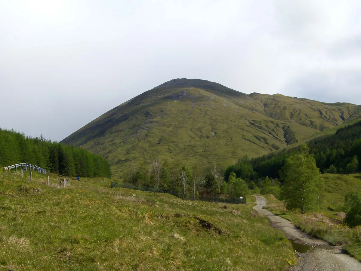
Beinn Odhar — mountain in Argyll and Bute, Scotland, UK.

Wikimedia Commons contributors — see linked file page for photographer and licence licence
Plan your visit
- Typical visit
- 1 h–2 h
- Nearest railway station
- Upper Tyndrum · 3.7 km
- Free entry
- Dog-friendly
About
Beinn Odhar is a named natural landmark in the United Kingdom. Wikidata describes it as: "mountain in Argyll and Bute, Scotland, UK". Coordinates: 56.4680°, -4.6984°.
Photo gallery
From the Wikipedia article
Beinn Odhar is a Scottish mountain situated at the northern extremity of the Loch Lomond and the Trossachs National Park. It stands four km (2.5 mi) north of Tyndrum, a location with which it has strong ties, being well seen from the village. The mountain lies on the border between Argyll and Bute and Stirling council areas within the Auch and Invermeran estate.
Excerpt from Wikipedia under CC BY-SA 4.0. See the source article linked in Sources below.
Background
Description
Beinn Odhar reaches a height of 901 metres (2956 feet) making it the 18th highest Corbett, failing to make Munro status by just 13 metres. The hill also qualifies as a Marilyn having a considerable prominence of 457 metres making it an excellent viewpoint. The grassy, steep, conical shape of Beinn Odhar is a well-known sight for vehicles travelling on the A82 road and for walkers on the West Highland Way, both of which pass on the immediate western side of the mountain. Beinn Odhar stands four km south of the Munro Beinn Dorain, both mountains being similar in shape and character and the possibility of confusing the two peaks by a cursory glance is not impossible. Beinn Odhar is part of the…
Sourced from Wikipedia under CC BY-SA 4.0.
- Coordinates
- 56.4680, -4.6984
- Address
- Argyll and Bute/Stirling, Scotland
- Nearest railway station
- Upper Tyndrum — 3.7 km
Sources
- wikidata: Q4881337 (CC0)
- wikipedia: Beinn Odhar (CC BY-SA 4.0)
- commons: Beinn Odhar 6.jpg (CC BY-SA 4.0)
Other places nearby
Loading nearby places…
Nearby
 📷 3
📷 3Mountains & hills · Scottish Highlands
Beinn Odhar
Beinn Odhar — Named summit at 901 m.
 📷 3
📷 3Natural landmarks · Scottish Highlands
Eas nam Beatach
Eas nam Beatach in Scotland Islands, United Kingdom.
 📷 3
📷 3Memorials & monuments · Scottish Highlands
G. Harris Memorial Cairn
G. Harris Memorial Cairn — a memorial in scotland-highlands, United Kingdom.
 📷 5
📷 5Historic bridges · Scottish Highlands
Allt Kinglass bridge
Allt Kinglass bridge — category B listed building-listed bridge in scotland-highlands, United Kingdom.
 📷 3
📷 3Mountains & hills · Scottish Highlands
Beinn a' Chaisteil
Beinn a' Chaisteil — Named summit at 886 m.
 📷 3
📷 3Natural landmarks · Scottish Highlands
Beinn a' Chaisteil
Beinn a' Chaisteil — 886m mountain on the Argyll and Bute, and Perth and Kinross border, Scotland, UK.
More natural landmarks in this region
 Flagship📷 3
Natural landmarks · Scottish Highlands
Dunalastair Water
Dunalastair Water — lake in Perth and Kinross, Scotland, UK, on the River Tummel.
 Flagship📷 3
Natural landmarks · Scottish Highlands
Loch Arkaig
Loch Arkaig — lake in Highland, Scotland, UK, outflows east to River Arkaig.
 Flagship📷 3
Natural landmarks · Scottish Highlands
Loch Assynt
Loch Assynt — lake in Highland, Scotland, UK, outflows to the River Inver and Loch na Garbh Uidhe.
 Flagship📷 3
Natural landmarks · Scottish Highlands
Loch Awe
Loch Awe — lake in Argyll and Bute, Scotland, UK, outflows to the River Awe.
Frequently asked questions
- Where is Beinn Odhar?
- Beinn Odhar is in the Scottish Highlands, United Kingdom.
- Is Beinn Odhar free to visit?
- Yes, Beinn Odhar is free to enter.
- How do I get to Beinn Odhar?
- The nearest railway station is Upper Tyndrum, about 3.7 km away.