Hill forts · South West England
Bartinney Castle
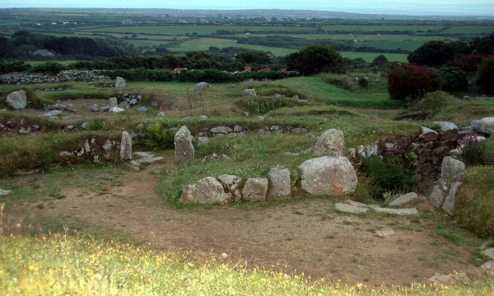
Bartinney Castle — Iron Age enclosure in Cornwall, England, UK.

Wikimedia Commons contributors — see linked file page for photographer and licence licence
Plan your visit
- Typical visit
- 1 h–2 h
- Nearest railway station
- Penzance · 8.3 km
- Free entry
- Dog-friendly
About
Bartinney Castle is a hill fort in the United Kingdom. Heritage designation: scheduled monument. Wikidata describes it as: "Iron Age enclosure in Cornwall, England, UK". Coordinates: 50.1067°, -5.6452°.
Photo gallery
Protected designations
- Site of Special Scientific Interest: Aire Point to Carrick Du SSSI
- Site of Special Scientific Interest: West Penwith Moors and Downs SSSI
- Area of Outstanding Natural Beauty: Cornwall
Designations sourced from Natural England open data under OGL v3.
From the Wikipedia article
Bartinney Castle is an Iron Age enclosure located in the Penwith Peninsula of Southwest Cornwall, England, it is surrounded by a circular earthwork standing on a hill surrounded by various archaeological prehistoric remains, including ancient settlements, field systems, tumuli and cairns. One mile to the southwest is Carn Brea, the westernmost hill in Britain; and a mile to the southeast is Carn Euny Iron Age village and fogou, and the neighbouring Caer Bran hillfort and Sancreed Beacon. On the hilltop are the remains of a circular bank, about 250 feet across, and an encircling ditch. This bank may have been much higher and there are suggestions the site could have been a sacred enclosure or Plen an Gwarry, which was a type of amphitheatre with rows of stone seats where feast days or fire festivals celebrating the Celtic solar god, Belenos, were held or where mystery plays were staged. Other theories suggest a large disc barrow or an unfinished hill fort; the outer wall is not high enough to have been of any defensive value. In the centre of the enclosure are three smaller circles arranged in a triangle, originally made of contiguous stones which have since been removed. The largest of these is forty feet in diameter; the other two are about 25 and 30 feet across. Local parish records suggest that Bartinney Castle was the site of a Celtic fire festival marking the harvest or Samhain, the Celtic New Year's Day. The name Bartinè signifies the lighted eminence, or the hill of fires (Cornish - Bretanow). The Druids, it is said, had their fires on the eve of November, when the people were obliged to resort and re-kindle the private fires in their houses from the consecrated fires of the Druids, the domestic fire having been first carefully extinguished. On Midsummer's Day, in recent times, the inhabitants, of this parish were greeted with sounds resembling the discharge of musketry in different directions, proceeding from holes bored in rocks, which being charged with…
Excerpt from Wikipedia under CC BY-SA 4.0. See the source article linked in Sources below.
- Coordinates
- 50.1067, -5.6452
- District
- Cornwall
- Parish
- St. Just
- Postcode
- TR19 7RR
- Parliamentary constituency
- St Ives
- Nearest railway station
- Penzance — 8.3 km
Sources
- wikidata: Q4865329 (CC0)
- wikipedia: Bartinney Castle (CC BY-SA 4.0)
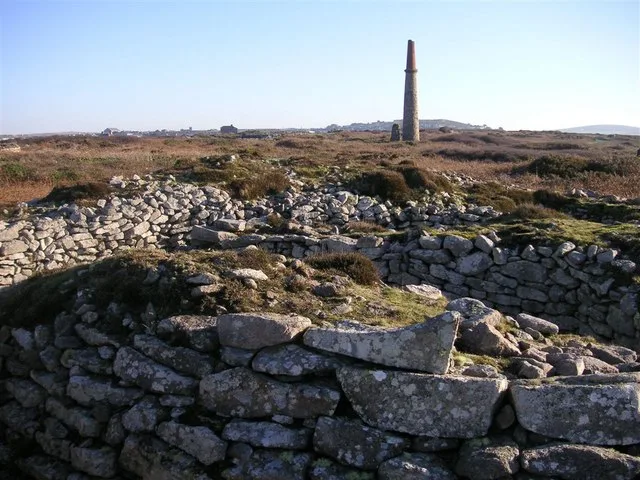
- commons: Trig point on Bartinney Down - geograph.org.uk - 3288507.jpg (CC BY-SA 4.0)
Featured in this guide
Other places nearby
Loading nearby places…
Nearby
 📷 3
📷 3Castles · South West England
Bartine Castle
Bartine Castle — a castle in england-south-west, United Kingdom.
 📷 5
📷 5Hill forts · South West England
Carn Euny
Carn Euny — archaeological site near Sancreed, Cornwall, England.
 📷 3
📷 3Memorials & monuments · South West England
Brane Barrow
Brane Barrow, or Chapel Euny Barrow, is a Neolithic entrance grave located near the hamlet of Brane, Cornwall, England, United Kingdom. It is considered to be one of the smallest and best preserved bu
 📷 3
📷 3Archaeological sites · South West England
Caer Bran
Caer Bran — a archaeological in england-south-west, United Kingdom.
Vineyards · South West England
Caer Bran
Iron Age defended settlement, 330m south east of Caer Bran Farm, Cornwall, England, UK
 📷 3
📷 3Archaeological sites · South West England
enclosure
enclosure — a archaeological in england-south-west, United Kingdom.
More places in this region
 📷 5
📷 5Hill forts · South West England
Ballowall Barrow
Ballowall Barrow — archaeological site in St Just, Cornwall, England, UK.
 📷 5
📷 5Hill forts · South West England
Barnstaple Castle
Barnstaple Castle — castle in Devon, England, UK.
 📷 5
📷 5Hill forts · South West England
Berry's Wood
Berry's Wood — iron Age hill fort in south Devon, England, UK.
 📷 5
📷 5Hill forts · South West England
Boscawen-Un
Boscawen-Un — stone circle in Cornwall.
Frequently asked questions
- Where is Bartinney Castle?
- Bartinney Castle is in South-West England, United Kingdom (postcode TR19 7RR), in the parish of St. Just.
- Is Bartinney Castle a listed building?
- Bartinney Castle is officially recognised as scheduled monument listed.
- Is Bartinney Castle a protected site?
- Yes — Bartinney Castle is part of the Aire Point to Carrick Du SSSI Site of Special Scientific Interest and the West Penwith Moors and Downs SSSI Site of Special Scientific Interest.
- Is Bartinney Castle free to visit?
- Yes, Bartinney Castle is free to enter.
- How do I get to Bartinney Castle?
- Drivers can navigate to postcode TR19 7RR. It sits within the St Ives parliamentary constituency.