Archaeological sites · South East England
Barbury Castle Farm deserted Medieval village
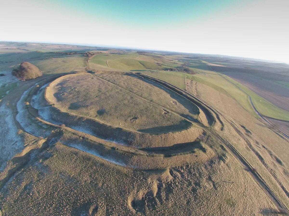
Barbury Castle Farm deserted Medieval village — archaeological site in Ogbourne St Andrew, Wiltshire, England, UK.
.jpg?width=1200)
Wikimedia Commons contributors — see linked file page for photographer and licence licence
.jpg)
Plan your visit
- Typical visit
- 45 min–1.5 h
- Nearest railway station
- Lakeside · 7.4 km
- Free entry
- Dog-friendly
About
Barbury Castle Farm deserted Medieval village is an archaeological site in the United Kingdom. Heritage designation: scheduled monument. Wikidata describes it as: "archaeological site in Ogbourne St Andrew, Wiltshire, England, UK". Coordinates: 51.4811°, -1.7831°.
Photo gallery
Protected designations
- Area of Outstanding Natural Beauty: Cotswolds
- Area of Outstanding Natural Beauty: North Wessex Downs
Designations sourced from Natural England open data under OGL v3.
Place summary
Barbury Castle Farm is a deserted medieval village located in South-East England. It is designated as a scheduled monument and lies within the Areas of Outstanding Natural Beauty of the Cotswolds and North Wessex Downs. The site offers insights into medieval settlement patterns and rural life.
AI-generated from the structured facts on this page (operator, designation, listing, era). Not a substitute for visiting.
- Coordinates
- 51.4811, -1.7831
- District
- Swindon
- Parish
- Wroughton
- Postcode
- SN4 0QH
- Parliamentary constituency
- East Wiltshire
- Nearest railway station
- Lakeside — 7.4 km
Sources
- wikidata: Q17675836 (CC0)
- commons: Barbury Castle Aerial View (2).jpg (CC BY-SA 4.0)
Other places nearby
Loading nearby places…
Nearby
 📷 5
📷 5Hill forts · South East England
Barbury Castle
Barbury Castle — hill fort in England.
 📷 5
📷 5Public art & sculpture · South East England
Farley Henge
Farley Henge — a public art in england-south-east, United Kingdom.
 📷 5
📷 5Burial mounds & barrows · South East England
Burderop Down Tumulus
Burderop Down Tumulus — a burial mound in england-south-east, United Kingdom.
 📷 5
📷 5Natural landmarks · South East England
Hackpen White Horse
Hackpen White Horse — a other in england-south-east, United Kingdom.
 📷 5
📷 5Memorials & monuments · South East England
RAF Princess Alexandra Hospital
RAF Princess Alexandra Hospital — a memorial in england-south-east, United Kingdom.
📷 5Public art & sculpture · South East England
Cipher Wave
Cipher Wave — a public art in england-south-east, United Kingdom.
More archaeological sites in this region
 Flagship📷 6
Archaeological sites · South East England
America Wood
America Wood — biological Site of Special Scientific Interest on the Isle of Wight.
 Flagship📷 10
Archaeological sites · South East England
Bisham Woods
Bisham Woods — woodland in Berkshire, England.
 Flagship📷 10
Archaeological sites · South East England
Savernake Forest
Savernake Forest — 4500 acre forest in Wiltshire, England.
 📷 5
📷 5Archaeological sites · South East England
A quadrangular castle and its landscaped setting, an associated millpond, medieval crofts and cultivation earthworks, and a World War II pillbox at Bodiam
A quadrangular castle and its landscaped setting, an associated millpond, medieval crofts and cultivation earthworks, and a World War II pillbox at Bodiam — archaeological site in Bodiam, Rother, England, UK.
Frequently asked questions
- Where is Barbury Castle Farm deserted Medieval village?
- Barbury Castle Farm deserted Medieval village is in South-East England, United Kingdom (postcode SN4 0QH), in the parish of Wroughton.
- Is Barbury Castle Farm deserted Medieval village a listed building?
- Barbury Castle Farm deserted Medieval village is officially recognised as scheduled monument listed.
- Is Barbury Castle Farm deserted Medieval village a protected site?
- Yes — Barbury Castle Farm deserted Medieval village is part of the Cotswolds National Landscape (AONB) and the North Wessex Downs National Landscape (AONB).
- How do I get to Barbury Castle Farm deserted Medieval village?
- The nearest railway station is Lakeside, about 7.4 km away. Drivers can navigate to postcode SN4 0QH.