Hill forts · West Midlands
Aves ditch
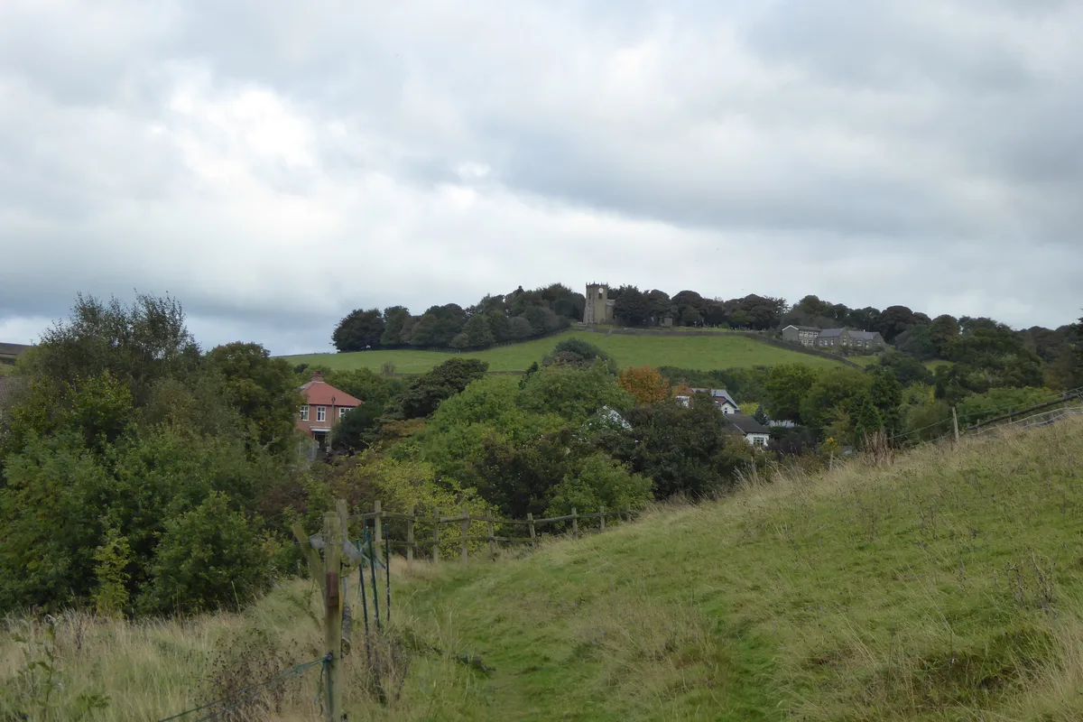
Aves ditch — archaeological site in Oxfordshire.

Wikimedia Commons licence
Plan your visit
- Typical visit
- 1 h–2 h
- Nearest railway station
- Heyford · 3.1 km
- Free entry
- Dog-friendly
About
Aves ditch is a hill fort in the United Kingdom. Wikidata describes it as: "archaeological site in Oxfordshire". Coordinates: 51.9040°, -1.2610°.
Photo gallery
From the Wikipedia article
Aves Ditch (also known as Ash Bank, or Wattle Bank) is an Iron Age ditch and bank structure running about 3 miles (4.8 km) on a northeast to southwest alignment in the Cherwell District of Oxfordshire. It was once believed to have been a Roman road but excavation has shown it to be a boundary dyke of Iron Age date that was reused in the Anglo-Saxon period. A skull found in the ditch was dated to the Anglo-Saxon period. It now forms the boundary between the civil parishes of Lower Heyford and Middleton Stoney. Both Sauer and Lambrick have suggested that the Aves Ditch along with the North Oxfordshire Grim’s Ditch and the South Oxfordshire Grim’s Ditch may have formed the boundary between the Iron Age tribes of the Dobunni and the Catuvellauni.
Excerpt from Wikipedia under CC BY-SA 4.0. See the source article linked in Sources below.
- Coordinates
- 51.9040, -1.2610
- County
- Oxfordshire
- District
- Cherwell
- Parish
- Lower Heyford
- Postcode
- OX25 4NF
- Parliamentary constituency
- Bicester and Woodstock
- Nearest railway station
- Heyford — 3.1 km
Sources
- wikidata: Q4828423 (CC0)
- wikipedia: Aves ditch (CC BY-SA 4.0)
Other places nearby
Loading nearby places…
Nearby
_p5.140_-_Middleton_Park%2C_Oxfordshire.jpg?width=1200) 📷 2
📷 2Historic houses · West Midlands
Middleton Park, Oxfordshire
Middleton Park, Oxfordshire — a Grade I-listed historic house in england-west-midlands, United Kingdom.
 📷 3
📷 3Archaeological sites · West Midlands
Ash Bank
Ash Bank — a archaeological in england-west-midlands, United Kingdom.
 📷 3
📷 3Castles · West Midlands
Middleton Stoney Castle
Middleton Stoney Castle — a castle in england-west-midlands, United Kingdom.
 📷 3
📷 3Historic bridges · West Midlands
Oxford Canal Bridge At Dashwood Lock
Oxford Canal Bridge At Dashwood Lock — Grade II listed building-listed bridge in england-west-midlands, United Kingdom.
 📷 3
📷 3Historic bridges · West Midlands
Bridge 400 Metres North Of Dashwood Lock
Bridge 400 Metres North Of Dashwood Lock — Grade II listed building-listed bridge in england-west-midlands, United Kingdom.
Campsites · West Midlands
Heyford Leys
Heyford Leys — a campsite in england west midlands.
More places in this region
 Flagship📷 3
Hill forts · West Midlands
Mellor hill fort
Mellor hill fort — prehistoric site in North West England.
 📷 3
📷 3Hill forts · West Midlands
Ariconium
Ariconium — Ariconium was a road station of Roman Britain mentioned in Iter XIII of the Iter Britanniarum of the Antonine Itineraries. It was located at Bury Hill.
 📷 3
📷 3Hill forts · West Midlands
Ascot d'Oilly Castle
Ascot d'Oilly Castle — castle in Oxfordshire, England, UK.
 📷 5
📷 5Hill forts · West Midlands
Bannaventa
Bannaventa — settlement in Northamptonshire, England.
Frequently asked questions
- Where is Aves ditch?
- Aves ditch is in Oxfordshire, the West Midlands, United Kingdom (postcode OX25 4NF), in the parish of Lower Heyford.
- Is Aves ditch free to visit?
- Yes, Aves ditch is free to enter.
- How do I get to Aves ditch?
- The nearest railway station is Heyford, about 3.1 km away. Drivers can navigate to postcode OX25 4NF.