Castles · West Midlands
Altrincham
Altrincham ( OL-tring-əm, locally ) is a market town in the Metropolitan Borough of Trafford, Greater Manchester, England. It is located south of the River Mersey, 8 miles (13 km) south-west of Manch

Richard Sutcliffe — CC BY-SA 2.0 via Wikimedia Commons licence
Plan your visit
- Typical visit
- 1.5 h–3 h
- Family-friendly
- Limited wheelchair access
About
Altrincham ( OL-tring-əm, locally ) is a market town in the Metropolitan Borough of Trafford, Greater Manchester, England. It is located south of the River Mersey, 8 miles (13 km) south-west of Manchester, 3 miles (5 km) south-west of Sale and 10 miles (16 km) east of Warrington. At the 2021 census, the built up area had a population of 49,680. It lies within the historic county boundaries of Cheshire and became part of Greater Manchester in 1974. Altrincham developed as a market town following the right to hold a market being granted in 1290; the market continues today. Further socioeconomic development came with the extension of the Bridgewater Canal to Altrincham in 1765 and the arrival of the railway in 1849, stimulating industrial activity in the town. Outlying villages were absorbed by Altrincham's subsequent growth, along with the grounds of Dunham Massey Hall, formerly the home of the Earl of Stamford and now a tourist attraction, with three Grade I listed buildings and a deer park. Altrincham has good transport links to Manchester, Sale, Stretford and Stockport, among other destinations. The town has a strong middle-class presence; there has been a steady increase in Altrincham's middle classes since the 19th century. It is also home to Altrincham F.C. and three ice hockey clubs: Manchester Storm, Altrincham Aces and Trafford Tornados.
Photo gallery
From the Wikipedia article
Altrincham ( OL-tring-əm, locally ) is a market town in the Metropolitan Borough of Trafford, Greater Manchester, England. It is located south of the River Mersey, 8 miles (13 km) south-west of Manchester, 3 miles (5 km) south-west of Sale and 10 miles (16 km) east of Warrington. At the 2021 census, the built up area had a population of 49,680. It lies within the historic county boundaries of Cheshire and became part of Greater Manchester in 1974. Altrincham developed as a market town following the right to hold a market being granted in 1290; the market continues today. Further socioeconomic development came with the extension of the Bridgewater Canal to Altrincham in 1765 and the arrival of the railway in 1849, stimulating industrial activity in the town. Outlying villages were absorbed by Altrincham's subsequent growth, along with the grounds of Dunham Massey Hall, formerly the home of the Earl of Stamford and now a tourist attraction, with three Grade I listed buildings and a deer park. Altrincham has good transport links to Manchester, Sale, Stretford and Stockport, among other destinations. The town has a strong middle-class presence; there has been a steady increase in Altrincham's middle classes since the 19th century. It is also home to Altrincham F.C. and three ice hockey clubs: Manchester Storm, Altrincham Aces and Trafford Tornados.
Excerpt from Wikipedia under CC BY-SA 4.0. See the source article linked in Sources below.
Background
History
Local evidence of prehistoric human activity exists in the form of two Neolithic arrowheads found in Altrincham and, further afield, a concentration of artefacts around Dunham. The remains of a Roman road, part of one of the major Roman roads in North West England connecting the legionary fortresses of Chester (Deva Victrix) and York (Eboracum), run through the Broadheath area. As it shows signs of having been repaired, the road was in use for a considerable period of time. The town's name first appears as Aldringeham, probably meaning "homestead of Aldhere's people". As recently as the 19th century, it was spelt both Altrincham and Altringham. Until the Normans invaded England, the manors…
Sourced from Wikipedia under CC BY-SA 4.0.
- Coordinates
- 53.3838, -2.3547
- District
- Trafford
- Parish
- Trafford, unparished area
- Postcode
- WA14 2QD
- Parliamentary constituency
- Altrincham and Sale West
Sources
- wikipedia: Altrincham (CC BY-SA 4.0)
Other places nearby
Loading nearby places…
Nearby
 📷 3
📷 3Public art & sculpture · West Midlands
Borat Mask
Borat Mask — a public art in england-west-midlands, United Kingdom.
 📷 3
📷 3Theatres · West Midlands
Altrincham Little Theatre
Altrincham Little Theatre is a theatre in the United Kingdom.
 📷 3
📷 3Memorials & monuments · West Midlands
Chapel Street Plaque
Chapel Street Plaque — a memorial in england-west-midlands, United Kingdom.
 📷 3
📷 3Galleries · West Midlands
The Contemporary
The Contemporary — a gallery in england-west-midlands, United Kingdom.
Cinemas · West Midlands
Everyman Altrincham
Everyman Altrincham — a cinema in england west midlands. Brand: Everyman Cinemas.
Cinemas · West Midlands
Vue Altrincham
Vue Altrincham — a cinema in england west midlands.
More castles in this region
 📷 3
📷 3Castles · West Midlands
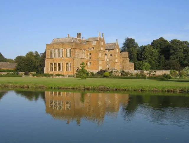
Broughton Castle
Broughton Castle — medieval manor house in Oxfordshire, England, UK.
 📷 3
📷 3Castles · West Midlands
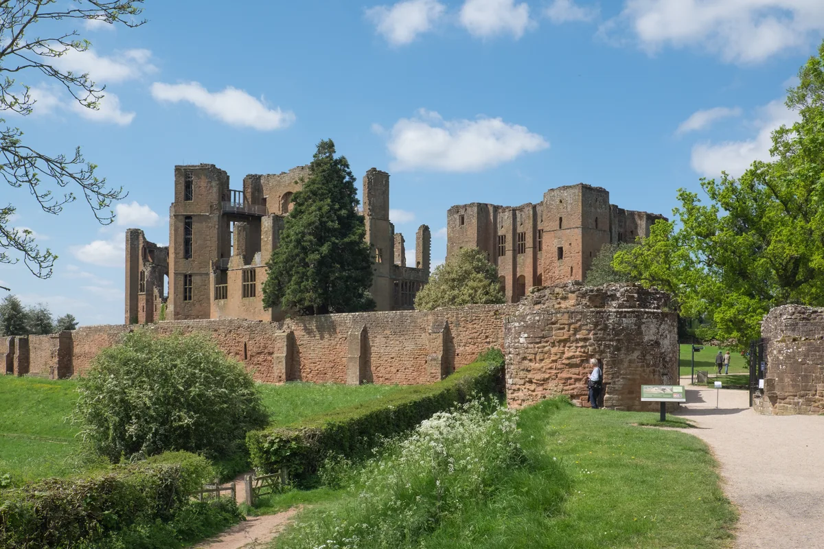
Kenilworth Castle
Kenilworth Castle — castle ruin in the town of Kenilworth, Warwickshire, England, UK.
 📷 3
📷 3Castles · West Midlands
Allesley Castle
Allesley Castle — motte-and-bailey castle in Coventry, West Midlands, England, UK.
 📷 3
📷 3Castles · West Midlands
Ardley Castle
Ardley Castle is a castle in the United Kingdom.
Frequently asked questions
- Where is Altrincham?
- Altrincham is in the West Midlands, United Kingdom (postcode WA14 2QD), in the parish of Trafford, unparished area.
- Does Altrincham charge admission?
- Altrincham typically charges admission. Check the official site for current ticket prices and opening hours.
- How do I get to Altrincham?
- Drivers can navigate to postcode WA14 2QD. It sits within the Altrincham and Sale West parliamentary constituency.