Historic bridges · Yorkshire & the Humber
Aldwark Bridge
Aldwark Bridge is a historic bridge in the United Kingdom.

Wikimedia Commons contributors — see linked file page for photographer and licence licence
Plan your visit
- Typical visit
- 15 min–30 min
- Nearest railway station
- Hammerton · 6.3 km
- Free entry
- Dog-friendly
About
Aldwark Bridge is a named historic bridge in the United Kingdom. Coordinates: 54.0534°, -1.2883°. This entry is part of The Great Britain Guide, a free, ad-free, open-data tourist directory.
Photo gallery
From the Wikipedia article
Aldwark Bridge is a historic bridge over the River Ure in North Yorkshire, in England. Until the mid-18th century, a ferry connected the two banks of the river at Aldwark. The ferryman in 1768 was John Thomson, and that year, he rode to London to seek permission to construct a bridge, in exchange for collecting tolls. This was granted in the Aldwark Bridge Act 1772 (12 Geo. 3. c. 87), and the bridge opened in 1772. It originally had brick piers and a wooden deck. In 1848, it was described as "a substantial wooden structure, which crosses the river and its banks by twenty-seven arches and culverts". A local legend claims that it was once damaged by an iceberg. In 1880, the central section of the bridge was destroyed during a flood, and the bridge was largely rebuilt, using an iron frame. By 1962, the bridge was owned by Yorkshire Farmers Ltd. The company offered to sell it to the North Riding of Yorkshire County Council, but the council was uninterested, and it remained in private hands. It remains a toll bridge, thought to be the last one wholly in Yorkshire since the fee for crossing Selby toll bridge was abolished in 1991. The toll can only be increased by permission of the Secretary of State for Transport; it was doubled to one penny in 1980, while in 2005, it rose from 15p to 40p. The bridge was purchased by Alex Bell in 2021. In 2022, permission was refused to increase the toll to 80p. In January 2025, Bell announced his intention to raise the toll from 40p to £1, with a future hike to £1.40 scheduled for 2035. The increase was criticised by local teachers who feared the increased cost would prevent children living on one side of the bridge from attending school on the other side. A public enquiry into the fee increase was held in Easingwold in March 2025, and the increase was agreed. The bridge was grade II listed in 1988. The bridge was used by 700,000 vehicles over the course of 1997. It closed in April 2023 for maintenance. The bridge reopened on 17…
Excerpt from Wikipedia under CC BY-SA 4.0. See the source article linked in Sources below.
- Coordinates
- 54.0534, -1.2883
- District
- North Yorkshire
- Parish
- Aldwark
- Postcode
- YO26 9SL
- Parliamentary constituency
- Wetherby and Easingwold
- Nearest railway station
- Hammerton — 6.3 km
Sources
- osm: w1420966361 (ODbL)
- wikipedia: Aldwark Bridge (CC BY-SA 4.0)
- commons: Aldwark Bridge - geograph.org.uk - 1586694.jpg (CC BY-SA 4.0)
Other places nearby
Loading nearby places…
Nearby
Campsites · Yorkshire & the Humber
Burrows Park
Burrows Park — a campsite in england yorkshire.
 📷 3
📷 3Historic bridges · Yorkshire & the Humber
Little Ouseburn Bridge
Little Ouseburn Bridge is a historic bridge in the United Kingdom.
 📷 3
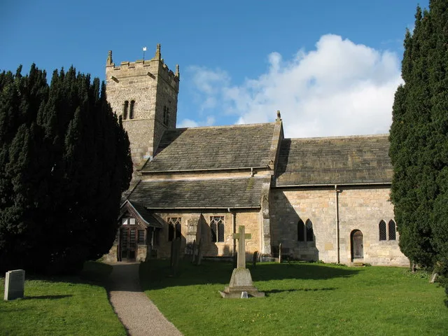
📷 3Historic churches · Yorkshire & the Humber
Holy Trinity Church, Little Ouseburn
Holy Trinity Church, Little Ouseburn — church in Little Ouseburn, North Yorkshire, England, UK.
 📷 3
📷 3Follies · Yorkshire & the Humber
Thompson Mausoleum
Thompson Mausoleum is a folly in the United Kingdom.
 📷 5
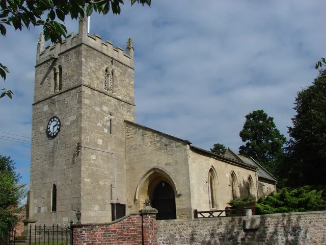
📷 5Historic churches · Yorkshire & the Humber
St Mary the Virgin's Church, Great Ouseburn
St Mary the Virgin's Church, Great Ouseburn — church in Great Ouseburn, Harrogate, North Yorkshire, England, UK.
 📷 5
📷 5Museums · Yorkshire & the Humber
River Ure
River Ure — a museum in england-yorkshire, United Kingdom.
More bridges in this region
.jpg?width=1200) 📷 3
📷 3Historic bridges · Yorkshire & the Humber
Aberford Bridge
Aberford Bridge is a historic bridge in the United Kingdom.
 📷 3
📷 3Historic bridges · Yorkshire & the Humber
Anchor Bridge
Anchor Bridge is a historic bridge in the United Kingdom.
 📷 3
📷 3Historic bridges · Yorkshire & the Humber
Apperley Viaduct
Apperley Viaduct is a historic bridge in the United Kingdom.
📷 3Historic bridges · Yorkshire & the Humber
Apperley Viaduct
Apperley Viaduct is a historic bridge in the United Kingdom.
Frequently asked questions
- Where is Aldwark Bridge?
- Aldwark Bridge is in Yorkshire, United Kingdom (postcode YO26 9SL), in the parish of Aldwark.
- Who owns Aldwark Bridge?
- Aldwark Bridge is owned by | maint =.
- Is Aldwark Bridge free to visit?
- Yes, Aldwark Bridge is free to enter.
- How do I get to Aldwark Bridge?
- The nearest railway station is Hammerton, about 6.3 km away. Drivers can navigate to postcode YO26 9SL.