Cemeteries · West Midlands
Wythall Cemetery
Wythall Cemetery is a cemetery in the United Kingdom.

Robin Stott — CC BY-SA 2.0 via Wikimedia Commons licence
Plan your visit
- Typical visit
- 30 min–1 h
- Nearest railway station
- Wythall · 1.9 km
- Free entry
- Dog-friendly
About
Wythall Cemetery is a named cemetery in the United Kingdom. Coordinates: 52.3741°, -1.8917°. This entry is part of The Great Britain Guide, a free, ad-free, open-data tourist directory.
Photo gallery
From the Wikipedia article
Wythall is a large village and civil parish in the Bromsgrove District, in the northeastern corner of the county of Worcestershire, England. Wythall parish borders Solihull and Birmingham, and had a population of 12,269 in the UK census of 2021. The civil parish was created in 1911 when the remainder of the previous King's Norton civil parish was absorbed into the then County Borough of Birmingham. Wythall village is around 7 miles south of Birmingham City Centre (a 20-minute train journey from Wythall railway station) along Alcester Road. There are a number of 19th century buildings on this road including the Wythall Institute (erected 1888/89). The civil parish of Wythall has always included Drake's Cross, Hollywood and Headley Heath and today also includes Major's Green and the formerly undeveloped Worcestershire part of Walker's Heath. Wythall village itself is generally the area covered by the parish ward of Grimes Hill and the northeastern portion of the Wythall Heath parish ward, combined population 2,080, although the Silver Street and Chapel Lane areas are also usually included (the remainder of the Wythall Heath parish ward additionally includes the subsidiary settlements of Inkford and Tanner's Green along with the Kings Norton Golf Course). The easternmost section of Wythall village, around the railway station, was traditionally referred to as Grimes Hill. The former St Mary's Anglican church has a roof and stair turret added by W.H. Bidlake. There are two primary schools within Wythall parish, the Coppice Primary School in Hollywood and Meadow Green Primary School in Wythall village. There was previously a school in Silver Street from circa 1875 to 1992 which for many years catered for all primary aged school children in Wythall and the surrounding area, until a growing population required more school development. Woodrush High School in Hollywood opened in 1958 for children aged 11 and over, and Shawhurst Infants School (next door to Woodrush) opened…
Excerpt from Wikipedia under CC BY-SA 4.0. See the source article linked in Sources below.
- Coordinates
- 52.3741, -1.8917
- County
- Worcestershire
- District
- Bromsgrove
- Parish
- Wythall
- Postcode
- B47 6JX
- Parliamentary constituency
- Bromsgrove
- Nearest railway station
- Wythall — 1.9 km
Sources
Featured in this guide
Other places nearby
Loading nearby places…
Nearby
Caravan parks · West Midlands
Caravan Club Chapel Lane
Caravan Club Chapel Lane — a caravan park in england west midlands.
 📷 3
📷 3Museums · West Midlands
Transport Museum Wythall
Transport Museum Wythall — a museum in england-west-midlands, United Kingdom.
 📷 4
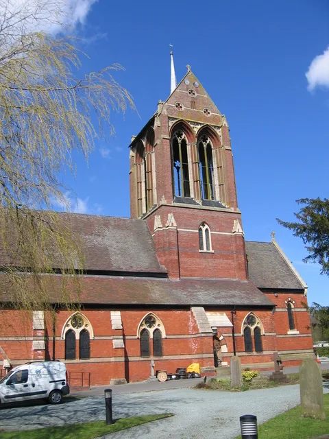
📷 4Historic churches · West Midlands
St Mary's Church, Wythall
St Mary's Church, Wythall — church in Wythall, Worcestershire, England, UK.
📷 3Miniature railways · West Midlands
miniature railway
miniature railway — a miniature railway in england-west-midlands, United Kingdom.
 📷 3
📷 3Towns & cities · West Midlands
Wythall
Wythall — village in Worcestershire, England, UK.
 📷 5
📷 5Memorials & monuments · West Midlands
War Memorial
War Memorial is a memorial in the United Kingdom.
More cemeteries in this region
 📷 5
📷 5Cemeteries · West Midlands
All Saints Church
All Saints Church is a cemetery in the United Kingdom.
 📷 3
📷 3Cemeteries · West Midlands
Aylesbury Vale Burial Meadow
Aylesbury Vale Burial Meadow is a cemetery in the United Kingdom.
 📷 3
📷 3Cemeteries · West Midlands
Barnetts Lane Cemetery
Barnetts Lane Cemetery is a cemetery in the United Kingdom.
 📷 3
📷 3Cemeteries · West Midlands
Belgrave Cemetery
Belgrave Cemetery is a cemetery in the United Kingdom.
Frequently asked questions
- Where is Wythall Cemetery?
- Wythall Cemetery is in West Midlands, in the United Kingdom — coordinates 52.3741°, -1.8917°. The nearest railway station is Wythall, around 1.9 km away.
- Is Wythall Cemetery free to visit?
- Yes — admission to Wythall Cemetery is free.