Towns & cities · London
Wraysbury
Wraysbury — village located in Windsor and Maidenhead, United Kingdom.

Wikimedia Commons contributors — see linked file page for photographer and licence licence
Plan your visit
- Typical visit
- 3 h–6 h
- Nearest railway station
- Wraysbury · 0.7 km
- Free entry
- Family-friendly
- Dog-friendly
About
Wraysbury is a town, city, village or settlement in the United Kingdom. Recent population estimates put it at around 3,641 people. Wikidata describes it as: "village located in Windsor and Maidenhead, United Kingdom". Coordinates: 51.4580°, -0.5520°.
Photo gallery
From the Wikipedia article
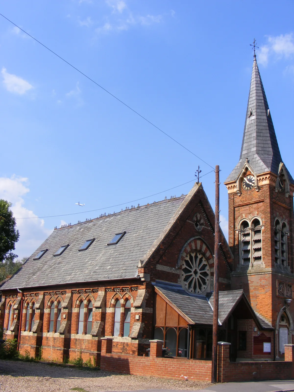
Wraysbury is a village and civil parish in the Royal Borough of Windsor and Maidenhead in England. It is under the western approach path of London Heathrow Airport. It is located on the east bank of the River Thames, roughly midway between Windsor and Staines-upon-Thames, and 18 miles (29 km) west by south-west of London. Historically part of Buckinghamshire, Wraysbury was made part of the new non-metropolitan county of Berkshire in 1974, under the Local Government Act 1972. The Wraysbury Reservoir is located to the east, administratively wholly in the Spelthorne district of Surrey, although it was historically divided between Buckinghamshire and Middlesex.
Excerpt from Wikipedia under CC BY-SA 4.0. See the source article linked in Sources below.
Background
History
Investigation by Windsor and Wraysbury Archaeological Society of a field in the centre of Wraysbury to the east of St Andrew's Church revealed evidence of human activity in Neolithic times. Many hundreds of flint artefacts were found and are now in the care of the Windsor Museum collection. The village name was traditionally spelt Wyrardisbury; it is Anglo Saxon in origin and means "Wigred's fort". Its name is recorded in the Domesday Book of 1086 as Wirecesberie and as Wiredesbur in 1195. The name is seen again as Wyrardesbury in 1422.
Description
The enclosure of the parish of Wraysbury was ordered by a private inclosure act of 1799 and was signed by the commissioners in 1803. The map of the village was redrawn by Thomas Bainbridge and shows the distribution of the lands in the following enclosure. Immediately prior to this the common land of the village was owned by the Lord of the Manor of Wraysbury, at that time John Simon Harcourt, the church and the trustees of William Gyll Esq., although, as common land, they were subject to legal rights of pasture and grazing for copyholders and other tenants. In addition to those with legal rights over the land, the poor of the district would have had 'real' or 'customary rights', for…
Sourced from Wikipedia under CC BY-SA 4.0.
- Coordinates
- 51.4580, -0.5520
- District
- Windsor and Maidenhead
- Parish
- Wraysbury
- Postcode
- TW19 5ND
- Parliamentary constituency
- Windsor
- Population
- 3,641
- Nearest railway station
- Wraysbury — 0.7 km
Sources
- wikidata: Q629786 (CC0)
- wikipedia: Wraysbury (CC BY-SA 4.0)
- commons: High St - geograph.org.uk - 4734001.jpg (CC BY-SA 4.0)
Other places nearby
Loading nearby places…
Nearby
 📷 5
📷 5Historic churches · London
Wraysbury Baptist Chapel
Wraysbury Baptist Chapel — chapel in Berkshire, England.
 📷 5
📷 5Windmills · London
Splash Windmill
Splash Windmill is a windmill in the United Kingdom.
 📷 5
📷 5Canal locks · London
Old Windsor Lock
Old Windsor Lock — lock on the River Thames in Berkshire, England.
 📷 5
📷 5Public art & sculpture · London
River Roads
River Roads — a public art in england-london, United Kingdom.
 📷 5
📷 5Historic churches · London
SS Peter and Andrew's Church, Old Windsor
SS Peter and Andrew's Church, Old Windsor — church in Old Windsor, Berkshire, England, UK.
 📷 5
📷 5Natural landmarks · London
Ankerwycke Yew
Ankerwycke Yew — a other in england-london, United Kingdom.
More towns in this region
 Flagship📷 10
Towns & cities · London
Aldenham
Aldenham — village and civil parish in Hertfordshire, England.
 Flagship📷 10
Towns & cities · London
Ashdon
Ashdon — village and civil parish in Essex, UK.
 Flagship📷 10
Towns & cities · London
Betchworth
Betchworth — village and civil parish in the Mole Valley district of Surrey, England.
 Flagship📷 10
Towns & cities · London
Boxley
Boxley — village and civil parish in Maidstone District, Kent, England, UK.
Frequently asked questions
- Where is Wraysbury?
- Wraysbury is in London, United Kingdom (postcode TW19 5ND), in the parish of Wraysbury.
- Is Wraysbury free to visit?
- Yes, Wraysbury is free to enter.
- How do I get to Wraysbury?
- The nearest railway station is Wraysbury, about 0.7 km away. Drivers can navigate to postcode TW19 5ND.