Archaeological sites · South West England
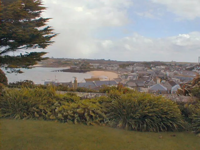
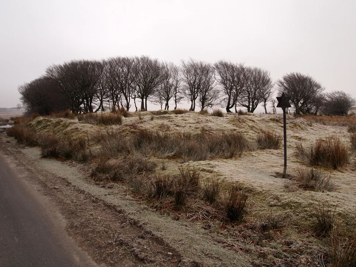
World War II pillbox west of Porth Hellick, 90m north of Drum Rock, St Mary's
World War II pillbox west of Porth Hellick, 90m north of Drum Rock, St Mary's — archaeological site in St Mary's, Scilly Isles, Cornwall, England, UK.

Wikimedia Commons contributors — see linked file page for photographer and licence licence
Plan your visit
- Typical visit
- 45 min–1.5 h
- Free entry
- Dog-friendly
About
World War II pillbox west of Porth Hellick, 90m north of Drum Rock, St Mary's is an archaeological site in the United Kingdom. Heritage designation: scheduled monument. Wikidata describes it as: "archaeological site in St Mary's, Scilly Isles, Cornwall, England, UK". Coordinates: 49.9165°, -6.2868°.
Photo gallery
Protected designations
- Area of Outstanding Natural Beauty: Isles Of Scilly
Designations sourced from Natural England open data under OGL v3.
Place summary
The World War II pillbox, located west of Porth Hellick and 90 metres north of Drum Rock on St Mary's, is an archaeological site in South-West England. It is designated as a scheduled monument and lies within the Area of Outstanding Natural Beauty of the Isles of Scilly.
AI-generated from the structured facts on this page (operator, designation, listing, era). Not a substitute for visiting.
- Coordinates
- 49.9165, -6.2868
- District
- Isles of Scilly
- Parish
- St Mary's
- Postcode
- TR21 0NZ
- Parliamentary constituency
- St Ives
Sources
- wikidata: Q17664707 (CC0)
- commons: World War II Pill Box, Porth Hellick - geograph.org.uk - 910589.jpg (CC BY-SA 4.0)
Other places nearby
Loading nearby places…
Nearby
 📷 5
📷 5Beaches · South West England
Porth Hellick
Porth Hellick is a beach in the United Kingdom.
 📷 5
📷 5Mountains & hills · South West England
Porth Hellick
Porth Hellick — inlet on the island of St Mary's, in the Isles of Scilly, Cornwall, England, UK.
📷 3Memorials & monuments · South West England
Sir Cloudesley Shovell's Grave
Sir Cloudesley Shovell's Grave — a memorial in england-south-west, United Kingdom.
Vineyards · South West England
Kerbed platform cairn on Salakee Down, 190m north west of the Giant's Castle cliff castle, St Mary's
Kerbed platform cairn on Salakee Down, 190m north west of the Giant's Castle cliff castle, St Mary's — a UK vineyard in england south west, producing English or Welsh wine from cool-climate grape varieties.
.jpg?width=1200) 📷 5
📷 5Hill forts · South West England
Porth Hellick Down
Porth Hellick Down — archaeological site on the island of St Mary's, in the Isles of Scilly, Cornwall, England.
 Flagship📷 10
Islands · South West England
St Mary's
St Mary's — UK island of the Isles of Scilly.
More archaeological sites in this region
 📷 3
📷 3Archaeological sites · South West England
A partly enclosed stone hut circle settlement on Kennon Hill
A partly enclosed stone hut circle settlement on Kennon Hill — archaeological site in Throwleigh, West Devon, England, UK.
.jpg?width=1200) 📷 5
📷 5Archaeological sites · South West England
A prehistoric and historic archaeological landscape within Merrivale Newtake
A prehistoric and historic archaeological landscape within Merrivale Newtake — archaeological site in Dartmoor Forest, West Devon, England, UK.
.jpg?width=1200) 📷 5
📷 5Archaeological sites · South West England
A prehistoric settlement with cairns and a historic tin mill, streamwork and buildings lying adjacent to the Langcombe Brook
A prehistoric settlement with cairns and a historic tin mill, streamwork and buildings lying adjacent to the Langcombe Brook — archaeological site in Shaugh Prior, South Hams, England, UK.
 📷 5
📷 5Archaeological sites · South West England
Alderman's Barrow at N of Almsworthy Common
Alderman's Barrow at N of Almsworthy Common — burial mound on Exmoor.
Frequently asked questions
- Where is World War II pillbox west of Porth Hellick, 90m north of Drum Rock, St Mary's?
- World War II pillbox west of Porth Hellick, 90m north of Drum Rock, St Mary's is in South-West England, United Kingdom (postcode TR21 0NZ), in the parish of St Mary's.
- Is World War II pillbox west of Porth Hellick, 90m north of Drum Rock, St Mary's a listed building?
- World War II pillbox west of Porth Hellick, 90m north of Drum Rock, St Mary's is officially recognised as scheduled monument listed.
- Is World War II pillbox west of Porth Hellick, 90m north of Drum Rock, St Mary's a protected site?
- Yes — World War II pillbox west of Porth Hellick, 90m north of Drum Rock, St Mary's is part of the Isles Of Scilly National Landscape (AONB).
- How do I get to World War II pillbox west of Porth Hellick, 90m north of Drum Rock, St Mary's?
- Drivers can navigate to postcode TR21 0NZ. It sits within the St Ives parliamentary constituency.