Mountains & hills · South East England
Worbarrow Tout
Worbarrow Tout — Named summit at 53 m.

Wikimedia Commons contributors — see linked file page for photographer and licence licence
Plan your visit
- Typical visit
- 3 h–8 h
- Best time of year
- Late spring – early autumn (May–Oct)
- Nearest railway station
- Wool · 7.7 km
- Free entry
- Dog-friendly
About
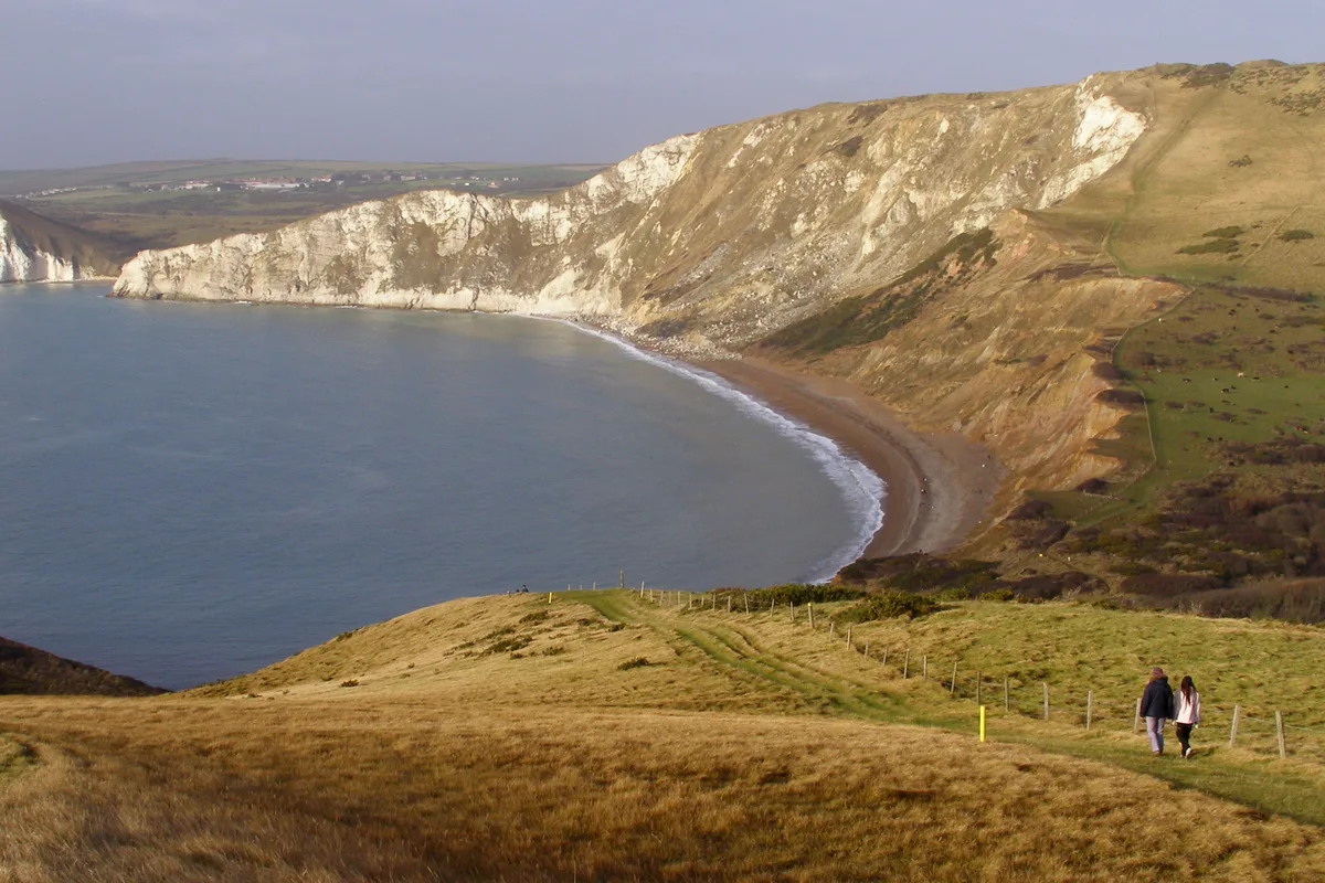
Worbarrow Tout is a named summit in the United Kingdom. Wikidata describes it as: "Named summit at 53 m.". Coordinates: 50.6159°, -2.1857°.
Photo gallery
Protected designations
- Site of Special Scientific Interest: South Dorset Coast SSSI
- Area of Outstanding Natural Beauty: Dorset
Designations sourced from Natural England open data under OGL v3.
From the Wikipedia article
Worbarrow Tout is a promontory at the eastern end of Worbarrow Bay on Isle of Purbeck in Dorset on the south coast of England, about 6 kilometres (3.7 mi) south of Wareham and about 16 kilometres (10 mi) west of Swanage. Immediately to its east is Pondfield Cove. Worbarrow Tout ("tout" means lookout) was originally part of Gad Cliff to its east, but sea erosion has virtually separated the two completely.
Excerpt from Wikipedia under CC BY-SA 4.0. See the source article linked in Sources below.
- Coordinates
- 50.6159, -2.1857
- Nearest railway station
- Wool — 7.7 km
Sources
- osm: n7164320924 (ODbL)
- wikipedia: Worbarrow Tout (CC BY-SA 4.0)
- commons: Worbarrow tout and pondfield cove dorset.jpg (CC BY-SA 4.0)
Other places nearby
Loading nearby places…
Nearby
 📷 5
📷 5Beaches · South East England
Pondfield
Pondfield is a beach in the United Kingdom.
Vineyards · South East England
Flower's Barrow
Flower's Barrow — a UK vineyard in england south east, producing English or Welsh wine from cool-climate grape varieties.
 📷 5
📷 5Burial mounds & barrows · South East England
Flower's Barrow
Flower's Barrow — a burial mound in england-south-east, United Kingdom.
 📷 5
📷 5Mountains & hills · South East England
Cow Corner
Cow Corner — bay in Dorset, England.
 📷 5
📷 5Historic houses · South East England
Rectory
Rectory — a historic house in england-south-east, United Kingdom.
 📷 5
📷 5Historic houses · South East England
Gwyle Cottages
Gwyle Cottages — a historic house in england-south-east, United Kingdom.
More mountains in this region
 📷 5
📷 5Mountains & hills · South East England
Alum Bay
Alum Bay is a mountain or hill in the United Kingdom.
 📷 5
📷 5Mountains & hills · South East England
Arish Mell
Arish Mell — bay in Dorset, England.
 📷 5
📷 5Mountains & hills · South East England
Balaclava Bay
Balaclava Bay — bay in Dorset, England.
 📷 5
📷 5Mountains & hills · South East England
Balch Cave
Balch Cave — Cave in Somerset, England.
Frequently asked questions
- Where is Worbarrow Tout?
- Worbarrow Tout is in South-East England, United Kingdom.
- Is Worbarrow Tout a protected site?
- Yes — Worbarrow Tout is part of the South Dorset Coast SSSI Site of Special Scientific Interest and the Dorset National Landscape (AONB).
- Is Worbarrow Tout free to visit?
- Yes, Worbarrow Tout is free to enter.
- How do I get to Worbarrow Tout?
- The nearest railway station is Wool, about 7.7 km away.