Towns & cities · West Midlands
Wingfield
Wingfield — village in Bedfordshire, United Kingdom.

Wikimedia Commons contributors — see linked file page for photographer and licence licence
Plan your visit
- Typical visit
- 3 h–6 h
- Nearest railway station
- Harlington · 5.3 km
- Free entry
- Family-friendly
- Dog-friendly
About
Wingfield is a town, city, village or settlement in the United Kingdom. Address: LU7. Wikidata describes it as: "village in Bedfordshire, United Kingdom". Coordinates: 51.9259°, -0.5467°.
Photo gallery
Protected designations
- Area of Outstanding Natural Beauty: Chilterns
Designations sourced from Natural England open data under OGL v3.
From the Wikipedia article
Wingfield is a village located in the Central Bedfordshire district of Bedfordshire, England. The settlement is close to Tebworth and Chalgrave, with the nearest town being Houghton Regis. Wingfield forms part of the Chalgrave civil parish, and is home to The Plough Inn public house. The Icknield Way Path passes through the village on its 110-mile journey from Ivinghoe Beacon in Buckinghamshire to Knettishall Heath in Suffolk. The Icknield Way Trail, a multi-user route for walkers, horse riders and off-road cyclists also passes through the village. Wingfield is part of the ward of 'Heath and Reach' which sends a Councillor to Central Bedfordshire Council. The ward includes the villages of Heath and Reach, Hockliffe, Eggington, Stanbridge, Tilsworth, Tebworth, and Wingrave. The ward was created in 2011 and has since been represented by Councillor Mark Versallion.
Excerpt from Wikipedia under CC BY-SA 4.0. See the source article linked in Sources below.
- Coordinates
- 51.9259, -0.5467
- District
- Central Bedfordshire
- Parish
- Chalgrave
- Postcode
- LU7
- Parliamentary constituency
- Dunstable and Leighton Buzzard
- Nearest railway station
- Harlington — 5.3 km
Sources
- wikidata: Q1519053 (CC0)
- wikipedia: Wingfield, Bedfordshire (CC BY-SA 4.0)
- commons: The Plough Inn, Wingfield - geograph.org.uk - 204391.jpg (CC BY-SA 4.0)
Other places nearby
Loading nearby places…
Nearby
 📷 3
📷 3Towns & cities · West Midlands
Tebworth
Tebworth — village in Bedfordshire, United Kingdom.
 📷 3
📷 3Castles · West Midlands
Chalgrave Castle
Chalgrave Castle — castle in Bedfordshire with no visible remains.
 📷 3
📷 3Historic churches · West Midlands
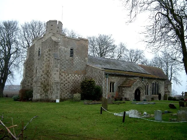
Church of All Saints, Chalgrave
Church of All Saints, Chalgrave — church in Chalgrave, Bedfordshire, England, UK.
 📷 3
📷 3Wildlife reserves · West Midlands
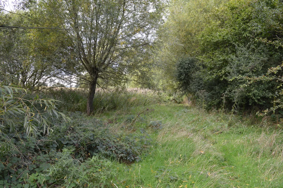
Dropshort Marsh
Dropshort Marsh — nature reserve in the United Kingdom.
 📷 3
📷 3Towns & cities · West Midlands
Fancott
Fancott — village in Bedfordshire, United Kingdom.
 📷 3
📷 3Towns & cities · West Midlands
Bidwell
Bidwell — village in Bedfordshire, England, UK.
More towns in this region
 Flagship📷 3
Towns & cities · West Midlands
Adderbury
Adderbury — village and civil parish in Cherwell district, Oxfordshire, England.
 Flagship📷 3
Towns & cities · West Midlands
Admington
Admington — village in Warwickshire, England, UK.
 Flagship📷 3
Towns & cities · West Midlands
Aldington
Aldington — village in Worcestershire, United Kingdom.
 Flagship📷 5
Towns & cities · West Midlands
Anstey
Anstey — large village in Leicestershire, England.
Frequently asked questions
- Where is Wingfield?
- Wingfield is in the West Midlands, United Kingdom (postcode LU7), in the parish of Chalgrave.
- Is Wingfield a protected site?
- Yes — Wingfield is part of the Chilterns National Landscape (AONB).
- Is Wingfield free to visit?
- Yes, Wingfield is free to enter.
- How do I get to Wingfield?
- The nearest railway station is Harlington, about 5.3 km away. Drivers can navigate to postcode LU7.