Towns & cities · West Midlands
Wing
Also known as: Wing, Swydd Buckingham
Wing — village and civil parish in Buckinghamshire, England.

Wikimedia Commons contributors — see linked file page for photographer and licence licence
Plan your visit
- Typical visit
- 3 h–6 h
- Nearest railway station
- Leighton Buzzard · 3.4 km
- Free entry
- Family-friendly
- Dog-friendly
About
Wing is a town, city, village or settlement in the United Kingdom. Recent population estimates put it at around 2,745 people. Address: LU7. Wikidata describes it as: "village and civil parish in Buckinghamshire, England". Coordinates: 51.8980°, -0.7170°.
Photo gallery
Protected designations
- Area of Outstanding Natural Beauty: Chilterns
Designations sourced from Natural England open data under OGL v3.
From the Wikipedia article
Wing, known in antiquity as Wyng, is a village and civil parish in east Buckinghamshire, England. The village is on the main A418 road between Aylesbury and Leighton Buzzard. It is about 8 miles (13 km) north-east of Aylesbury, 3 miles (5 km) west of Leighton Buzzard, and 12 miles (19 km) south of Milton Keynes.
Excerpt from Wikipedia under CC BY-SA 4.0. See the source article linked in Sources below.
Background
History
The Domesday Book of 1086 records the toponym as Witehunge. The name occurs in Old English circa 966–975 as Weowungum (dative plural case). It could mean: The first syllables of the names of the nearby village of Wingrave and the nearby hamlet of Wingbury have the same etymology. The remains of the temple referred to may be under the Anglo-Saxon Church of England parish church of All Saints. The BBC programme Meet the Ancestors came to Wing in 2000 and recreated the face of an Anglo-Saxon girl found buried in the old graveyard. Wing claims to have the oldest continuously used religious site in the country, with evidence showing the site has had religious use going back well over 1300 years.…
Sourced from Wikipedia under CC BY-SA 4.0.
- Coordinates
- 51.8980, -0.7170
- District
- Buckinghamshire
- Parish
- Wing
- Postcode
- LU7
- Parliamentary constituency
- Aylesbury
- Population
- 2,745
- Nearest railway station
- Leighton Buzzard — 3.4 km
- Official site
- wingvillagebucks.co.uk
Sources
- wikidata: Q1785125 (CC0)
- wikipedia: Wing, Buckinghamshire (CC BY-SA 4.0)
- commons: AllSaintsChurchWing-2.jpg (CC BY-SA 4.0)
Other places nearby
Loading nearby places…
Nearby
 📷 5
📷 5Historic churches · West Midlands
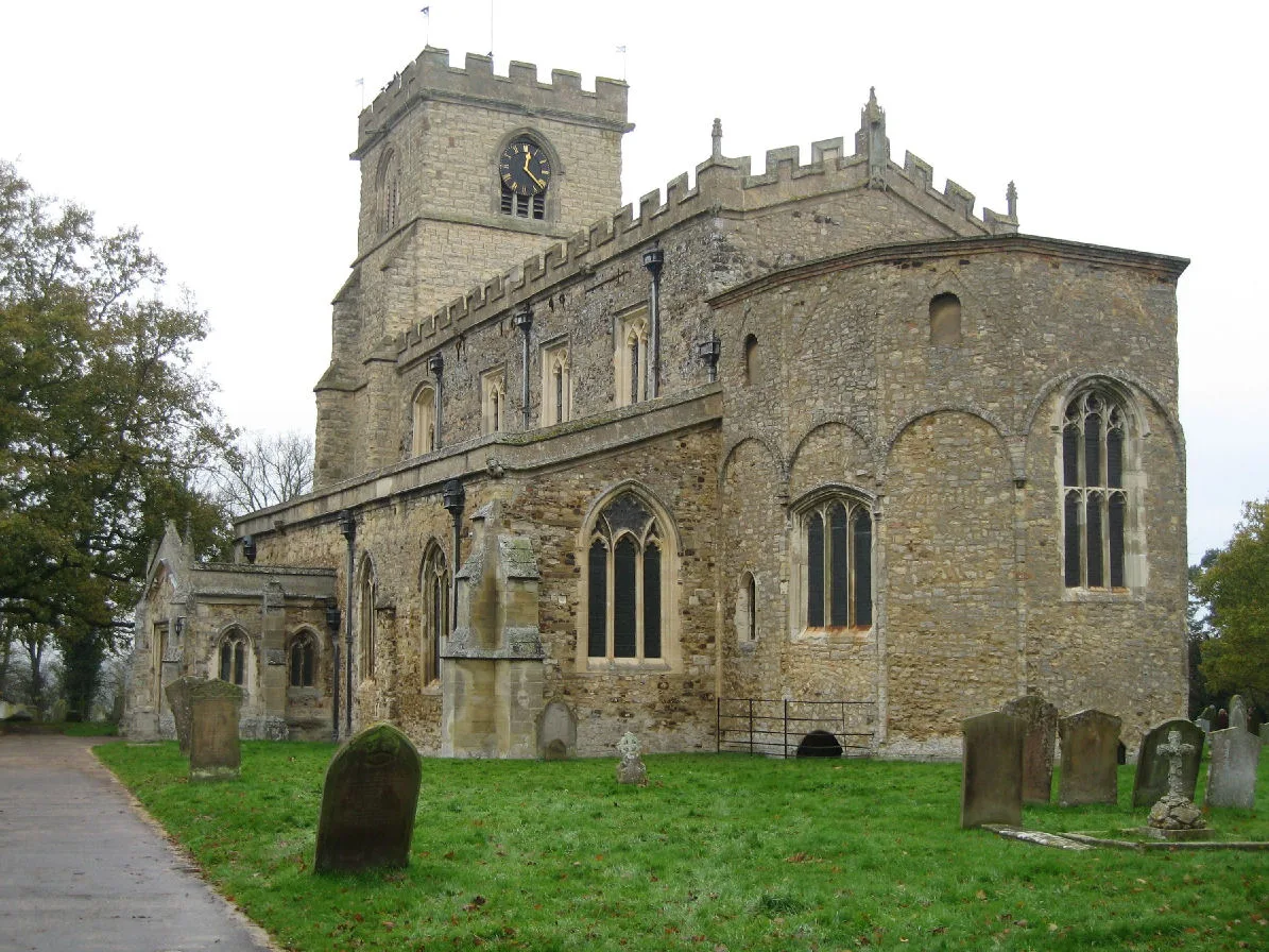
All Saints' Church, Wing
All Saints' Church, Wing — church in Wing, Buckinghamshire, England, UK.
 📷 5
📷 5Museums · West Midlands
Ascott House
Ascott House, sometimes referred to as simply Ascott, is a Grade II* listed building in the hamlet of Ascott near Wing in Buckinghamshire, England. It is set in a 32-acre / 13 hectare estate. Ascott
 📷 5
📷 5Museums · West Midlands
Ascott, Buckinghamshire
Ascott is a hamlet and country house in the parish of Wing, Buckinghamshire, England. The hamlet lies completely within the boundary of the Ascott Estate; it is home to many of the estate and house st
 📷 3
📷 3Forests & woodlands · West Midlands
Tiddenfoot Waterside Park
Tiddenfoot Waterside Park is a forest or woodland in the United Kingdom.
 📷 3
📷 3Memorials & monuments · West Midlands
Linslade War Memorial
Linslade War Memorial — Grade II listed building-listed memorial in england-west-midlands, United Kingdom.
📷 3Memorials & monuments · West Midlands
The Linslade War Memorial
The Linslade War Memorial — a memorial in england-west-midlands, United Kingdom.
More towns in this region
 Flagship📷 3
Towns & cities · West Midlands
Adderbury
Adderbury — village and civil parish in Cherwell district, Oxfordshire, England.
 Flagship📷 3
Towns & cities · West Midlands
Admington
Admington — village in Warwickshire, England, UK.
 Flagship📷 3
Towns & cities · West Midlands
Aldington
Aldington — village in Worcestershire, United Kingdom.
 Flagship📷 5
Towns & cities · West Midlands
Anstey
Anstey — large village in Leicestershire, England.
Frequently asked questions
- Where is Wing?
- Wing is in the West Midlands, United Kingdom (postcode LU7), in the parish of Wing.
- Is Wing a protected site?
- Yes — Wing is part of the Chilterns National Landscape (AONB).
- Is Wing free to visit?
- Yes, Wing is free to enter.
- How do I get to Wing?
- The nearest railway station is Leighton Buzzard, about 3.4 km away. Drivers can navigate to postcode LU7.