Towns & cities · London
Whyteleafe
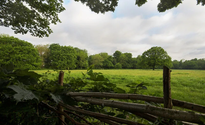
Whyteleafe — village in Tandridge district, Surrey, United Kingdom.

Wikimedia Commons contributors — see linked file page for photographer and licence licence
.jpg)
Plan your visit
- Typical visit
- 3 h–6 h
- Nearest railway station
- Whyteleafe · 0.2 km
- Free entry
- Family-friendly
- Dog-friendly
About
Whyteleafe is a town, city, village or settlement in the United Kingdom. It covers approximately 2 km². Recent population estimates put it at around 3,315 people. Address: CR3. Wikidata describes it as: "village in Tandridge district, Surrey, United Kingdom". Coordinates: 51.3089°, -0.0834°.
Photo gallery
Protected designations
- National Nature Reserve: SOUTH LONDON DOWNS
Designations sourced from Natural England open data under OGL v3.
From the Wikipedia article
Whyteleafe is a village in the district of Tandridge, Surrey, England, with a few streets falling inside the London Borough of Croydon. The village, in a dry valley of the North Downs, has three railway stations (on two parallel lines). Neighbouring villages and towns include Woldingham, Caterham, Coulsdon, Warlingham, and Kenley. To the west are Kenley Aerodrome, Kenley Common (owned by the Corporation), Coxes Wood, and Blize Wood. To the east are Riddlesdown, the Dobbin and Marden Park. The churchyard contains graves of airmen who died during WWII, stationed at RAF Kenley nearby. The village forms part of the Greater London Built-up Area.
Excerpt from Wikipedia under CC BY-SA 4.0. See the source article linked in Sources below.
Background
History
The village name comes from the distinctive white underside of the whitebeam trees growing in the area. In 1855 Nathaniel Glover purchased White Leaf field and George Henry Drew later completed the building that was called "White Leafe House". By 1881 the surrounding area had become known as "Whiteleafe". As with Kenley the history of its land before that was that of other parishes, in this case Caterham and to a lesser extent Warlingham and Coulsdon. Its first primary school was built in 1892, enlarged in 1900 and again in 1907. In 1911 the population of Whyteleafe was "now larger than that of Warlingham village...A county council secondary school for girls has been set up in this year…
Sourced from Wikipedia under CC BY-SA 4.0.
- Coordinates
- 51.3089, -0.0834
- County
- Surrey
- District
- Tandridge
- Parish
- Whyteleafe
- Postcode
- CR3
- Parliamentary constituency
- East Surrey
- Population
- 3,315
- Nearest railway station
- Whyteleafe — 0.2 km
- Official site
- www.whyteleafepc.org.uk
Sources
- wikidata: Q1610387 (CC0)
- wikipedia: Whyteleafe (CC BY-SA 4.0)
- commons: Houses above the A22, Whyteleafe (geograph 2309246).jpg (CC BY-SA 4.0)
Other places nearby
Loading nearby places…
Nearby
 📷 10
📷 10Country parks · London
Kenley Common
Kenley Common is a country park in the United Kingdom.
.jpg?width=1200) 📷 5
📷 5Archaeological sites · London
Group of seven World War II fighter pens at the former airfield of RAF Kenley
Group of seven World War II fighter pens at the former airfield of RAF Kenley — archaeological site in London Borough of Croydon, Greater London, England, UK.
 📷 5
📷 5Country parks · London
Hawkhirst
Hawkhirst — urban park in London Borough of Croydon, United Kingdom.
 📷 5
📷 5Archaeological sites · London
Group of four World War II fighter pens at the former airfield of RAF Kenley
Group of four World War II fighter pens at the former airfield of RAF Kenley — archaeological site in London Borough of Croydon, Greater London, England, UK.
 📷 5
📷 5Memorials & monuments · London
RAF Kenley Tribute
RAF Kenley Tribute is a memorial in the United Kingdom.
 📷 5
📷 5Natural landmarks · London
Sunnydown School
Sunnydown School — a school heritage in england-london, United Kingdom.
More towns in this region
 Flagship📷 10
Towns & cities · London
Aldenham
Aldenham — village and civil parish in Hertfordshire, England.
 Flagship📷 10
Towns & cities · London
Ashdon
Ashdon — village and civil parish in Essex, UK.
 Flagship📷 10
Towns & cities · London
Betchworth
Betchworth — village and civil parish in the Mole Valley district of Surrey, England.
 Flagship📷 10
Towns & cities · London
Boxley
Boxley — village and civil parish in Maidstone District, Kent, England, UK.
Frequently asked questions
- Where is Whyteleafe?
- Whyteleafe is in Surrey, London, United Kingdom (postcode CR3), in the parish of Whyteleafe.
- Is Whyteleafe a protected site?
- Yes — Whyteleafe is part of the SOUTH LONDON DOWNS National Nature Reserve.
- Is Whyteleafe free to visit?
- Yes, Whyteleafe is free to enter.
- How do I get to Whyteleafe?
- The nearest railway station is Whyteleafe, about 0.2 km away. Drivers can navigate to postcode CR3.