Natural landmarks · North West England
Whitfell
Whitfell — mountain in United Kingdom.

Wikimedia Commons contributors — see linked file page for photographer and licence licence
Plan your visit
- Typical visit
- 1 h–2 h
- Nearest railway station
- Eskdale Green · 7.0 km
- Free entry
- Dog-friendly
About
Whitfell is a named natural landmark in the United Kingdom. Wikidata describes it as: "mountain in United Kingdom". Coordinates: 54.3247°, -3.2961°.
Photo gallery
From the Wikipedia article
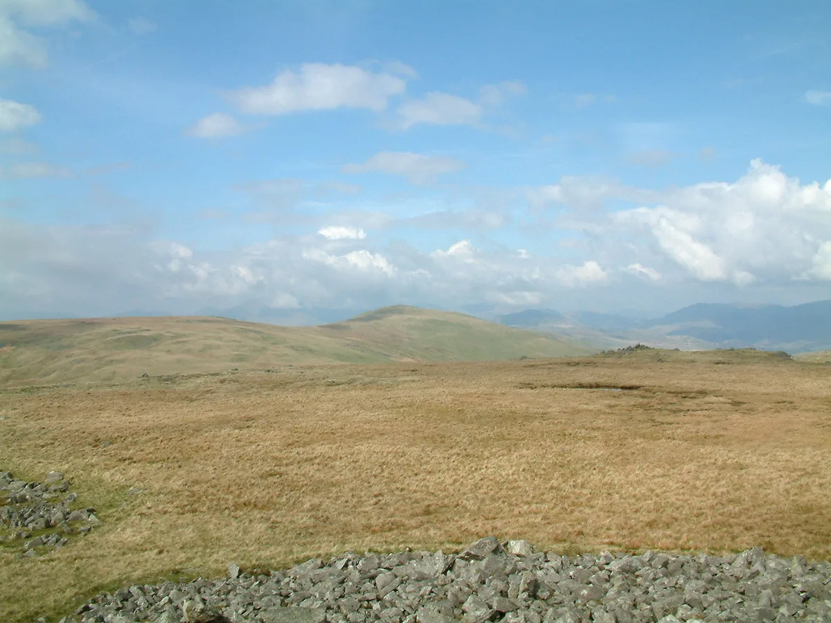
Whitfell (or sometimes Whit Fell) is a hill of 573 metres (1,880 ft) in the southwestern part of the Lake District. It is the highest point between Black Combe and Harter Fell on the broad ridge to the west of the Duddon Valley. Views from the summit include the full length of the Duddon Valley including its estuary; the western side of the Coniston fells; the Eskdale fells including Scafell and Bowfell; much of western Cumbria including the estuary of the Rivers Esk, Mite and Irt; the Isle of Man; as well as the hills to the south culminating in Black Combe. The hill is relatively infrequently visited, and is a fairly characterless grassy mound, extensively grazed by sheep, though with a very large cairn, whose stones may be from a tumulus. A bridleway crosses the fell to the north of the summit, but it is probably more frequently visited on a round including Burn Moor at 1,780 feet (540 m), Kinmont Buck Barrow at 1,754 feet (535 m), and Buck Barrow at 1,799 feet (548 m) from the summit of the Corney Fell road, a route described by Alfred Wainwright in the "Whit Fell" chapter of his book The Outlying Fells of Lakeland.
Excerpt from Wikipedia under CC BY-SA 4.0. See the source article linked in Sources below.
- Coordinates
- 54.3247, -3.2961
- Address
- Lake District, England
- Nearest railway station
- Eskdale Green — 7 km
Sources
- wikidata: Q7996430 (CC0)
- wikipedia: Whitfell (CC BY-SA 4.0)
- commons: Whitfell from Kinmont Buck Barrow.jpg (CC BY-SA 4.0)
Other places nearby
Loading nearby places…
Nearby
 📷 3
📷 3Mountains & hills · North West England
Whitfell
Whitfell — Named summit at 573 m.
 📷 3
📷 3Viewpoints · North West England
Buckbarrow Beck Copper Mine
Buckbarrow Beck Copper Mine is a viewpoint in the United Kingdom.
 📷 3
📷 3Historic bridges · North West England
Bridge On Old Coach Road
Bridge On Old Coach Road — Grade II listed building-listed bridge in england-north-west, United Kingdom.
 📷 3
📷 3Historic bridges · North West England
Ulpha Bridge (That Part In Dunnerdale With Seathwaite Cp)
Ulpha Bridge (That Part In Dunnerdale With Seathwaite Cp) — Grade II listed building-listed bridge in england-north-west, United Kingdom.
 📷 3
📷 3Natural landmarks · North West England
Devoke Water
Devoke Water — lake in the United Kingdom.
.jpg?width=1200) 📷 3
📷 3Archaeological sites · North West England
Prehistoric cairnfield, associated field system and hut circle east of Water Crag
Prehistoric cairnfield, associated field system and hut circle east of Water Crag — archaeological site in Eskdale, Copeland, England, UK.
More natural landmarks in this region
 ★ Iconic📷 4
Natural landmarks · North West England
Coniston Water
Lake District lake — Swallows and Amazons setting and Donald Campbell water-speed history.
 📷 3
📷 3Natural landmarks · North West England
Elter Water
Elter Water — lake in the United Kingdom.
 📷 3
📷 3Natural landmarks · North West England
Esthwaite Water
Esthwaite Water — lake in the United Kingdom.
 Flagship📷 5
Natural landmarks · North West England
Semerwater
Semerwater — lake in North Yorkshire, England, UK.
Frequently asked questions
- Where is Whitfell?
- Whitfell is in North-West England, United Kingdom.
- Is Whitfell free to visit?
- Yes, Whitfell is free to enter.
- How do I get to Whitfell?
- The nearest railway station is Eskdale Green, about 7.0 km away.