Mountains & hills · South Wales
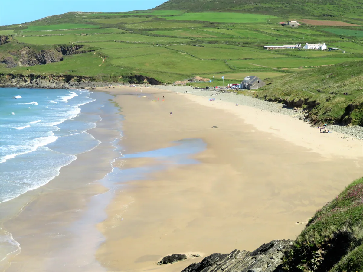
Whitesands Bay
Whitesands Bay — bay and beach in Pembrokeshire, Wales, UK.

Wikimedia Commons contributors — see linked file page for photographer and licence licence
_near_Tyddewi_(St_David's)%2C_Sir_Benfro%2C_Cymru%2C_Wales_15.jpg)
Plan your visit
- Typical visit
- 3 h–8 h
- Best time of year
- Late spring – early autumn (May–Oct)
- Free entry
- Dog-friendly
About
Whitesands Bay is a named summit in the United Kingdom. Heritage designation: National Monuments of Wales. Wikidata describes it as: "bay and beach in Pembrokeshire, Wales, UK". Coordinates: 51.8944°, -5.2958°.
Photo gallery
From the Wikipedia article
Whitesands Bay (Welsh: Porth Mawr) is a Blue Flag beach situated on the St David's peninsula in the Pembrokeshire Coast National Park, Wales. Whitesand Bay, on some maps, located 2 miles (3.2 km) west of St. Davids and 1 mile (1.6 km) south of St Davids Head, has been described as the best surfing beach in Pembrokeshire.
Excerpt from Wikipedia under CC BY-SA 4.0. See the source article linked in Sources below.
Background
Description
The area northeast of the wide, sandy bay is dominated by Carn Llidi, a rocky outcrop, 594 ft at its highest point. The Pembrokeshire Coast Path provides access on foot in the north to the secluded bays of Porthlleuog and Porthmelgan. To the south, the coastal path leads to Porthselau and St. Justinian's, with views of Ramsey Island. A number of megalithic burial chambers, stone hut circles and Iron Age field systems and enclosures are in the vicinity of Carn Llidi and St Davids Head. There is a tradition that St. Patrick set sail from this beach in 432 AD to convert Ireland to Christianity. The site of a Celtic chapel, dedicated to St Patrick, is located under a mound by the car park just…
Sourced from Wikipedia under CC BY-SA 4.0.
- Coordinates
- 51.8944, -5.2958
- District
- Pembrokeshire
- Parish
- St. David's and the Cathedral Close
- Postcode
- SA62 6PT
- Parliamentary constituency
- Mid and South Pembrokeshire
Sources
- wikidata: Q7996233 (CC0)
- wikipedia: Whitesands Bay (Pembrokeshire) (CC BY-SA 4.0)
- commons: Porth Mawr (Whitesands Bay) near Tyddewi (St David's), Sir Benfro, Cymru, Wales 15.jpg (CC BY-SA 4.0)
Other places nearby
Loading nearby places…
Nearby
 📷 5
📷 5Beaches · South Wales
Whitesands Beach
Whitesands Beach is a beach in the United Kingdom.
 📷 3
📷 3Archaeological sites · South Wales
Menapia Roman Station
Menapia Roman Station — a archaeological in wales-south, United Kingdom.
Campsites · South Wales
Whitesands Camping
Whitesands Camping — a campsite in wales south.
Campsites · South Wales
Dunes at Whitesands Camping
Dunes at Whitesands Camping — a campsite in wales south.
 📷 3
📷 3Archaeological sites · South Wales
Carn Llidi Chambered Tomb
Carn Llidi Chambered Tomb — a archaeological in wales-south, United Kingdom.
Hostels · South Wales
YHA St Davids
YHA St Davids — a hostel in wales south.
More mountains in this region
 Flagship📷 3
Mountains & hills · South Wales
Milford Haven Waterway
Milford Haven Waterway — ria, or flooded valley, in Pembrokeshire, south-west Wales, UK.
 📷 5
📷 5Mountains & hills · South Wales
Ogof Ffynnon Ddu
Ogof Ffynnon Ddu — cave in the Upper Swansea Valley in South Wales.
 📷 3
📷 3Mountains & hills · South Wales
Abereiddi Bay
Abereiddi Bay — bay in the United Kingdom.
 📷 3
📷 3Mountains & hills · South Wales
Allt Lwyd
Allt Lwyd — Named summit at 653 m.
Frequently asked questions
- Where is Whitesands Bay?
- Whitesands Bay is in South Wales, United Kingdom (postcode SA62 6PT), in the parish of St. David's and the Cathedral Close.
- Is Whitesands Bay a listed building?
- Whitesands Bay is officially recognised as National Monuments of Wales listed.
- Is Whitesands Bay free to visit?
- Yes, Whitesands Bay is free to enter.
- How do I get to Whitesands Bay?
- Drivers can navigate to postcode SA62 6PT. It sits within the Mid and South Pembrokeshire parliamentary constituency.