Beaches · South Wales
Whiteford Sands
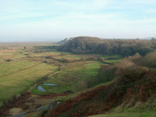
Whiteford Sands — beach on the northern side of the Gower Peninsula, south Wales.

Wikimedia Commons contributors — see linked file page for photographer and licence licence
Plan your visit
- Typical visit
- 1 h–3 h
- Best time of year
- Summer (Jun–Aug)
- Nearest railway station
- Pembrey and Burry Port · 5.3 km
- Free entry
- Family-friendly
- Dog-friendly
About
Whiteford Sands is a named beach on the United Kingdom coastline. Wikidata describes it as: "beach on the northern side of the Gower Peninsula, south Wales". Coordinates: 51.6361°, -4.2536°.
Photo gallery
From the Wikipedia article
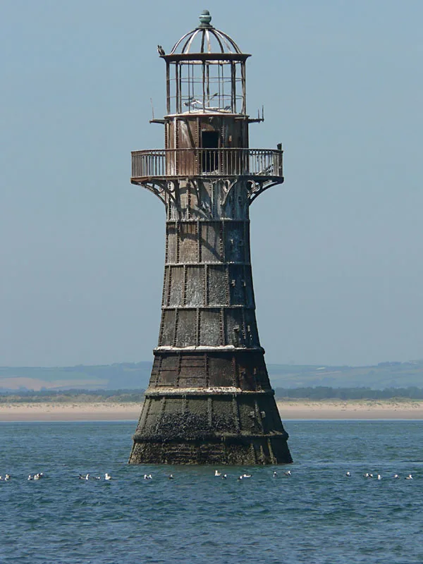
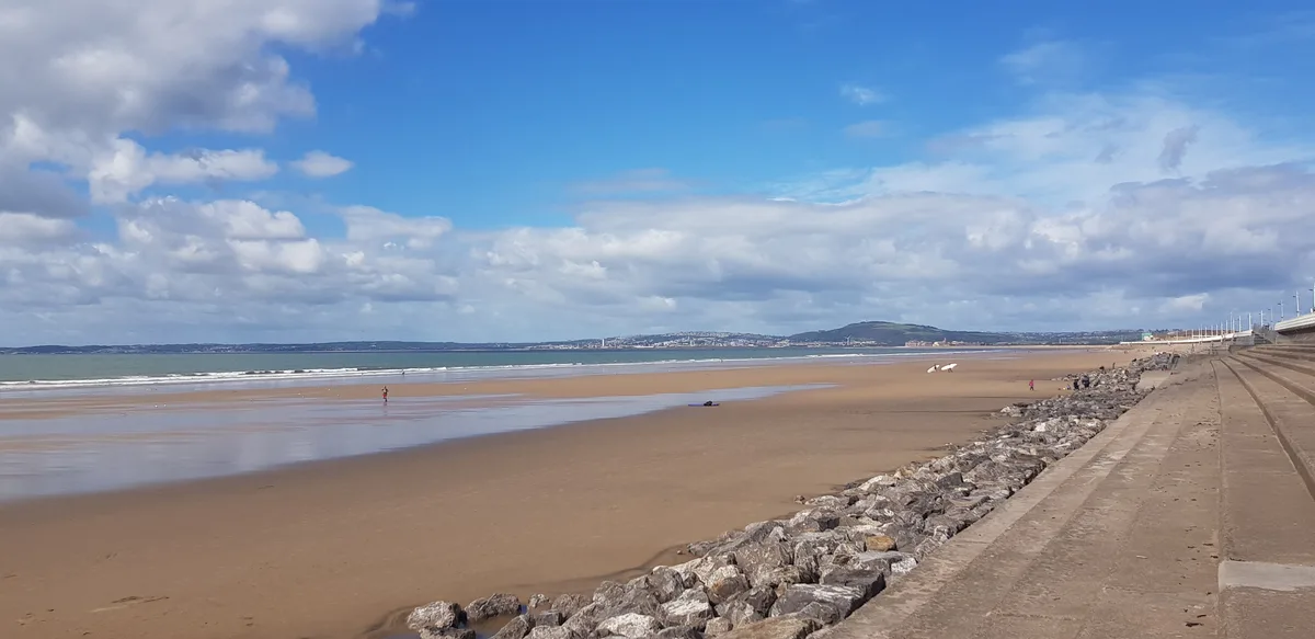
Whiteford Sands is a two-mile expanse of beach on the northern side of the Gower Peninsula, south Wales. It is the most northerly beach on Gower and sits on the edge of the Loughor estuary. The beach has no direct access by car. Visitors have to park near the village of Llanmadoc, and make their way on foot via country paths. Its relative inaccessibility compared to many other beaches in the Gower makes it a very quiet beach. The beach is popular amongst naturists The cast iron Whiteford Lighthouse is situated in the bay at Whiteford Sands. Whiteford Sands / Whitford Sands is a stretch of coastline which includes Llanmadoc Beach, the local beach to the village of Llanmadoc and which is separated from Broughton Beach at high tide by Prissens, Hill, and Cwm Ivy Tors. This area includes some of the most beautiful woodland in Gower. Whiteford Burrows is the dune system backing Whiteford Sands further inland. Whiteford Burrows is a National Trust property containing a dune and pine plantation and is classified as a national nature reserve.
Excerpt from Wikipedia under CC BY-SA 4.0. See the source article linked in Sources below.
- Coordinates
- 51.6361, -4.2536
- District
- Swansea
- Parish
- Llangennith, Llanmadoc and Cheriton
- Postcode
- SA3 1DL
- Parliamentary constituency
- Gower
- Nearest railway station
- Pembrey and Burry Port — 5.3 km
Sources
- wikidata: Q1482078 (CC0)
- wikipedia: Whiteford Sands (CC BY-SA 4.0)
- commons: Whiteford sands view 072006 rb.jpg (CC BY-SA 4.0)
Other places nearby
Loading nearby places…
Nearby
 📷 3
📷 3Wildlife reserves · South Wales
Cwm Ivy Woods
Cwm Ivy Woods — woodland and nature reserve in Wales.
 📷 3
📷 3Battlefields & battle sites · South Wales
Cwm Ivy Woods
Cwm Ivy Woods in Wales South, United Kingdom.
 📷 5
📷 5Lighthouses · South Wales
Whiteford Lighthouse
Whiteford Lighthouse — lighthouse at Whiteford Point, Gower Peninsula, Swansea, Wales, UK.
Vineyards · South Wales
North Hill Tor Camp
North Hill Tor Camp — a UK vineyard in wales south, producing English or Welsh wine from cool-climate grape varieties.
Caravan parks · South Wales
Whitford Bay Caravan Park
Whitford Bay Caravan Park — a caravan park in wales south.
Campsites · South Wales
Phillistone Farm
Phillistone Farm — a campsite in wales south.
More beaches in this region
 📷 3
📷 3Beaches · South Wales
ABCC Meeting Point
ABCC Meeting Point is a beach in the United Kingdom.
 📷 3
📷 3Beaches · South Wales
Aber Castle
Aber Castle is a beach in the United Kingdom.
 📷 3
📷 3Beaches · South Wales
Aber Mawr
Aber Mawr is a beach in the United Kingdom.
 📷 4
📷 4Beaches · South Wales
Aberavon Beach
Aberavon Beach is a beach in the United Kingdom.
Frequently asked questions
- Where is Whiteford Sands?
- Whiteford Sands is in South Wales, United Kingdom (postcode SA3 1DL), in the parish of Llangennith, Llanmadoc and Cheriton.
- Is Whiteford Sands free to visit?
- Yes, Whiteford Sands is free to enter.
- How do I get to Whiteford Sands?
- The nearest railway station is Pembrey and Burry Port, about 5.3 km away. Drivers can navigate to postcode SA3 1DL.