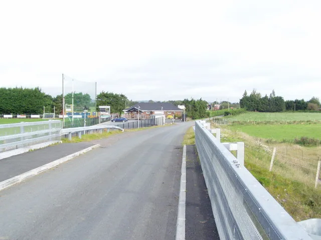
Islands · Northern Ireland
White Island
White Island — island in County Fermanagh, Northern Ireland, United Kingdom.

Wikimedia Commons contributors — see linked file page for photographer and licence licence
Plan your visit
- Typical visit
- 4 h–12 h
- Free entry
- Dog-friendly
About
White Island is a island in the United Kingdom. Wikidata describes it as: "island in County Fermanagh, Northern Ireland, United Kingdom". Coordinates: 54.4888°, -7.7362°.
Photo gallery
From the Wikipedia article
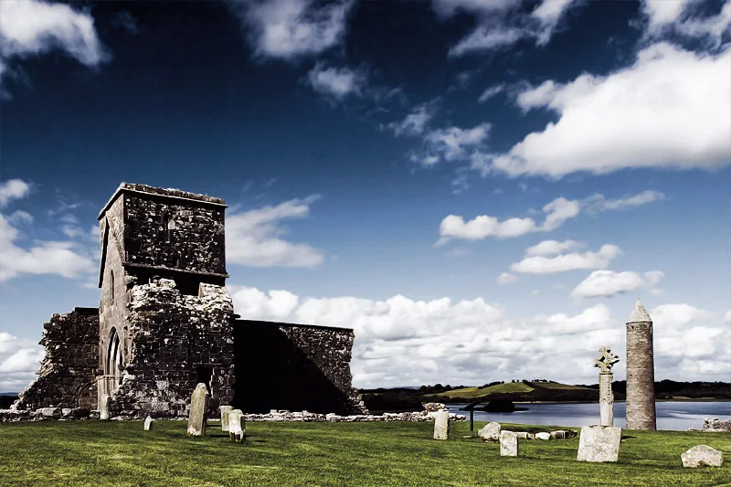
White Island is an island in Lower Lough Erne, County Fermanagh, Northern Ireland. It is situated in Castle Archdale Bay off the east shore of Lower Lough Erne. The ruins of an ancient church are found near the shore, built on the site of an earlier monastic settlement. It still has an intact (restored) arched Romanesque doorway. The Church and carved figures are State Care Historic Monuments sited in the townland of White Island, in Fermanagh and Omagh District Council area. The rath, earthwork, and area surrounding the state care monument are Scheduled Historic Monuments, at grid ref: H1753 6000. The island is accessed by ferry from the marina in Castle Archdale Country Park, near Irvinestown.
Excerpt from Wikipedia under CC BY-SA 4.0. See the source article linked in Sources below.
Background
Description
The ruined church on the island has a reconstructed plain Romanesque doorway. Secured to the north side of the south wall are eight carvings (seven figures and one head) built into the masonry of the church. Most of the figures were carved wearing the long tunics of churchmen. They are all carved in quartzite and were probably constructed between 800 and 1000 AD, and were later used as building stones in the church before being uncovered in recent centuries. The Australian historian Helen Hickey identified them as three pairs of caryatids (architectural supports). Each pair a different height and suggests that because of the sockets on the top of their heads that they may have supported a…
Sourced from Wikipedia under CC BY-SA 4.0.
- Coordinates
- 54.4888, -7.7362
- District
- Fermanagh and Omagh
- Postcode
- BT93 1DE
- Parliamentary constituency
- Fermanagh and South Tyrone
Sources
- wikidata: Q6978800 (CC0)
- wikipedia: White Island, County Fermanagh (CC BY-SA 4.0)
- commons: White Island,Lower Lough Erne..JPG (CC BY-SA 4.0)
Other places nearby
Loading nearby places…
Nearby
 📷 3
📷 3Historic houses · Northern Ireland
White Island Carved Figures
White Island Carved Figures — a historic house in northern-ireland, United Kingdom.
 📷 5
📷 5Castles · Northern Ireland
RAF Castle Archdale
RAF Castle Archdale in Northern Ireland, United Kingdom.
Caravan parks · Northern Ireland
Clareview Caravan Park
Clareview Caravan Park — a caravan park in northern ireland.
Campsites · Northern Ireland
Castle Archdale
Castle Archdale — a campsite in northern ireland.
 📷 5
📷 5Castles · Northern Ireland
Castle Archdale
Castle Archdale in Northern Ireland, United Kingdom.
 📷 3
📷 3Castles · Northern Ireland
Old Castle Archdale
Old Castle Archdale — a castle in northern-ireland, United Kingdom.
More places in this region
 Flagship📷 3
Islands · Northern Ireland
Derrywarragh Island
Derrywarragh Island — island in County Armagh, Northern Ireland, United Kingdom.
 Flagship📷 5
Islands · Northern Ireland
Devenish Island
Devenish Island — island in Lower Lough Erne, Northern Ireland.
 Flagship📷 3
Islands · Northern Ireland
Rathlin Island
Rathlin Island — island in County Antrim, Northern Ireland, UK.
 Flagship📷 5
Islands · Northern Ireland
Sanda Island
Sanda Island — a small island in Argyll and Bute, Scotland, UK.
Frequently asked questions
- Where is White Island?
- White Island is in Northern Ireland, United Kingdom (postcode BT93 1DE).
- Is White Island free to visit?
- Yes, White Island is free to enter.
- How do I get to White Island?
- Drivers can navigate to postcode BT93 1DE. It sits within the Fermanagh and South Tyrone parliamentary constituency.