Towns & cities · East Midlands
Whissendine
Whissendine — village in Rutland, England, UK.

Wikimedia Commons contributors — see linked file page for photographer and licence licence
Plan your visit
- Typical visit
- 3 h–6 h
- Nearest railway station
- Central Station · 4.5 km
- Free entry
- Family-friendly
- Dog-friendly
About
Whissendine is a town, city, village or settlement in the United Kingdom. It covers approximately 6 km². Recent population estimates put it at around 1,189 people. Address: LE15. Wikidata describes it as: "village in Rutland, England, UK". Coordinates: 52.7200°, -0.7710°.
Photo gallery
From the Wikipedia article
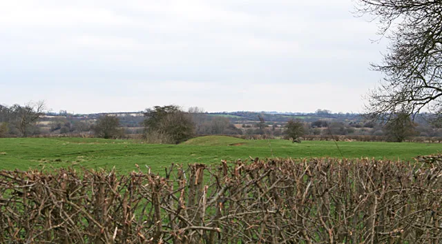
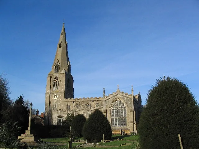
Whissendine is a village and civil parish in Rutland, England, north-west of the county town, Oakham. The population at the 2001 census was 1,189, increasing to 1,253 at the 2011 census. The village's name either means 'valley of Hwicce' or 'valley of the people of Hwicci'. Alternatively, perhaps 'valley of the pirates'. It has a pub, The White Lion; a Church of England parish church and a working windmill. The Methodist chapel closed in 2009, the last service being held on 30 August. Whissendine Windmill was built in 1809 and returned to milling in September 2006. The windmill is a Grade II* listed building and is said to be the tallest stone windmill in the country. St Andrew's Church, Whissendine, was built in the 13th century and has a 14th-century tower. The screen to the Lady Chapel was brought here from the old chapel of St John's College, Cambridge during the 1870 restoration by George Gilbert Scott. St Andrew's is a Grade I listed building. Whissendine Church of England Primary School is in the middle of the village. The Village Hall hosts many events throughout the year including antiques fairs and the village pantomime. Each year in late June, the village hosts a "feast week", an ancient custom from the Middle Ages that has been reintroduced and entails a week of activities for the community. This includes a 6-mile run, a UK Athletics licensed race, the Feast week extravaganza, the knockout and the fete on the green. The village also has a sports club that has a cricket team, football pitch, tennis club, archery club and a bowling green. The pasture called The Banks is still let by ancient custom. This involves a candle in which a pin is stuck is lit and the last bidder before the pin falls is entitled to rent The Banks for the ensuing year. The village had a scout troop up until 2010 and a cub pack until 2012. The village is on the Rutland Round, the circular walk around Britain's smallest county. In 2019, the parish was the location of an unlicensed…
Excerpt from Wikipedia under CC BY-SA 4.0. See the source article linked in Sources below.
- Coordinates
- 52.7200, -0.7710
- District
- Rutland
- Parish
- Whissendine
- Postcode
- LE15
- Parliamentary constituency
- Rutland and Stamford
- Population
- 1,189
- Nearest railway station
- Central Station — 4.5 km
- Official site
- www.whissendine.net
Sources
- wikidata: Q1887312 (CC0)
- wikipedia: Whissendine (CC BY-SA 4.0)
- commons: Rainbow over St Andrew's - geograph.org.uk - 149188.jpg (CC BY-SA 4.0)
Other places nearby
Loading nearby places…
Nearby
 📷 5
📷 5Historic churches · East Midlands
St Andrew's Church, Whissendine
St Andrew's Church, Whissendine — a church in england-east-midlands, United Kingdom.
 📷 3
📷 3Public art & sculpture · East Midlands
Whissendine Village Sign
Whissendine Village Sign — a public art in england-east-midlands, United Kingdom.
 📷 3
📷 3Windmills · East Midlands
Whissendine Windmill
Whissendine Windmill is a windmill in the United Kingdom.
 📷 3
📷 3Archaeological sites · East Midlands
Moor Lane moated site, Whissendine
Moor Lane moated site, Whissendine — archaeological site in Whissendine, Rutland, England, UK.
Caravan parks · East Midlands
Greendale Farm Caravan Park
Greendale Farm Caravan Park — a caravan park in england east midlands.
 📷 5
📷 5Towns & cities · West Midlands
Langham
Langham — village and civil parish in Rutland, UK.
More towns in this region
 Flagship📷 3
Towns & cities · East Midlands
Aldborough
Aldborough — village in Norfolk, England, UK.
 Flagship📷 4
Towns & cities · East Midlands
Alderford
Alderford — village and civil parish in Norfolk, UK.
 Flagship📷 5
Towns & cities · East Midlands
Ashmanhaugh
Ashmanhaugh — village in Norfolk, England, UK.
 Flagship📷 3
Towns & cities · East Midlands
Attlebridge
Attlebridge — a village located in Broadland, United Kingdom.
Frequently asked questions
- Where is Whissendine?
- Whissendine is in the East Midlands, United Kingdom (postcode LE15), in the parish of Whissendine.
- Is Whissendine free to visit?
- Yes, Whissendine is free to enter.
- How do I get to Whissendine?
- The nearest railway station is Central Station, about 4.5 km away. Drivers can navigate to postcode LE15.