Towns & cities · London
Wheathampstead
Wheathampstead — village in Hertfordshire, England.

Wikimedia Commons contributors — see linked file page for photographer and licence licence
Plan your visit
- Typical visit
- 3 h–6 h
- Nearest railway station
- Harpenden · 4.0 km
- Free entry
- Family-friendly
- Dog-friendly
About
Wheathampstead is a town, city, village or settlement in the United Kingdom. It covers approximately 10 km². Recent population estimates put it at around 6,058 people. Wikidata describes it as: "village in Hertfordshire, England". Coordinates: 51.8120°, -0.2930°.
Photo gallery
From the Wikipedia article
Wheathampstead is a large village and civil parish in Hertfordshire, England, north of St Albans. Included within the parish is the small hamlet of Amwell. The built up area of Wheathampstead had an estimated population of 4,628 in 2022, whilst the parish had a population of 6,622 at the 2021 census.
Excerpt from Wikipedia under CC BY-SA 4.0. See the source article linked in Sources below.
Background
History
Belgic invaders settled in this area around 50 BC. They moved up the rivers Thames and Lea from what is now Belgium. Evidence for them was found in Devil's Dyke, at the eastern side of Wheathampstead. The Devil's Dyke earthworks are part of the remains of an ancient settlement of the Catuvellauni and thought to have been the tribe's original capital. The capital was moved to Verlamion (which after the Roman conquest the Romans would rename Verulamium, which in turn would become modern St Albans) in about 20 BC. Silver Republican coins dating back to 100 BC are common finds around the Verulam settlement. The Devil's Dyke is reputedly where Julius Caesar defeated Cassivellaunus in 54 BC,…
Sourced from Wikipedia under CC BY-SA 4.0.
- Coordinates
- 51.8120, -0.2930
- County
- Hertfordshire
- District
- St Albans
- Parish
- Wheathampstead
- Postcode
- AL4 8BA
- Parliamentary constituency
- Harpenden and Berkhamsted
- Population
- 6,058
- Nearest railway station
- Harpenden — 4 km
- Official site
- wheathampstead-pc.gov.uk
Sources
- wikidata: Q19947 (CC0)
- wikipedia: Wheathampstead (CC BY-SA 4.0)
- commons: Wheathampstead Town Centre.jpg (CC BY-SA 4.0)
Other places nearby
Loading nearby places…
Nearby
 📷 5
📷 5Memorials & monuments · London
Lattimores
Lattimores — a memorial in england-london, United Kingdom.
 📷 5
📷 5Memorials & monuments · London
The White Cottage
The White Cottage — a memorial in england-london, United Kingdom.
📷 5Memorials & monuments · London
St Helen's Church Yard
St Helen's Church Yard — a memorial in england-london, United Kingdom.
 📷 5
📷 5Memorials & monuments · London
Collins Corner
Collins Corner — a memorial in england-london, United Kingdom.
 📷 5
📷 5Memorials & monuments · London
Jessamine Cottage
Jessamine Cottage — a memorial in england-london, United Kingdom.
 📷 5
📷 5Historic churches · London
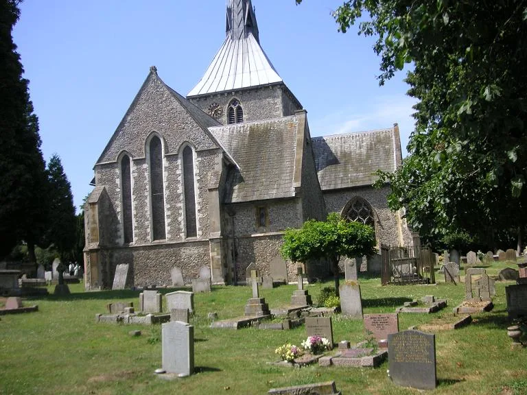
St Helen's Church, Wheathampstead
St Helen's Church, Wheathampstead — Grade I listed church in Wheathampstead, St Albans, Hertfordshire, England, UK.
More towns in this region
 Flagship📷 10
Towns & cities · London
Aldenham
Aldenham — village and civil parish in Hertfordshire, England.
 Flagship📷 10
Towns & cities · London
Ashdon
Ashdon — village and civil parish in Essex, UK.
 Flagship📷 10
Towns & cities · London
Betchworth
Betchworth — village and civil parish in the Mole Valley district of Surrey, England.
 Flagship📷 10
Towns & cities · London
Boxley
Boxley — village and civil parish in Maidstone District, Kent, England, UK.
Frequently asked questions
- Where is Wheathampstead?
- Wheathampstead is in Hertfordshire, London, United Kingdom (postcode AL4 8BA), in the parish of Wheathampstead.
- Is Wheathampstead free to visit?
- Yes, Wheathampstead is free to enter.
- How do I get to Wheathampstead?
- The nearest railway station is Harpenden, about 4.0 km away. Drivers can navigate to postcode AL4 8BA.