Farms (open to visitors) · South West England
Wayside cross 660m north of Basil Farm
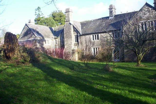
Wayside cross 660m north of Basil Farm — a Grade II*-listed farm in england-south-west, United Kingdom.

Derek Harper — CC BY-SA 2.0 via Wikimedia Commons licence
Plan your visit
- Typical visit
- 2 h–4 h
- Family-friendly
About
Wayside cross 660m north of Basil Farm is a Grade II*-listed building in england-south-west, United Kingdom. Grade II* status is conferred by Historic England (or Cadw, Historic Environment Scotland or NIEA equivalents) on buildings of exceptional national interest. See the linked Wikipedia article for full historical and architectural details.
Photo gallery
Place summary
Wayside cross 660m north of Basil Farm is a Grade II* listed structure located in South-West England. This farm cross is notable for its historical significance and architectural merit.
AI-generated from the structured facts on this page (operator, designation, listing, era). Not a substitute for visiting.
- Coordinates
- 50.6362, -4.5536
- District
- Cornwall
- Parish
- St. Clether
- Postcode
- PL15 8QN
- Parliamentary constituency
- North Cornwall
Sources
- wikidata: Q17663539 (CC0)
Other places nearby
Loading nearby places…
Nearby
 📷 5
📷 5Chapels · South West England
Chapel of St Clether
Chapel of St Clether — chapel in St Clether, Cornwall, England, UK.
📷 3Chapels · South West England
St Clether's Chapel and Holy Well
St Clether's Chapel and Holy Well — structures in St Clether, Cornwall, England, UK.
 📷 3
📷 3Archaeological sites · South West England
St Clether Holy Well
St Clether Holy Well — a archaeological in england-south-west, United Kingdom.
 Flagship📷 5
Stately homes · South West England
Basil Manor
Basil Manor — manor house in St Clether, Cornwall, England, UK.
 📷 5
📷 5Historic churches · South West England
St Clether
St Clether — a church in england-south-west, United Kingdom.
 📷 3
📷 3Chapels · South West England
Trecollas Chapel
Trecollas Chapel — chapel in Altarnun, Cornwall, England, UK.
More places in this region
 📷 4
📷 4Farms (open to visitors) · South West England
Burrow Hill Cider Farm
Burrow Hill Cider Farm is a cider farm in Somerset, England at the base of Burrow Hill overlooking the Somerset Levels. It has views of most of South Somerset on clear days. The cider is made in tradi
 📷 3
📷 3Farms (open to visitors) · South West England
Occombe Farm
Occombe Farm — a other in england-south-west, United Kingdom.
 📷 3
📷 3Farms (open to visitors) · South West England
Totnes Rare Breeds Farm
Totnes Rare Breeds Farm — a other in england-south-west, United Kingdom.
 📷 3
📷 3Farms (open to visitors) · South West England
Abbotsbury Children's Farm
Abbotsbury Children's Farm — a other in england-south-west, United Kingdom.
Frequently asked questions
- Where is Wayside cross 660m north of Basil Farm?
- Wayside cross 660m north of Basil Farm is in South-West England, United Kingdom (postcode PL15 8QN), in the parish of St. Clether.
- Is Wayside cross 660m north of Basil Farm a listed building?
- Wayside cross 660m north of Basil Farm is officially recognised as Grade II* listed.
- How do I get to Wayside cross 660m north of Basil Farm?
- Drivers can navigate to postcode PL15 8QN. It sits within the North Cornwall parliamentary constituency.