Towns & cities · West Midlands
Water Orton
Water Orton — village in Warwickshire, England, UK.

Wikimedia Commons contributors — see linked file page for photographer and licence licence
Plan your visit
- Typical visit
- 3 h–6 h
- Nearest railway station
- Water Orton · 0.5 km
- Free entry
- Family-friendly
- Dog-friendly
About
Water Orton is a town, city, village or settlement in the United Kingdom. It covers approximately 252 km². Recent population estimates put it at around 3,444 people. Wikidata describes it as: "village in Warwickshire, England, UK". Coordinates: 52.5170°, -1.7360°.
Photo gallery
Protected designations
- Site of Special Scientific Interest: River Blythe SSSI
Designations sourced from Natural England open data under OGL v3.
From the Wikipedia article
Water Orton is a village and civil parish in the North Warwickshire borough of Warwickshire in the West Midlands, England near the River Tame. It is located between Castle Bromwich and Coleshill, and borders the West Midlands metropolitan county boundary to the north, west and south. At the 2001 Census, the population was 3,573, falling to 3,444 at the 2011 Census. In the 2021 Census the population slightly rose to 3,487.
Excerpt from Wikipedia under CC BY-SA 4.0. See the source article linked in Sources below.
Background
History
]] The oldest part of the village is centred on the western end of Old Church Road and was designated a conservation area in 1983. This area overlooking the crossing of the River Tame formed the original medieval settlement of Overton and has seen the discovery of pottery remains dating back to the 12th century. Until the 14th century Water Orton's inhabitants attended ordinary church services at the chapel of ease in Castle Bromwich. It had a spire which was dismantled in 1987 after being declared unsafe due to the effects of atmospheric pollution. Until the 1840s Water Orton was mainly an agricultural village, but this changed with the coming of the railways. The first one was from to via…
Description
There is a grade II listed sandstone bridge which is scheduled as an ancient monument over the River Tame on the road to neighbouring Minworth. It was built by Bishop John Vesey of Sutton Coldfield in 1520, replacing an earlier bridge that existed from at least 1469 that was recorded as being in a poor state when Reginald Boulers, the Bishop of Coventry and Lichfield, offered to issue an indulgence to anybody who would contribute to its repair.
Sourced from Wikipedia under CC BY-SA 4.0.
- Coordinates
- 52.5170, -1.7360
- County
- Warwickshire
- District
- North Warwickshire
- Parish
- Water Orton
- Postcode
- B46 1QN
- Parliamentary constituency
- North Warwickshire and Bedworth
- Population
- 3,444
- Nearest railway station
- Water Orton — 0.5 km
Sources
- wikidata: Q1858244 (CC0)
- wikipedia: Water Orton (CC BY-SA 4.0)
- commons: Water Orton Bridge - geograph.org.uk - 1298542.jpg (CC BY-SA 4.0)
Other places nearby
Loading nearby places…
Nearby
 📷 4
📷 4Historic churches · West Midlands
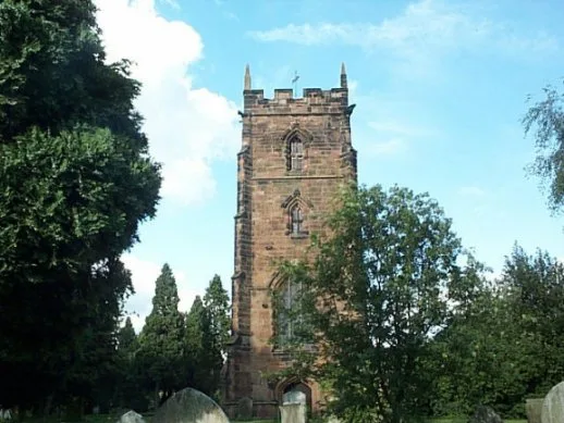
St Peter and St Paul's Church, Water Orton
St Peter and St Paul's Church, Water Orton — a Grade II*-listed church in england-west-midlands, United Kingdom.
 📷 3
📷 3Manor houses · West Midlands
Gilson Hall
Gilson Hall — a manor in england-west-midlands, United Kingdom.
Vineyards · West Midlands
Grimstock Hill Romano-British settlement
Grimstock Hill Romano-British settlement — a UK vineyard in england west midlands, producing English or Welsh wine from cool-climate grape varieties.
 📷 3
📷 3Public art & sculpture · West Midlands
Curdworth Village Sign
Curdworth Village Sign — a public art in england-west-midlands, United Kingdom.
 📷 3
📷 3Historic churches · West Midlands
Church of St Nicholas and St Peter ad Vincula, Curdworth
Church of St Nicholas and St Peter ad Vincula, Curdworth — church in Curdworth, North Warwickshire, England, UK.
 📷 5
📷 5Historic houses · West Midlands
Park Hall Academy
Park Hall Academy — a school heritage in england-west-midlands, United Kingdom.
More towns in this region
 Flagship📷 3
Towns & cities · West Midlands
Adderbury
Adderbury — village and civil parish in Cherwell district, Oxfordshire, England.
 Flagship📷 3
Towns & cities · West Midlands
Admington
Admington — village in Warwickshire, England, UK.
 Flagship📷 3
Towns & cities · West Midlands
Aldington
Aldington — village in Worcestershire, United Kingdom.
 Flagship📷 5
Towns & cities · West Midlands
Anstey
Anstey — large village in Leicestershire, England.
Frequently asked questions
- Where is Water Orton?
- Water Orton is in Warwickshire, the West Midlands, United Kingdom (postcode B46 1QN), in the parish of Water Orton.
- Is Water Orton a protected site?
- Yes — Water Orton is part of the River Blythe SSSI Site of Special Scientific Interest.
- Is Water Orton free to visit?
- Yes, Water Orton is free to enter.
- How do I get to Water Orton?
- The nearest railway station is Water Orton, about 0.5 km away. Drivers can navigate to postcode B46 1QN.