Reservoirs & lochs · Scottish Lowlands
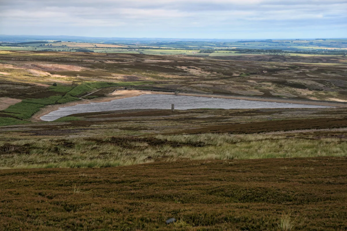
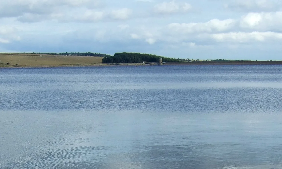
Waskerley Reservoir
Waskerley Reservoir — reservoir in County Durham, England, UK.

Wikimedia Commons licence
Plan your visit
- Typical visit
- 1 h–2.5 h
- Nearest railway station
- Stanhope · 6.0 km
- Free entry
- Dog-friendly
About
Waskerley Reservoir is a reservoir in the United Kingdom. Wikidata describes it as: "reservoir in County Durham, England, UK". Coordinates: 54.7931°, -1.9653°.
Photo gallery
Protected designations
- Site of Special Scientific Interest: Muggleswick, Stanhope and Edmundbyers Commons and Blanchland Moor SSSI
- Area of Outstanding Natural Beauty: North Pennines
Designations sourced from Natural England open data under OGL v3.
From the Wikipedia article
Waskerley Reservoir is the largest of a group of three reservoirs located on Muggleswick Common, County Durham, with the others being Smiddy Shaw and Hisehope Reservoirs. The reservoir, which was constructed in 1877, is owned and operated by Northumbrian Water. It and Smiddy Shaw—which in turn is fed by Hisehope—feed water under gravity to a water treatment works at Honey Hill. Because the three reservoirs cannot meet the full demand of Honey Hill, Waskerley can be replenished by a gravity feed from Burnhope Reservoir or, if necessary, by pumping water from the Tyne-Tees Tunnel via an airshaft. Waskerley and its two neighbouring reservoirs are located within the Muggleswick, Stanhope and Edmundbyers Commons and Blanchland Moor Site of Special Scientific Interest, which itself forms part of the North Pennines Area of Outstanding Natural Beauty.
Excerpt from Wikipedia under CC BY-SA 4.0. See the source article linked in Sources below.
- Coordinates
- 54.7931, -1.9653
- District
- County Durham
- Parish
- Muggleswick
- Postcode
- DH8 9DY
- Parliamentary constituency
- North Durham
- Nearest railway station
- Stanhope — 6 km
- Official site
- www.britishdams.org
Sources
- wikidata: Q7372269 (CC0)
- wikipedia: Waskerley Reservoir (CC BY-SA 4.0)
Other places nearby
Loading nearby places…
Nearby
 📷 3
📷 3Natural landmarks · Scottish Lowlands
Hawkburn Head Picnic Area
Hawkburn Head Picnic Area — a other in scotland-lowlands, United Kingdom.
 📷 3
📷 3Memorials & monuments · Scottish Lowlands
Edmundbyer's Cross
Edmundbyer's Cross — a memorial in scotland-lowlands, United Kingdom.
 📷 3
📷 3Reservoirs & lochs · Scottish Lowlands
Hisehope Reservoir
Hisehope Reservoir — reservoir in County Durham, England, UK.
 📷 3
📷 3Heritage railway stations · North East England
Blanchland railway station
Blanchland railway station in England North East, United Kingdom.
 📷 4
📷 4Other places · North East England
North West Durham
North West Durham in England North East, United Kingdom.
 📷 4
📷 4Mines & mining heritage · North East England
River Browney
River Browney in England North East, United Kingdom.
More places in this region
 Flagship📷 5
Reservoirs & lochs · Scottish Lowlands
Kielder Water
Kielder Water — reservoir in Northumberland, England, UK, on the River North Tyne.
 Flagship📷 3
Reservoirs & lochs · Scottish Lowlands
Q1200405
Q1200405 — reservoir on the border between County Durham and Northumberland, in England.
 📷 3
📷 3Reservoirs & lochs · Scottish Lowlands
Alemoor Reservoir
Alemoor Reservoir — reservoir lake in Scottish Borders, Scotland, UK, on Ale Water.
 📷 3
📷 3Reservoirs & lochs · Scottish Lowlands
Aucha Lochy
Aucha Lochy — reservoir on Kintyre, Argyll and Bute, Scotland, UK, outflows south to Auchalochy Burn.
Frequently asked questions
- Where is Waskerley Reservoir?
- Waskerley Reservoir is in the Scottish Lowlands, United Kingdom (postcode DH8 9DY), in the parish of Muggleswick.
- Is Waskerley Reservoir a protected site?
- Yes — Waskerley Reservoir is part of the Muggleswick, Stanhope and Edmundbyers Commons and Blanchland Moor SSSI Site of Special Scientific Interest and the North Pennines National Landscape (AONB).
- How do I get to Waskerley Reservoir?
- The nearest railway station is Stanhope, about 6.0 km away. Drivers can navigate to postcode DH8 9DY.