Museums · South West England
Washford River
The Washford River is a river in the English county of Somerset. It rises at 1,213 feet (370 m) above mean sea level near the village of Treborough, in the Brendon Hills, and flows into the Bristol Ch

Phil Champion — CC BY-SA 2.0 via Wikimedia Commons licence
Plan your visit
- Typical visit
- 1.5 h–3 h
- Best time of year
- Year-round
- Family-friendly
- Limited wheelchair access
About
The Washford River is a river in the English county of Somerset. It rises at 1,213 feet (370 m) above mean sea level near the village of Treborough, in the Brendon Hills, and flows into the Bristol Channel in the port town of Watchet. On its course it flows through the civil parishes of Treborough, Luxborough, Withycombe, Old Cleeve, Nettlecombe, Williton and Watchet, and through the settlements of Pooltown, Kingsbridge, Roadwater, Torre, Washford and Watchet. The river valley passes through the Cleeve Hill Site of Special Scientific Interest, and close to Cleeve Abbey. The Washford River has a length of 19 kilometres (12 mi) and drains a catchment area of 33.3 square kilometres (12.9 sq mi). The Environment Agency defines two waterbodies for the catchment area. The Washford - Lower waterbody comprises the area up to Tacker Street, just upstream of Roadwater, whilst the Washford - Upper waterbody comprises the area above that point. As of August 2023, the Washford - Lower waterbody had a moderate ecological status, whilst the Washford - Upper had a poor ecological status.
Photo gallery
From the Wikipedia article
The Washford River is a river in the English county of Somerset. It rises at 1,213 feet (370 m) above mean sea level near the village of Treborough, in the Brendon Hills, and flows into the Bristol Channel in the port town of Watchet. On its course it flows through the civil parishes of Treborough, Luxborough, Withycombe, Old Cleeve, Nettlecombe, Williton and Watchet, and through the settlements of Pooltown, Kingsbridge, Roadwater, Torre, Washford and Watchet. The river valley passes through the Cleeve Hill Site of Special Scientific Interest, and close to Cleeve Abbey. The Washford River has a length of 19 kilometres (12 mi) and drains a catchment area of 33.3 square kilometres (12.9 sq mi). The Environment Agency defines two waterbodies for the catchment area. The Washford - Lower waterbody comprises the area up to Tacker Street, just upstream of Roadwater, whilst the Washford - Upper waterbody comprises the area above that point. As of August 2023, the Washford - Lower waterbody had a moderate ecological status, whilst the Washford - Upper had a poor ecological status.
Excerpt from Wikipedia under CC BY-SA 4.0. See the source article linked in Sources below.
- Coordinates
- 51.1833, -3.3358
- District
- Somerset
- Parish
- Watchet
- Postcode
- TA23 0BJ
- Parliamentary constituency
- Tiverton and Minehead
Sources
- wikipedia: Washford River (CC BY-SA 4.0)
Other places nearby
Loading nearby places…
Nearby
 📷 3
📷 3Museums · South West England
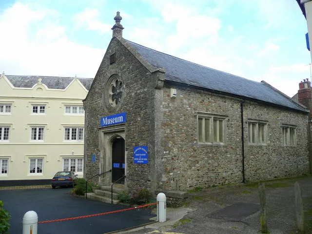
Watchet Museum
Watchet Museum — a museum in england-south-west, United Kingdom.
📷 5Museums · South West England
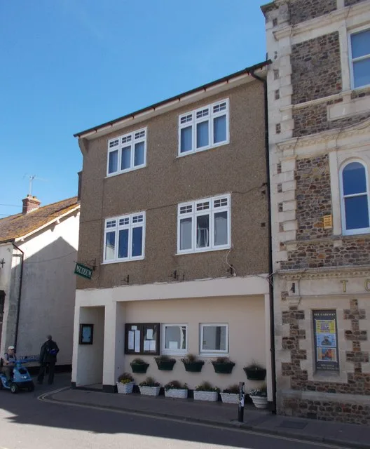
Market House Museum
The Market House Museum is a small museum in Watchet, Somerset, England. The building on Market Street was constructed in 1820 on the site of the previous market house which had been demolished in 180
 📷 3
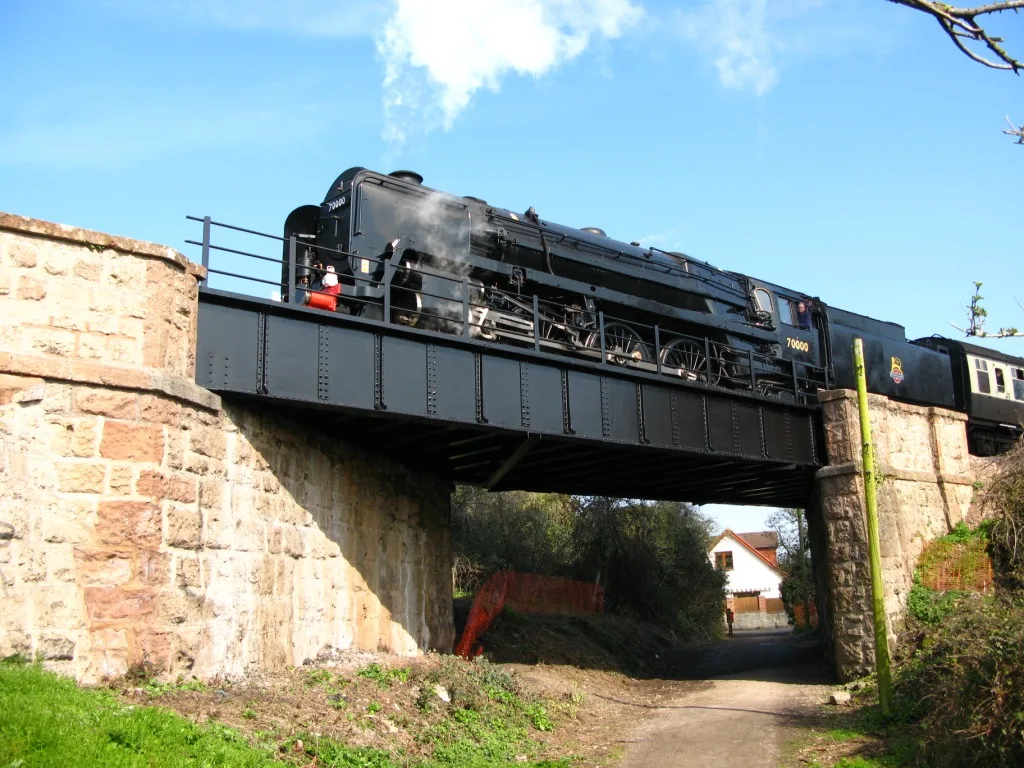
📷 3Heritage railways · South West England
West Somerset Railway
West Somerset Railway is a heritage railway in the United Kingdom.
 📷 3
📷 3Heritage railways · South West England
West Somerset Railway
West Somerset Railway is a heritage railway in the United Kingdom.
 📷 3
📷 3Public art & sculpture · South West England
The Ancient Mariner
The Ancient Mariner — a public art in england-south-west, United Kingdom.
 📷 3
📷 3Museums · South West England
The Radio Museum
The Radio Museum — a museum in england-south-west, United Kingdom.
More museums in this region
 📷 5
📷 5Museums · South West England
Allhallows Museum
Allhallows Museum — museum in Honiton, Devon, England, United Kingdom.
 📷 5
📷 5Museums · South West England
Axe Valley Heritage Museum
Axe Valley Heritage Museum — museum in Seaton, England, UK.
 📷 5
📷 5Museums · South West England
Bakelite Museum
Bakelite Museum is a museum in the United Kingdom.
 📷 5
📷 5Museums · South West England
Barometer World
Barometer World — former museum in Devon, England.
Frequently asked questions
- Where is Washford River?
- Washford River is in South West England, in the United Kingdom — coordinates 51.1833°, -3.3358°.
- Is Washford River wheelchair accessible?
- Partially — OpenStreetMap notes limited wheelchair access at Washford River. Check ahead for specific facilities.