Towns & cities · South East England
Ware
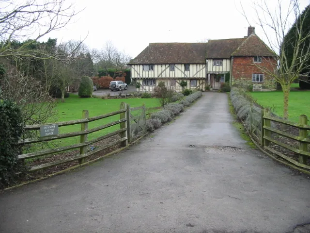
Ware — village in Kent, England, UK.

Nick Smith — CC BY-SA 2.0 via Wikimedia Commons licence
Plan your visit
- Typical visit
- 3 h–6 h
- Nearest railway station
- Minster · 4.6 km
- Free entry
- Family-friendly
- Dog-friendly
About
Ware is a town, city, village or settlement in the United Kingdom. Wikidata describes it as: "village in Kent, England, UK". Coordinates: 51.3000°, 1.2700°.
Photo gallery
Protected designations
- Area of Outstanding Natural Beauty: Kent Downs
Designations sourced from Natural England open data under OGL v3.
From the Wikipedia article
Ware is a village situated between Canterbury and Ramsgate in Kent, England. The population of the village is included in the civil parish of Ash
Excerpt from Wikipedia under CC BY-SA 4.0. See the source article linked in Sources below.
- Coordinates
- 51.3000, 1.2700
- County
- Kent
- District
- Dover
- Parish
- Ash
- Postcode
- CT3 2LZ
- Parliamentary constituency
- Herne Bay and Sandwich
- Nearest railway station
- Minster — 4.6 km
Sources
- wikidata: Q338093 (CC0)
- wikipedia: Ware, Kent (CC BY-SA 4.0)
Other places nearby
Loading nearby places…
Nearby
 Flagship📷 5
Stately homes · South East England
Wingham Barton Manor
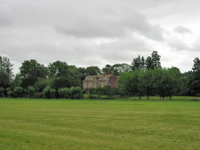
Wingham Barton Manor — manor house in Ash, Dover, Kent, England, UK.
Campsites · South East England
Goldstone Camping
Goldstone Camping — a campsite in england south east.
 📷 5
📷 5Towns & cities · South East England
Elmstone
Elmstone — village in Kent, England, UK.
 📷 5
📷 5Memorials & monuments · South East England
Monument About 1 Metre South Of Church Of St Nicholas
Monument About 1 Metre South Of Church Of St Nicholas — Grade II listed building-listed memorial in england-south-east, United Kingdom.
 📷 5
📷 5Historic churches · South East England
Church of St Nicholas
Church of St Nicholas — church in Ash, Dover, Kent, England, UK.
 Flagship📷 5
Stately homes · South East England
Poulton Manor
Poulton Manor — manor house in Woodnesborough, Kent, England, UK.
More towns in this region
 Flagship📷 10
Towns & cities · South East England
Aldermaston
Aldermaston — village and civil parish in West Berkshire in England, UK.
 Flagship📷 10
Towns & cities · South East England
Aldingbourne
Aldingbourne — village and civil parish in Arun, West Sussex, UK.
 Flagship📷 10
Towns & cities · South East England
Aldington
Aldington — village and civil parish in the Ashford District of Kent, England.
 Flagship📷 10
Towns & cities · South East England
Aldworth
Aldworth — village and civil parish in the English county of Berkshire.
Frequently asked questions
- Where is Ware?
- Ware is in Kent, South-East England, United Kingdom (postcode CT3 2LZ), in the parish of Ash.
- Is Ware a protected site?
- Yes — Ware is part of the Kent Downs National Landscape (AONB).
- Is Ware free to visit?
- Yes, Ware is free to enter.
- How do I get to Ware?
- The nearest railway station is Minster, about 4.6 km away. Drivers can navigate to postcode CT3 2LZ.