Mountains & hills · West Midlands
Walton Hill
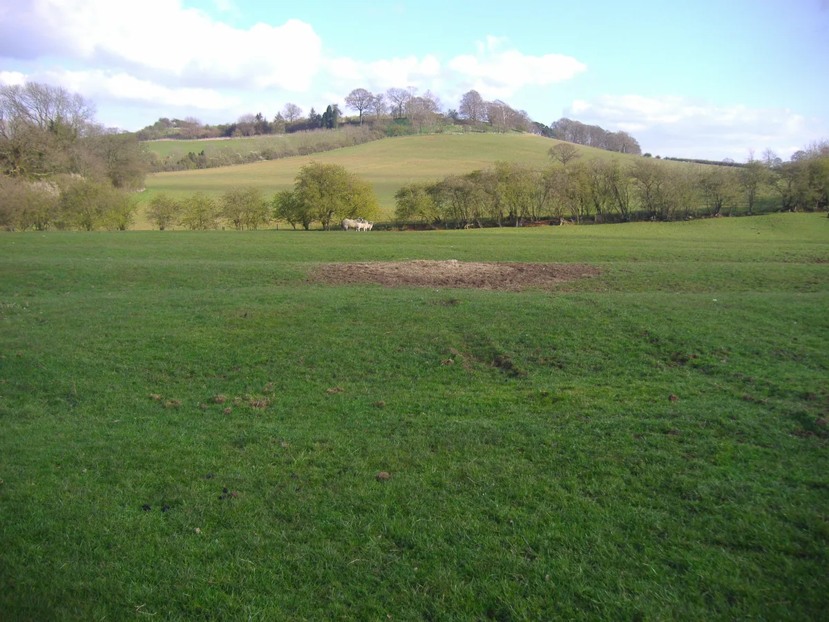
Walton Hill — Named summit at 316 m.

Wikimedia Commons contributors — see linked file page for photographer and licence licence
Plan your visit
- Typical visit
- 3 h–8 h
- Best time of year
- Late spring – early autumn (May–Oct)
- Nearest railway station
- Hagley · 4.2 km
- Free entry
- Dog-friendly
About
Walton Hill is a named summit in the United Kingdom. Wikidata describes it as: "Named summit at 316 m.". Coordinates: 52.4155°, -2.0862°.
Photo gallery
From the Wikipedia article
At 316 metres (1,037 ft) above sea level, Walton Hill is the highest point in the range of hills in northern Worcestershire known as the Clent Hills. It is the highest point for 21 miles (34 km) in all directions, and as such commands an excellent panorama. Its neighbours include Clent Hill, Wychbury Hill (which is hidden from view by Clent Hill), Calcot Hill, and Romsley Hill. The summit of the hill is open grassland and heath, which was commonland of the manor of Clent. This became a regulated common in 1935, as a result of action by Bromsgrove Rural District Council, and was given to the National Trust in 1959. Woodlands on the side of the hill in the Clatterbach valley were bought by Worcestershire County Council in 1957 and given by it to the National Trust in 1959.
Excerpt from Wikipedia under CC BY-SA 4.0. See the source article linked in Sources below.
- Coordinates
- 52.4155, -2.0862
- County
- Worcestershire
- District
- Bromsgrove
- Parish
- Clent
- Postcode
- B62 0NB
- Parliamentary constituency
- Bromsgrove
- Nearest railway station
- Hagley — 4.2 km
Sources
- osm: n926404083 (ODbL)
- wikipedia: Walton Hill (CC BY-SA 4.0)
- commons: Walton Hill.jpg (CC BY-SA 4.0)
Other places nearby
Loading nearby places…
Nearby
 📷 3
📷 3Memorials & monuments · West Midlands
Four Stones
Four Stones is a memorial in the United Kingdom.
 📷 3
📷 3Historic churches · West Midlands
Church of St Kenelm
Church of St Kenelm — Grade I listed building-listed church in england-west-midlands, United Kingdom.
Campsites · West Midlands
Clent Hills Camping and Caravanning Club Site
Clent Hills Camping and Caravanning Club Site — a campsite in england west midlands.
 📷 3
📷 3Memorials & monuments · West Midlands
Cader Idris Glacial Erratic Boulder
Cader Idris Glacial Erratic Boulder — a memorial in england-west-midlands, United Kingdom.
 📷 3
📷 3Memorials & monuments · West Midlands
Clent War Memorial
Clent War Memorial — Grade II listed building-listed memorial in england-west-midlands, United Kingdom.
 📷 3
📷 3Historic bridges · West Midlands
Moat Bridge And Walls About 16 Yards South-West Of Moor Hall
Moat Bridge And Walls About 16 Yards South-West Of Moor Hall — Grade II listed building-listed bridge in england-west-midlands, United Kingdom.
More mountains in this region
 📷 5
📷 5Mountains & hills · West Midlands
Arbury Hill
Arbury Hill — Named summit at 224.3 m.
Mountains & hills · West Midlands
Barr Beacon
Barr Beacon — Named summit at 227 m.
 📷 3
📷 3Mountains & hills · West Midlands
Barrow Hill
Barrow Hill — Named summit at 179 m.
Mountains & hills · West Midlands
Beacon Hill
Beacon Hill — Named summit at 237 m.
Frequently asked questions
- Where is Walton Hill?
- Walton Hill is in Worcestershire, the West Midlands, United Kingdom (postcode B62 0NB), in the parish of Clent.
- Is Walton Hill free to visit?
- Yes, Walton Hill is free to enter.
- How do I get to Walton Hill?
- The nearest railway station is Hagley, about 4.2 km away. Drivers can navigate to postcode B62 0NB.