Islands · East of England
Wallasea Island
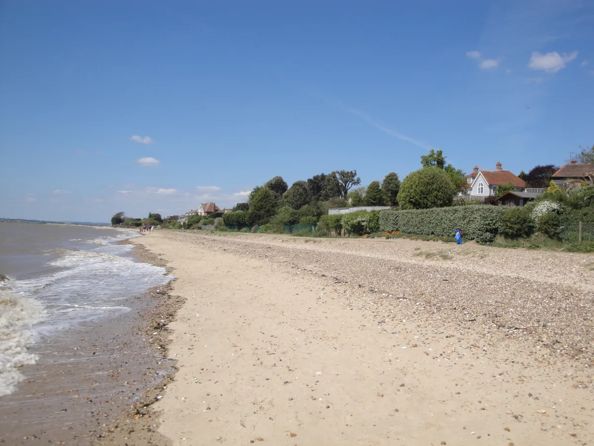
Wallasea Island — low lying island on coast of Essex, United Kingdom.

Wikimedia Commons licence
Plan your visit
- Typical visit
- 4 h–12 h
- Nearest railway station
- Burnham-on-Crouch · 4.0 km
- Free entry
- Dog-friendly
About
Wallasea Island is a island in the United Kingdom. Wikidata describes it as: "low lying island on coast of Essex, United Kingdom". Coordinates: 51.6000°, 0.8333°.
Photo gallery
Protected designations
- Site of Special Scientific Interest: Crouch and Roach Estuaries SSSI
- Site of Special Scientific Interest: Foulness SSSI
- Ramsar wetland: Crouch & Roach Estuaries (Mid-Essex Coast Phase 3)
- Ramsar wetland: Foulness (Mid-Essex Coast Phase 5)
Designations sourced from Natural England open data under OGL v3.
From the Wikipedia article
Wallasea Island lies in Essex, England. It is bounded to the north by the River Crouch, to the south east by the River Roach, and to the west by Paglesham Pool and the narrow Paglesham Creek. The population of the Island is included in the civil parish of Canewdon. Much of the island is farmland, and wheat is the main crop. A small settlement at its western end is linked by road to the mainland and is home to a campsite and marina. It is linked by a ferry to Burnham-on-Crouch. It is possible to walk for about 8 mi (13 km) around most of the sea wall. The south side of the island is one of the most tranquil places in Essex, where wildlife typical of open farmland such as skylarks, corn buntings and hares can be observed. Close by, on the opposite side of the estuary of the River Roach, Foulness Island and Potton Island are visible.
Excerpt from Wikipedia under CC BY-SA 4.0. See the source article linked in Sources below.
Background
History
The name is said to derive from Old English "wala" meaning "foreigner" and the suffix -ey, meaning island. Almost nothing is known about the early history of Wallasea. At the end of the last ice age it was almost certainly dry land like most of the North Sea basin. Rising sea levels are thought to have deposited the silt and sand which (together with older clays) underlie the island's soil. Several archaeological features have been recorded on the south and east edges of the island, these are the "red hills" typical of the Roman period and were probably relics of a process of extraction of salt from sea water. Thirteenth-century records mention several places on Wallasea such as Lower Barn…
Sourced from Wikipedia under CC BY-SA 4.0.
- Coordinates
- 51.6000, 0.8333
- County
- Essex
- District
- Rochford
- Parish
- Foulness
- Postcode
- SS3 9XE
- Parliamentary constituency
- Southend East and Rochford
- Nearest railway station
- Burnham-on-Crouch — 4 km
Sources
- wikidata: Q7962983 (CC0)
- wikipedia: Wallasea Island (CC BY-SA 4.0)
Other places nearby
Loading nearby places…
Nearby
 📷 5
📷 5Viewpoints · South East England
Beagle Viewpoint
Beagle Viewpoint is a viewpoint in the United Kingdom.
 📷 5
📷 5Viewpoints · South East England
Half Moon Viewpoint
Half Moon Viewpoint is a viewpoint in the United Kingdom.
 📷 5
📷 5Archaeological sites · South East England
HMS Beagle (remains of)
HMS Beagle (remains of) — a archaeological in england-south-east, United Kingdom.
 📷 5
📷 5Wildlife reserves · East of England
Wallasea Wetlands
Wallasea Wetlands — reclaimed wetlands area located in Essex, England.
 📷 3
📷 3Viewpoints · East of England
School House Viewpoint
School House Viewpoint is a viewpoint in the United Kingdom.
Caravan parks · East of England
Sea End Caravan Park
Sea End Caravan Park — a caravan park in england east.
More places in this region
 Flagship📷 5
Islands · East of England
Mersea Island
Mersea Island — island in Essex, England.
 📷 5
📷 5Islands · East of England
Bridgemarsh Island
Bridgemarsh Island — island in the River Crouch, Essex.
 📷 5
📷 5Islands · East of England
Cindery Island
Cindery Island — island in Essex, United Kingdom.
 📷 3
📷 3Islands · East of England
Cobholm Island
Cobholm Island — island in Norfolk, England.
Frequently asked questions
- Where is Wallasea Island?
- Wallasea Island is in Essex, East of England, United Kingdom (postcode SS3 9XE), in the parish of Foulness.
- Is Wallasea Island a protected site?
- Yes — Wallasea Island is part of the Crouch and Roach Estuaries SSSI Site of Special Scientific Interest and the Foulness SSSI Site of Special Scientific Interest.
- Is Wallasea Island free to visit?
- Yes, Wallasea Island is free to enter.
- How do I get to Wallasea Island?
- The nearest railway station is Burnham-on-Crouch, about 4.0 km away. Drivers can navigate to postcode SS3 9XE.