Mountains & hills · South West England
Upper Flood Swallet
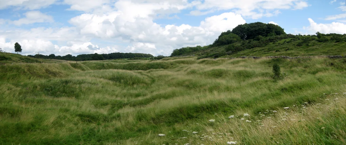
Upper Flood Swallet — limestone cave in Somerset, England.

Wikimedia Commons contributors — see linked file page for photographer and licence licence
.jpg)
Plan your visit
- Typical visit
- 3 h–8 h
- Best time of year
- Late spring – early autumn (May–Oct)
- Free entry
- Dog-friendly
About
Upper Flood Swallet is a named summit in the United Kingdom. Wikidata describes it as: "limestone cave in Somerset, England". Coordinates: 51.2988°, -2.7104°.
Photo gallery
Protected designations
- Site of Special Scientific Interest: The Cheddar Complex SSSI
- National Nature Reserve: MENDIP
- Area of Outstanding Natural Beauty: Mendip Hills
Designations sourced from Natural England open data under OGL v3.
From the Wikipedia article
Upper Flood Swallet which was originally known as Blackmoor Flood Swallet, is an exceptionally well-decorated cave near Charterhouse, in the carboniferous limestone of the Mendip Hills, in Somerset, England. The cave is part of the Cheddar Complex SSSI. The entrance was revealed in the Great Flood of 1968, giving the cave its name. It was dug consistently since then with breakthroughs occurring in 1971, 1972, 1985 and 2006. As of September 2008 it is over 3.5 km in length and around 125 m deep.
Excerpt from Wikipedia under CC BY-SA 4.0. See the source article linked in Sources below.
Background
Description
In September 2006 cavers squeezed through an excavated boulder choke into new passage. In a series of three digging trips they discovered 1.2 km of well decorated cave.
Sourced from Wikipedia under CC BY-SA 4.0.
- Coordinates
- 51.2988, -2.7104
- District
- Somerset
- Parish
- Priddy
- Postcode
- BS40 7XR
- Parliamentary constituency
- Wells and Mendip Hills
Sources
- wikidata: Q7898648 (CC0)
- wikipedia: Upper Flood Swallet (CC BY-SA 4.0)
- commons: Neverland. Upper Flood Swallet , Charterhouse (geograph 4144542).jpg (CC BY-SA 4.0)
Other places nearby
Loading nearby places…
Nearby
.jpg?width=1200) 📷 3
📷 3Caves · South West England
Upper Flood Swallet
Upper Flood Swallet is a cave in the United Kingdom.
 📷 3
📷 3Caves · South West England
Waterwheel Swallet
Waterwheel Swallet is a cave in the United Kingdom.
Vineyards · South West England
Charterhouse Camp
Charterhouse Camp — a UK vineyard in england south west, producing English or Welsh wine from cool-climate grape varieties.
 📷 5
📷 5Caves · South West England
Blackmoor Swallet
Blackmoor Swallet is a cave in the United Kingdom.
 📷 3
📷 3Archaeological sites · South Wales
Town Field rectangular enclosure
Town Field rectangular enclosure — a archaeological in wales-south, United Kingdom.
 📷 3
📷 3Hill forts · South Wales
Charterhouse Roman Town
Charterhouse Roman Town — town in the Roman province of Britannia, located close to Charterhouse-on-Mendip.
More mountains in this region
 📷 5
📷 5Mountains & hills · South West England
Alex Tor
Alex Tor — Named summit at 291 m.
 📷 5
📷 5Mountains & hills · South West England
Ash Hole Cavern
Ash Hole Cavern — cave in Brixham, Devon, England, UK.
 📷 5
📷 5Mountains & hills · South West England
Babbacombe Bay
Babbacombe Bay — bay in Devon, England.
 📷 5
📷 5Mountains & hills · South West England
Barley Bay
Barley Bay — bay in the United Kingdom.
Frequently asked questions
- Where is Upper Flood Swallet?
- Upper Flood Swallet is in South-West England, United Kingdom (postcode BS40 7XR), in the parish of Priddy.
- Is Upper Flood Swallet a protected site?
- Yes — Upper Flood Swallet is part of the The Cheddar Complex SSSI Site of Special Scientific Interest and the MENDIP National Nature Reserve.
- Is Upper Flood Swallet free to visit?
- Yes, Upper Flood Swallet is free to enter.
- How do I get to Upper Flood Swallet?
- Drivers can navigate to postcode BS40 7XR. It sits within the Wells and Mendip Hills parliamentary constituency.