Towns & cities · Central Scotland
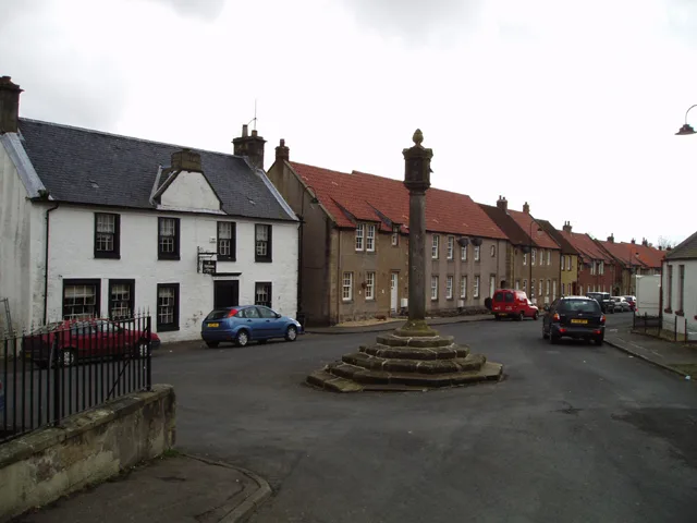
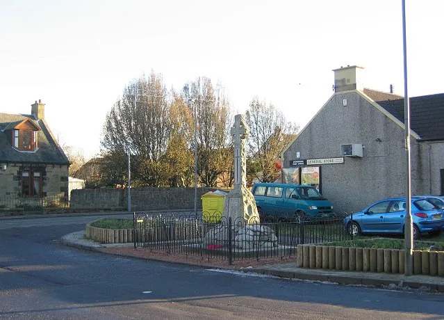
Twechar
Twechar — village in East Dunbartonshire, Scotland, UK.
.jpg?width=1200)
Wikimedia Commons contributors — see linked file page for photographer and licence licence
.jpg)
Plan your visit
- Typical visit
- 3 h–6 h
- Nearest railway station
- Croy · 3.2 km
- Free entry
- Family-friendly
- Dog-friendly
About
Twechar is a town, city, village or settlement in the United Kingdom. Recent population estimates put it at around 1,220 people. Wikidata describes it as: "village in East Dunbartonshire, Scotland, UK". Coordinates: 55.9539°, -4.0868°.
Photo gallery
From the Wikipedia article
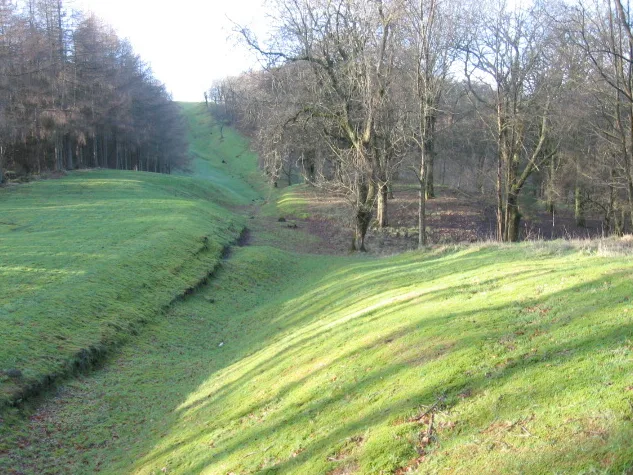
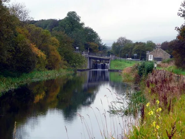
Twechar is a small former mining village historically in Dunbartonshire and administered by the council area of East Dunbartonshire, Scotland close to the boundary with North Lanarkshire. It lies between the larger towns of Cumbernauld, Kilsyth and Kirkintilloch. The Forth and Clyde Canal runs close to the village to the north, and closely follows the line of the Antonine Wall. There are visible remains of the wall on Bar Hill and the Roman Fort is a local tourist attraction.
Excerpt from Wikipedia under CC BY-SA 4.0. See the source article linked in Sources below.
Background
History
from Shirva, Twechar.]] The etymology of the name is probably ‘causeway or pavement’. Several old documents show Twechar with various spellings including maps by Charles Ross, and William Roy. There is a long history of mining activity in the Twechar locality but it was not until the coming of William Baird & Co. to the area, about 1860, that a close-knit mining community was created. Before that time Shirva was described as having the best farm land in the parish. Several tombstones from a possible Roman Cemetery were found at Shirva House. A legionary slab was also discovered. In 2020 a replica of the Eastermains stone was installed in Twechar. It was found on near the discovery site of…
Sourced from Wikipedia under CC BY-SA 4.0.
- Coordinates
- 55.9539, -4.0868
- District
- East Dunbartonshire
- Postcode
- G65 9DR
- Parliamentary constituency
- Cumbernauld and Kirkintilloch
- Population
- 1,220
- Nearest railway station
- Croy — 3.2 km
Sources
- wikidata: Q1011570 (CC0)
- wikipedia: Twechar (CC BY-SA 4.0)
- commons: Twechar Parish Church (geograph 3036627).jpg (CC BY-SA 4.0)
Other places nearby
Loading nearby places…
Nearby
 📷 4
📷 4Natural landmarks · Central Scotland
University of the West of Scotland
University of the West of Scotland — a university in scotland-central, United Kingdom.
 📷 3
📷 3Hill forts · Central Scotland
Bar Hill Fort Bathhouse
Bar Hill Fort Bathhouse — a hill fort in scotland-central, United Kingdom.
 📷 3
📷 3Archaeological sites · Central Scotland
Bar Hill Roman Fort
Bar Hill Roman Fort — a archaeological in scotland-central, United Kingdom.
Vineyards · Central Scotland
Castle Hill
Castle Hill — a UK vineyard in scotland central, producing English or Welsh wine from cool-climate grape varieties.
 Flagship📷 4
UNESCO World Heritage · Central Scotland
Antonine Wall
Antonine Wall — defensive fortification in Roman Britain.
 📷 3
📷 3Archaeological sites · Central Scotland
Auchendavy Roman Fort
Auchendavy Roman Fort — a archaeological in scotland-central, United Kingdom.
More towns in this region
 Flagship📷 3
Towns & cities · Central Scotland
Airth
Airth — village in Falkirk, Scotland, UK.
 Flagship📷 5
Towns & cities · Central Scotland
Avonbridge
Avonbridge — village in Falkirk, Scotland, UK.
 Flagship📷 3
Towns & cities · Central Scotland
Banknock
Banknock — village in Falkirk, Scotland, UK.
 Flagship📷 3
Towns & cities · Central Scotland
Dundee
Dundee — city in Scotland, UK.
Frequently asked questions
- Where is Twechar?
- Twechar is in central Scotland, United Kingdom (postcode G65 9DR).
- Is Twechar free to visit?
- Yes, Twechar is free to enter.
- How do I get to Twechar?
- The nearest railway station is Croy, about 3.2 km away. Drivers can navigate to postcode G65 9DR.