Towns & cities · West Midlands
Turvey
Turvey — village in Bedfordshire, England, United Kingdom.

Wikimedia Commons contributors — see linked file page for photographer and licence licence
Plan your visit
- Typical visit
- 3 h–6 h
- Free entry
- Family-friendly
- Dog-friendly
About
Turvey is a town, city, village or settlement in the United Kingdom. Recent population estimates put it at around 1,192 people. Address: MK43. Wikidata describes it as: "village in Bedfordshire, England, United Kingdom". Coordinates: 52.1621°, -0.6255°.
Photo gallery
From the Wikipedia article
Turvey is a village and civil parish on the River Great Ouse in the Borough of Bedford, Bedfordshire, England, about 7 miles (11 km) west of Bedford town centre. The village is on the A428 road between Bedford and Northampton, close to the border with Buckinghamshire. The 2011 Census recorded the parish's population as 1,225.
Excerpt from Wikipedia under CC BY-SA 4.0. See the source article linked in Sources below.
Background
History
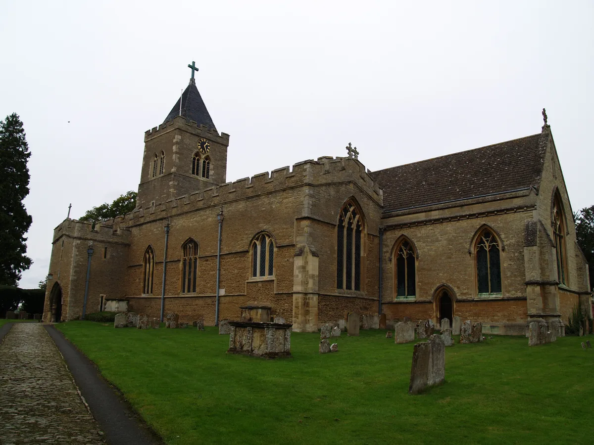
Turvey is recorded in Domesday Book of 1086 as a parish in the Hundred of Willey. There are eight separate entries for Turvey, including a total of 44 households. The Mordaunt family obtained the manor by marriage in 1197 and were ennobled as Barons of Turvey in the 16th century. The Mordaunt family house, Turvey Old Hall, was replaced by Turvey House in 1792, by which time the estate had passed to the Higgins family. It was extended in the 19th century and still stands. There is a second large house in the village called Turvey Abbey, which was historically a family house, but is now a Benedictine monastery. The parish church of All Saints has Saxon origins but is almost certainly a…
Sourced from Wikipedia under CC BY-SA 4.0.
- Coordinates
- 52.1621, -0.6255
- District
- Bedford
- Parish
- Turvey
- Postcode
- MK43
- Parliamentary constituency
- North Bedfordshire
- Population
- 1,192
- Official site
- www.turveybeds.com
Sources
- wikidata: Q1520342 (CC0)
- wikipedia: Turvey, Bedfordshire (CC BY-SA 4.0)
- commons: All Saints, Turvey, south aisle - geograph.org.uk - 1199817.jpg (CC BY-SA 4.0)
Other places nearby
Loading nearby places…
Nearby
 📷 3
📷 3Memorials & monuments · West Midlands
Turvey War Memorial
Turvey War Memorial is a memorial in the United Kingdom.
 📷 3
📷 3Historic churches · West Midlands
Parish Church of All Saints, Turvey
Parish Church of All Saints, Turvey — Grade I listed church in Bedfordshire, England, UK.
 📷 3
📷 3Historic bridges · West Midlands
Turvey Bridge
Turvey Bridge — scheduled monument-listed bridge in england-west-midlands, United Kingdom.
 📷 3
📷 3Historic houses · West Midlands
Turvey House
Turvey House — Grade I listed house in Turvey, Bedford, Bedfordshire, England, UK.
 📷 5
📷 5Museums · West Midlands
Turvey Abbey
Turvey Abbey — a museum in england-west-midlands, United Kingdom.
 📷 5
📷 5Towns & cities · West Midlands
Cold Brayfield
Cold Brayfield — village and civil parish in Milton Keynes, Buckinghamshire, England.
More towns in this region
 Flagship📷 3
Towns & cities · West Midlands
Adderbury
Adderbury — village and civil parish in Cherwell district, Oxfordshire, England.
 Flagship📷 3
Towns & cities · West Midlands
Admington
Admington — village in Warwickshire, England, UK.
 Flagship📷 3
Towns & cities · West Midlands
Aldington
Aldington — village in Worcestershire, United Kingdom.
 Flagship📷 5
Towns & cities · West Midlands
Anstey
Anstey — large village in Leicestershire, England.
Frequently asked questions
- Where is Turvey?
- Turvey is in the West Midlands, United Kingdom (postcode MK43), in the parish of Turvey.
- Is Turvey free to visit?
- Yes, Turvey is free to enter.
- How do I get to Turvey?
- Drivers can navigate to postcode MK43. It sits within the North Bedfordshire parliamentary constituency.