Reservoirs & lochs · Scottish Lowlands
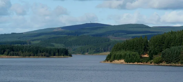
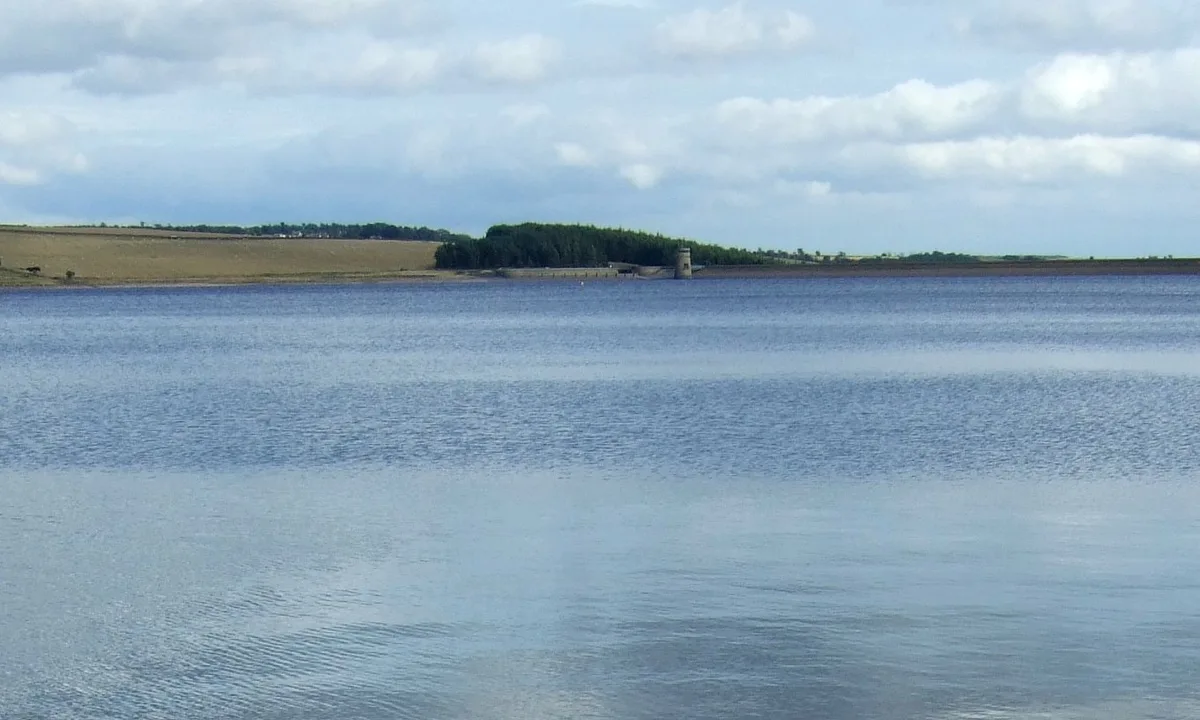
Tunstall Reservoir
Tunstall Reservoir — reservoir in County Durham, England, UK.

Wikimedia Commons licence
Plan your visit
- Typical visit
- 1 h–2.5 h
- Nearest railway station
- Wolsingham · 4.1 km
- Free entry
- Dog-friendly
About
Tunstall Reservoir is a reservoir in the United Kingdom. Wikidata describes it as: "reservoir in County Durham, England, UK". Coordinates: 54.7622°, -1.9008°.
Photo gallery
Protected designations
- Area of Outstanding Natural Beauty: North Pennines
Designations sourced from Natural England open data under OGL v3.
From the Wikipedia article
Tunstall Reservoir was a water supply storage reservoir completed in 1879, and now used solely to maintain minimum regulatory flows on the River Wear in northeast England. It is situated in the north Pennines of the United Kingdom, and lies 3.5 km north of the village of Wolsingham, in Weardale, County Durham. The earthen embankment dam, which impounds the reservoir, is recognized as the location where pressure grouting with cement grout was first utilized in 1876 by engineer Thomas Hawksley, to reduce leakage within the rock foundation under an earth dam. Pressure grouting has since become normal practice for construction and remediation at dams and related water resource projects.
Excerpt from Wikipedia under CC BY-SA 4.0. See the source article linked in Sources below.
- Coordinates
- 54.7622, -1.9008
- District
- County Durham
- Parish
- Wolsingham
- Postcode
- DL13 3LX
- Parliamentary constituency
- Bishop Auckland
- Nearest railway station
- Wolsingham — 4.1 km
- Official site
- www.gemstat.org
Sources
- wikidata: Q7372259 (CC0)
- wikipedia: Tunstall Reservoir (CC BY-SA 4.0)
Other places nearby
Loading nearby places…
Nearby
 📷 4
📷 4Reservoirs & lochs · North East England
Backstone Bank and Baal Hill Woods
Backstone Bank and Baal Hill Woods in England North East, United Kingdom.
 📷 3
📷 3Historic houses · Scottish Lowlands
Backstone Bank Depots
Backstone Bank Depots — a historic house in scotland-lowlands, United Kingdom.
Caravan parks · Scottish Lowlands
High Doctor Pasture Caravan Park
High Doctor Pasture Caravan Park — a caravan park in scotland lowlands.
 📷 3
📷 3Natural landmarks · North East England
Saltersgate Cottage railway station
Saltersgate Cottage railway station in England North East, United Kingdom.
 📷 3
📷 3Historic bridges · Scottish Lowlands
Bridge Over Thornhope Beck
Bridge Over Thornhope Beck — Grade II listed building-listed bridge in scotland-lowlands, United Kingdom.
📷 4Other places · North East England
Wolsingham School
Wolsingham School in England North East, United Kingdom.
More places in this region
 Flagship📷 5
Reservoirs & lochs · Scottish Lowlands
Kielder Water
Kielder Water — reservoir in Northumberland, England, UK, on the River North Tyne.
 Flagship📷 3
Reservoirs & lochs · Scottish Lowlands
Q1200405
Q1200405 — reservoir on the border between County Durham and Northumberland, in England.
 📷 3
📷 3Reservoirs & lochs · Scottish Lowlands
Alemoor Reservoir
Alemoor Reservoir — reservoir lake in Scottish Borders, Scotland, UK, on Ale Water.
 📷 3
📷 3Reservoirs & lochs · Scottish Lowlands
Aucha Lochy
Aucha Lochy — reservoir on Kintyre, Argyll and Bute, Scotland, UK, outflows south to Auchalochy Burn.
Frequently asked questions
- Where is Tunstall Reservoir?
- Tunstall Reservoir is in the Scottish Lowlands, United Kingdom (postcode DL13 3LX), in the parish of Wolsingham.
- Is Tunstall Reservoir a protected site?
- Yes — Tunstall Reservoir is part of the North Pennines National Landscape (AONB).
- How do I get to Tunstall Reservoir?
- The nearest railway station is Wolsingham, about 4.1 km away. Drivers can navigate to postcode DL13 3LX.