Towns & cities · East Midlands
Torksey
Torksey — village and civil parish in Lincolnshire, England, UK.

Wikimedia Commons contributors — see linked file page for photographer and licence licence
Plan your visit
- Typical visit
- 3 h–6 h
- Nearest railway station
- Saxilby · 6.4 km
- Free entry
- Family-friendly
- Dog-friendly
About
Torksey is a town, city, village or settlement in the United Kingdom. Recent population estimates put it at around 665 people. Address: LN1. Wikidata describes it as: "village and civil parish in Lincolnshire, England, UK". Coordinates: 53.2986°, -0.7453°.
Photo gallery
From the Wikipedia article
Torksey is a small village in the West Lindsey district of Lincolnshire, England. The population of the civil parish at the 2011 census was 875. It is situated on the A156 road, 7 miles (11 km) south of Gainsborough and 9 miles (14 km) north-west of Lincoln, and on the eastern bank of the tidal River Trent, which here forms the boundary with Nottinghamshire. It is notable historically as the site of a Roman canal, a major Viking camp, the late medieval Torksey Castle and the Torksey Viaduct.
Excerpt from Wikipedia under CC BY-SA 4.0. See the source article linked in Sources below.
Background
History
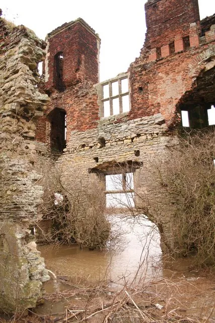
Foss Dyke, a Roman canal constructed in or about the 2nd century, joins the River Trent by way of a series of lock-gates about 0.5 mi south of the village. , a ruinous manor house]] During the 9th century, Torksey was part of the Anglo-Saxon Kingdom of Lindsey. In the late 860s, a Viking invasion force known to the English as the "Great Heathen Army" conquered eastern England. In 871–2, the Vikings established a winter camp in London, but returned to Northumbria soon afterwards, following a rebellion against their rule. During 872–3, the Great Heathen Army established its winter quarters at Torksey. The archaeological remains of the winter camp lie between the modern villages of Torksey and…
Sourced from Wikipedia under CC BY-SA 4.0.
- Coordinates
- 53.2986, -0.7453
- County
- Lincolnshire
- District
- West Lindsey
- Parish
- Torksey
- Postcode
- LN1
- Parliamentary constituency
- Gainsborough
- Population
- 665
- Nearest railway station
- Saxilby — 6.4 km
Sources
- wikidata: Q574397 (CC0)
- wikipedia: Torksey (CC BY-SA 4.0)
- commons: Torksey Lock slipway - geograph.org.uk - 663246.jpg (CC BY-SA 4.0)
Other places nearby
Loading nearby places…
Nearby
 📷 4
📷 4Stately homes · East Midlands
Torksey Castle
Torksey Castle — manor house in Torksey, West Lindsey, Lincolnshire, England, UK.
 📷 3
📷 3Canals · East Midlands
Foss Dyke
Foss Dyke — Canal that connects the River Trent.
Caravan parks · East Midlands
The Elms
The Elms — a caravan park in england east midlands.
Caravan parks · East Midlands
Little London Park
Little London Park — a caravan park in england east midlands.
 📷 5
📷 5Historic churches · East Midlands
Brampton, Lincolnshire
Brampton, Lincolnshire — a church in england-east-midlands, United Kingdom.
 📷 5
📷 5Historic churches · East Midlands
Fenton, West Lindsey
Fenton, West Lindsey — a church in england-east-midlands, United Kingdom.
More towns in this region
 Flagship📷 3
Towns & cities · East Midlands
Aldborough
Aldborough — village in Norfolk, England, UK.
 Flagship📷 4
Towns & cities · East Midlands
Alderford
Alderford — village and civil parish in Norfolk, UK.
 Flagship📷 5
Towns & cities · East Midlands
Ashmanhaugh
Ashmanhaugh — village in Norfolk, England, UK.
 Flagship📷 3
Towns & cities · East Midlands
Attlebridge
Attlebridge — a village located in Broadland, United Kingdom.
Frequently asked questions
- Where is Torksey?
- Torksey is in Lincolnshire, the East Midlands, United Kingdom (postcode LN1), in the parish of Torksey.
- Is Torksey free to visit?
- Yes, Torksey is free to enter.
- How do I get to Torksey?
- The nearest railway station is Saxilby, about 6.4 km away. Drivers can navigate to postcode LN1.