Towns & cities · South East England
Tonge
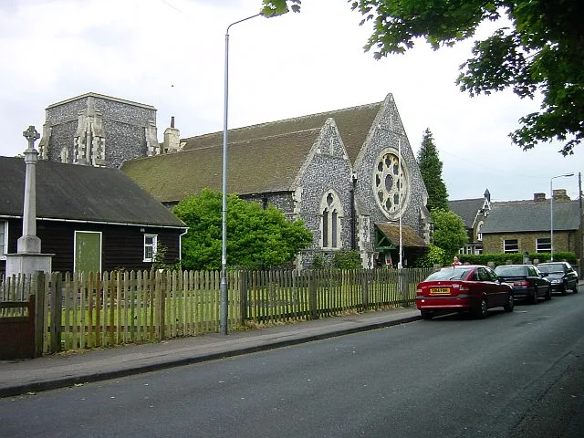
Tonge — village and civil parish in Kent, UK.

Wikimedia Commons contributors — see linked file page for photographer and licence licence
Plan your visit
- Typical visit
- 3 h–6 h
- Nearest railway station
- Kemsley Down · 2.0 km
- Free entry
- Family-friendly
- Dog-friendly
About
Tonge is a town, city, village or settlement in the United Kingdom. Recent population estimates put it at around 292 people. Wikidata describes it as: "village and civil parish in Kent, UK". Coordinates: 51.3519°, 0.7808°.
Photo gallery
Protected designations
- Site of Special Scientific Interest: The Swale SSSI
- Area of Outstanding Natural Beauty: Kent Downs
- Ramsar wetland: The Swale
Designations sourced from Natural England open data under OGL v3.
From the Wikipedia article
Tonge () is a village near Sittingbourne in Kent, England. The hamlet is north of Bapchild (where at the 2011 Census the population was included), close to Murston Marshes beside the Swale. It is mainly farmland with one road (Church Road and Blacketts Road) passing through it towards Blacketts Farm.
Excerpt from Wikipedia under CC BY-SA 4.0. See the source article linked in Sources below.
Background
History
In 1798, Edward Hasted records that it was once called 'Thwang' (a Saxon name). Vortigern, King of Saxon Britain, rewarded two Saxon chiefs Hengist and Horsa after his victory over the Scots and Picts. Hengist requested, as a pledge of the king's affection, only as much land as on ox-hide could surround. This being granted, he cut the whole hide into small thongs (long, thin strips, generally of sturdy fiber or leather, typically used for binding), and inclosed within them a space of ground, this was large enough to contain a castle, which he accordingly built on it, and named it Thwang-ceastre (i. e. Thong-castle). The castle later became a ruin in the later years of the Saxon age. Also…
Sourced from Wikipedia under CC BY-SA 4.0.
- Coordinates
- 51.3519, 0.7808
- County
- Kent
- District
- Swale
- Parish
- Tonge
- Postcode
- ME9 9AX
- Parliamentary constituency
- Faversham and Mid Kent
- Population
- 292
- Nearest railway station
- Kemsley Down — 2 km
Sources
- wikidata: Q594200 (CC0)
- wikipedia: Tonge, Kent (CC BY-SA 4.0)
- commons: St. Giles Church near Tonge - geograph.org.uk - 474395.jpg (CC BY-SA 4.0)
Other places nearby
Loading nearby places…
Nearby
 📷 5
📷 5Watermills · South East England
Old Mill and Mill House
Old Mill and Mill House — Grade II listed building-listed watermill in england-south-east, United Kingdom.
 📷 5
📷 5Stadiums · South East England
Central Park Stadium
Central Park Stadium — greyhound stadium in Kent.
📷 5Watermills · South East England
Tonge Mill
Tonge Mill — Grade II listed building-listed watermill in england-south-east, United Kingdom.
 📷 5
📷 5Museums · South East England
Sittingbourne and Kemsley Light Railway
Sittingbourne and Kemsley Light Railway — a museum in england-south-east, United Kingdom.
 📷 5
📷 5Historic churches · South East England
Milton Regis
Milton Regis — a church in england-south-east, United Kingdom.
 📷 5
📷 5Historic churches · South East England
Church of All Saints, Murston
Church of All Saints, Murston — church in Murston, Kent, England, UK.
More towns in this region
 Flagship📷 10
Towns & cities · South East England
Aldermaston
Aldermaston — village and civil parish in West Berkshire in England, UK.
 Flagship📷 10
Towns & cities · South East England
Aldingbourne
Aldingbourne — village and civil parish in Arun, West Sussex, UK.
 Flagship📷 10
Towns & cities · South East England
Aldington
Aldington — village and civil parish in the Ashford District of Kent, England.
 Flagship📷 10
Towns & cities · South East England
Aldworth
Aldworth — village and civil parish in the English county of Berkshire.
Frequently asked questions
- Where is Tonge?
- Tonge is in Kent, South-East England, United Kingdom (postcode ME9 9AX), in the parish of Tonge.
- Is Tonge a protected site?
- Yes — Tonge is part of the The Swale SSSI Site of Special Scientific Interest and the Kent Downs National Landscape (AONB).
- Is Tonge free to visit?
- Yes, Tonge is free to enter.
- How do I get to Tonge?
- The nearest railway station is Kemsley Down, about 2.0 km away. Drivers can navigate to postcode ME9 9AX.