Towns & cities · East Midlands
Thurning
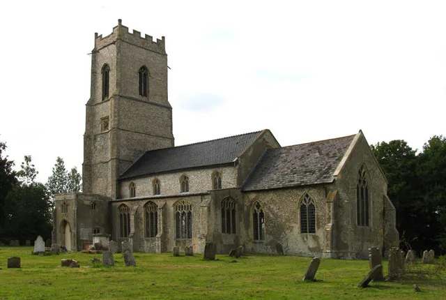
Thurning — village and civil parish in the English county of Norfolk and district of North Norfolk.

Wikimedia Commons contributors — see linked file page for photographer and licence licence
Plan your visit
- Typical visit
- 3 h–6 h
- Free entry
- Family-friendly
- Dog-friendly
About
Thurning is a town, city, village or settlement in the United Kingdom. It covers approximately 6 km². Recent population estimates put it at around 70 people. Address: NR20. Wikidata describes it as: "village and civil parish in the English county of Norfolk and district of North Norfolk". Coordinates: 52.8234°, 1.0870°.
Photo gallery
Protected designations
- Site of Special Scientific Interest: River Wensum SSSI
- Area of Outstanding Natural Beauty: Norfolk Coast
Designations sourced from Natural England open data under OGL v3.
From the Wikipedia article
Thurning is a small dispersed village and civil parish in the English county of Norfolk and district of North Norfolk, near the border with Broadland. The population at the 2011 Census remained less than 100 and is recorded together with the neighbouring civil parish of Hindolveston.
Excerpt from Wikipedia under CC BY-SA 4.0. See the source article linked in Sources below.
Background
History
At the time of the Domesday Book (1086), Thurning was recorded as 'Tyrninga', i.e. "Tyrnings" (pl.), signifying "the place of the followers or kin-group of Tyrn", typical of the earlier, immigration phase of Angle-Saxon settlements. Charles Parkin translates its findings from the Latin: In 1659, Peter Elwin of Thurning (1623–1695) married Anne Rolfe, the elder daughter of Thomas Rolfe, who was the son of John Rolfe and his wife Pocahontas. John Rolfe was originally from Heacham in Norfolk, and his granddaughter Anne was brought up there. Parish registers survive only from the early 18th century. Registers deposited in the Norfolk Record Office are for baptisms (1707, 1715–2006), marriages…
Sourced from Wikipedia under CC BY-SA 4.0.
- Coordinates
- 52.8234, 1.0870
- County
- Norfolk
- District
- North Norfolk
- Parish
- Thurning
- Postcode
- NR20
- Parliamentary constituency
- Broadland and Fakenham
- Population
- 70
- Official site
- web.archive.org
Sources
- wikidata: Q1875545 (CC0)
- wikipedia: Thurning, Norfolk (CC BY-SA 4.0)
- commons: S Andrew, Thurning, Norfolk - geograph.org.uk - 308718.jpg (CC BY-SA 4.0)
Other places nearby
Loading nearby places…
Nearby
 📷 3
📷 3Public art & sculpture · East Midlands
Thurning Village Sign
Thurning Village Sign — a public art in england-east-midlands, United Kingdom.
 📷 3
📷 3Historic bridges · East Midlands
Reepham Road Bridge
Reepham Road Bridge — Grade II listed building-listed bridge in england-east-midlands, United Kingdom.
Campsites · East Midlands
Pee Wit Farm
Pee Wit Farm — a campsite in england east midlands.
 📷 3
📷 3Public art & sculpture · East Midlands
Wood Dalling Village Sign
Wood Dalling Village Sign — a public art in england-east-midlands, United Kingdom.
 Flagship📷 5
Towns & cities · East Midlands
Wood Dalling
Wood Dalling — village in Norfolk, England, UK.
 📷 3
📷 3Historic houses · East Midlands
Cropton Hall
Cropton Hall — house in Heydon, Broadland, England, UK.
More towns in this region
 Flagship📷 3
Towns & cities · East Midlands
Aldborough
Aldborough — village in Norfolk, England, UK.
 Flagship📷 4
Towns & cities · East Midlands
Alderford
Alderford — village and civil parish in Norfolk, UK.
 Flagship📷 5
Towns & cities · East Midlands
Ashmanhaugh
Ashmanhaugh — village in Norfolk, England, UK.
 Flagship📷 3
Towns & cities · East Midlands
Attlebridge
Attlebridge — a village located in Broadland, United Kingdom.
Frequently asked questions
- Where is Thurning?
- Thurning is in Norfolk, the East Midlands, United Kingdom (postcode NR20), in the parish of Thurning.
- Is Thurning a protected site?
- Yes — Thurning is part of the River Wensum SSSI Site of Special Scientific Interest and the Norfolk Coast National Landscape (AONB).
- Is Thurning free to visit?
- Yes, Thurning is free to enter.
- How do I get to Thurning?
- Drivers can navigate to postcode NR20. It sits within the Broadland and Fakenham parliamentary constituency.