Castles · London
Thurnham, Kent
Thurnham is a village and civil parish which lies at the foot of the North Downs 3 miles (4.8 km) north east of Maidstone in the Borough of Maidstone and ceremonial county of Kent in England. It had a

Stephen Craven — CC BY-SA 2.0 via Wikimedia Commons licence
Plan your visit
- Typical visit
- 1.5 h–3 h
- Family-friendly
- Limited wheelchair access
About
Thurnham is a village and civil parish which lies at the foot of the North Downs 3 miles (4.8 km) north east of Maidstone in the Borough of Maidstone and ceremonial county of Kent in England. It had a population of 1,085 in 2001 including Weavering, which increased to 1,205 following the 2011 Census. There have been several archaeological finds in the area: an Anglo-Saxon burial ground was discovered within the grounds of Thurnham Friars in 1913, a 7th-century gold cross was found in 1967 and the remains of a Roman house were excavated in 1933. The remains of Thurnham Castle are just north of the village. Two miles further north are the fragmentary remains of Binbury Castle, a medieval fortified manor house beside a medieval motte. St Mary's church (a Norman building) and Milgate House are Grade I listed buildings. The railway station at Bearsted, opened on 1 July 1884, was originally named Bearsted and Thurnham. Residents of the village joined forces with the neighbouring village of Bearsted, in voicing their objections to the proposed Kent International Gateway development.
Photo gallery
From the Wikipedia article
Thurnham is a village and civil parish which lies at the foot of the North Downs 3 miles (4.8 km) north east of Maidstone in the Borough of Maidstone and ceremonial county of Kent in England. It had a population of 1,085 in 2001 including Weavering, which increased to 1,205 following the 2011 Census. There have been several archaeological finds in the area: an Anglo-Saxon burial ground was discovered within the grounds of Thurnham Friars in 1913, a 7th-century gold cross was found in 1967 and the remains of a Roman house were excavated in 1933. The remains of Thurnham Castle are just north of the village. Two miles further north are the fragmentary remains of Binbury Castle, a medieval fortified manor house beside a medieval motte. St Mary's church (a Norman building) and Milgate House are Grade I listed buildings. The railway station at Bearsted, opened on 1 July 1884, was originally named Bearsted and Thurnham. Residents of the village joined forces with the neighbouring village of Bearsted, in voicing their objections to the proposed Kent International Gateway development.
Excerpt from Wikipedia under CC BY-SA 4.0. See the source article linked in Sources below.
- Coordinates
- 51.2914, 0.5897
- County
- Kent
- District
- Maidstone
- Parish
- Thurnham
- Postcode
- ME14 3LE
- Parliamentary constituency
- Faversham and Mid Kent
- Official site
- www.neighbourhood.statistics.gov.uk
Sources
- wikipedia: Thurnham, Kent (CC BY-SA 4.0)
Other places nearby
Loading nearby places…
Nearby
 📷 5
📷 5Castles · London
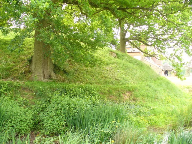
Thurnham Castle
Thurnham Castle — a castle in england-london, United Kingdom.
 📷 5
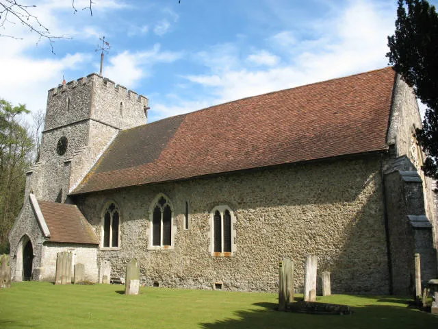
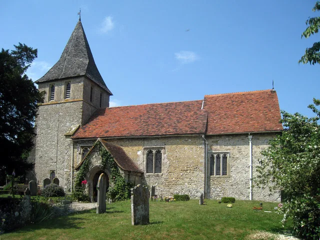
📷 5Historic churches · London
St Mary the Virgin Church, Thurnham
St Mary the Virgin Church, Thurnham — Grade I listed church in Thurnham, Maidstone, Kent, England, UK.
 📷 5
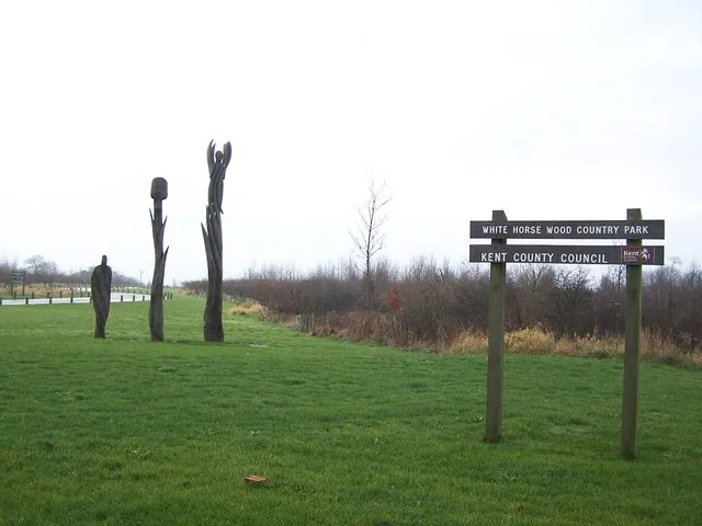
📷 5Parks · London
White Horse Wood
White Horse Wood — park in United Kingdom.
 📷 5
📷 5Natural landmarks · London
Kent Showground
Kent Showground — a other in england-london, United Kingdom.
Caravan parks · London
Oak View Caravan Park
Oak View Caravan Park — a caravan park in england london.
 📷 5
📷 5Historic churches · London
St Martin of Tours Church, Detling
St Martin of Tours Church, Detling — church in Detling, Kent, England, UK.
More castles in this region
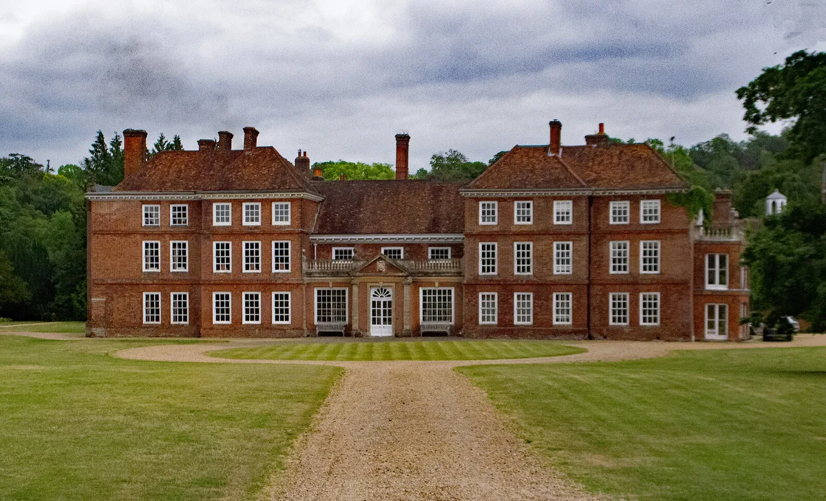 Flagship📷 10
Castles · London
Lullingstone Castle
Lullingstone Castle — historic manor house in the village of Lullingstone in England.
 📷 5
📷 5Castles · London
Abinger Castle
Abinger Castle — castle in Surrey, England, UK.
 📷 5
📷 5Castles · London
Allington Castle
Allington Castle — stone-built moated castle in Allington, England.
 📷 5
📷 5Castles · London
Barnwell Castle
Barnwell Castle — castle in Northamptonshire, England, UK.
Frequently asked questions
- Where is Thurnham, Kent?
- Thurnham, Kent is in Kent, London, United Kingdom (postcode ME14 3LE), in the parish of Thurnham.
- Does Thurnham, Kent charge admission?
- Thurnham, Kent typically charges admission. Check the official site for current ticket prices and opening hours.
- How do I get to Thurnham, Kent?
- Drivers can navigate to postcode ME14 3LE. It sits within the Faversham and Mid Kent parliamentary constituency.