Forests & woodlands · London
The Thicket
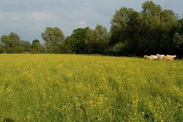
The Thicket is a forest or woodland in the United Kingdom.

Rob Noble — CC BY-SA 2.0 via Wikimedia Commons licence
Plan your visit
- Typical visit
- 1 h–3 h
- Nearest railway station
- Huntingdon · 6.6 km
- Free entry
- Family-friendly
- Dog-friendly
About
The Thicket is a named forest, woodland or nature reserve in the United Kingdom. Coordinates: 52.3278°, -0.0948°. This entry is part of The Great Britain Guide, a free, ad-free, open-data tourist directory.
Photo gallery
Place summary
The Thicket is a forest located in St. Ives, Cambridgeshire, within the London region. This area is characterised by its dense woodland, providing a natural habitat and recreational space.
AI-generated from the structured facts on this page (operator, designation, listing, era). Not a substitute for visiting.
- Coordinates
- 52.3278, -0.0948
- County
- Cambridgeshire
- District
- Huntingdonshire
- Parish
- St. Ives
- Postcode
- PE27 6RP
- Parliamentary constituency
- Huntingdon
- Nearest railway station
- Huntingdon — 6.6 km
- Official site
- www.huntingdonshire.gov.uk
Sources
- osm: w93405425 (ODbL)
Other places nearby
Loading nearby places…
Nearby
 📷 5
📷 5Forests & woodlands · London
Houghton Meadows Nature Reserve
Houghton Meadows Nature Reserve is a forest or woodland in the United Kingdom.
 📷 5
📷 5Wildlife reserves · London
Houghton Meadows
Houghton Meadows — nature reserve in the United Kingdom.
 📷 5
📷 5Historic churches · London
St Ivo School
St Ivo School — a school heritage in england-london, United Kingdom.
 📷 5
📷 5Historic houses · London
Hemingford Grey House
Hemingford Grey House — house in Hemingford Grey, Huntingdonshire, England, UK.
 📷 5
📷 5Historic churches · London
Church of All Saints
Church of All Saints — church in St Ives, Huntingdonshire, Cambridgeshire, England, UK.
 📷 5
📷 5Forests & woodlands · London
Holt Island Nature Reserve
Holt Island Nature Reserve is a forest or woodland in the United Kingdom.
More forests in this region
 📷 5
📷 5Forests & woodlands · London
Ackroyd Drive Green Link
Ackroyd Drive Green Link is a forest or woodland in the United Kingdom.
 📷 5
📷 5Forests & woodlands · London
Adams Road Bird Sanctuary
Adams Road Bird Sanctuary is a forest or woodland in the United Kingdom.
 📷 5
📷 5Forests & woodlands · London
Adelaide Nature Reserve
Adelaide Nature Reserve is a forest or woodland in the United Kingdom.
 📷 5
📷 5Forests & woodlands · London
Angel's Wings
Angel's Wings — Public artwork by Thomas Heatherwick.
Frequently asked questions
- Where is The Thicket?
- The Thicket is in Cambridgeshire, London, United Kingdom (postcode PE27 6RP), in the parish of St. Ives.
- Is The Thicket free to visit?
- Yes, The Thicket is free to enter.
- How do I get to The Thicket?
- The nearest railway station is Huntingdon, about 6.6 km away. Drivers can navigate to postcode PE27 6RP.