Islands · Scottish Highlands
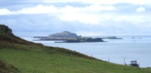
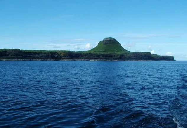
Texa
Texa — island south of Islay, in the Inner Hebrides, Scotland.

Wikimedia Commons contributors — see linked file page for photographer and licence licence
Plan your visit
- Typical visit
- 4 h–12 h
- Free entry
- Dog-friendly
About
Texa is a island in the United Kingdom. Part of Inner Hebrides. Wikidata describes it as: "island south of Islay, in the Inner Hebrides, Scotland". Coordinates: 55.6167°, -6.1417°.
Photo gallery
From the Wikipedia article
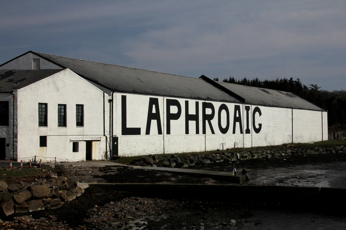
Texa (Scottish Gaelic: Teugsa) is a small island 700 metres (3⁄8 mile) directly south of Islay, in the Inner Hebrides, Scotland. It reaches a height of 48 metres (157 feet) at its highest point, Ceann Garbh. It is part of the parish of Kildalton, in the council area of Argyll and Bute. The distilleries of Laphroaig and Lagavulin are nearby on the Islay coast, as well as Port Ellen. It is currently uninhabited, but is home to wild goats, as well as otters.
Excerpt from Wikipedia under CC BY-SA 4.0. See the source article linked in Sources below.
- Coordinates
- 55.6167, -6.1417
- District
- Argyll and Bute
- Postcode
- PA42 7DU
- Parliamentary constituency
- Argyll, Bute and South Lochaber
- Official site
- www.scottish.parliament.uk
Sources
- wikidata: Q1786927 (CC0)
- wikipedia: Texa (CC BY-SA 4.0)
- commons: Texa - geograph.org.uk - 1015790.jpg (CC BY-SA 4.0)
Other places nearby
Loading nearby places…
Nearby
 📷 3
📷 3Historic churches · Scottish Highlands
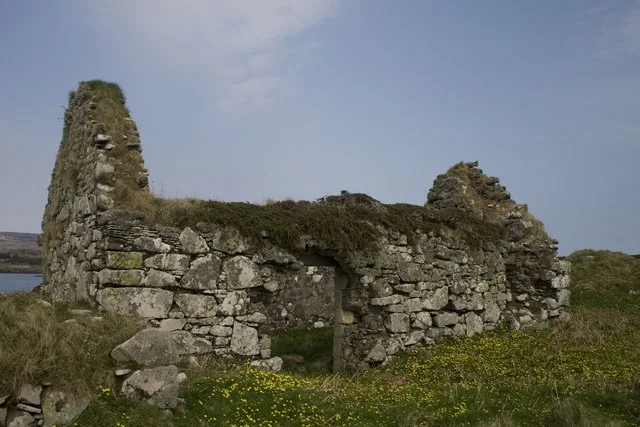
Texa Chapel
Texa Chapel — church in Argyll and Bute, Scotland, UK.
 📷 5
📷 5Public art & sculpture · Scottish Highlands
Barrel
Barrel — a public art in scotland-highlands, United Kingdom.
 📷 3
📷 3Distilleries · Scottish Highlands
Laphroaig Distillery
Laphroaig Distillery — Whisky/spirit distillery.
Vineyards · Scottish Highlands
Islay, Portintruan
Islay, Portintruan — a UK vineyard in scotland highlands, producing English or Welsh wine from cool-climate grape varieties.
Vineyards · Scottish Highlands
Islay, Lagavulin, Barr an t-Seann Duine
Islay, Lagavulin, Barr an t-Seann Duine — a UK vineyard in scotland highlands, producing English or Welsh wine from cool-climate grape varieties.
 📷 3
📷 3Memorials & monuments · Scottish Highlands
Laphroaig Bicentenary Cairn
Laphroaig Bicentenary Cairn — a memorial in scotland-highlands, United Kingdom.
More places in this region
 📷 5
📷 5Islands · Scottish Highlands
Bac Beag
Bac Beag — Scottish island, part of the Treshnish Isles in the Inner Hebrides.
 📷 5
📷 5Islands · Scottish Highlands
Bac Mòr
Bac Mòr — island in Argyll and Bute, Scotland, UK, one of the Treshnish Isles.
 Flagship📷 3
Islands · Scottish Highlands
Baleshare
Baleshare — flat tidal island in the Outer Hebrides, Scotland, UK.
 Flagship📷 5
Islands · Scottish Highlands
Barra
Barra — island in Outer Hebrides, Scotland, UK.
Frequently asked questions
- Where is Texa?
- Texa is in the Scottish Highlands, United Kingdom (postcode PA42 7DU).
- Is Texa free to visit?
- Yes, Texa is free to enter.
- How do I get to Texa?
- Drivers can navigate to postcode PA42 7DU. It sits within the Argyll, Bute and South Lochaber parliamentary constituency.