Historic bridges · North East England
Tees Viaduct
Tees Viaduct is a historic bridge in the United Kingdom.

Wikimedia Commons contributors — see linked file page for photographer and licence licence
Plan your visit
- Typical visit
- 15 min–30 min
- Nearest railway station
- Thornaby · 2.2 km
- Free entry
- Dog-friendly
About
Tees Viaduct is a named historic bridge in the United Kingdom. Records date its origin to 1975. Coordinates: 54.5701°, -1.2725°. This entry is part of The Great Britain Guide, a free, ad-free, open-data tourist directory.
Photo gallery
Protected designations
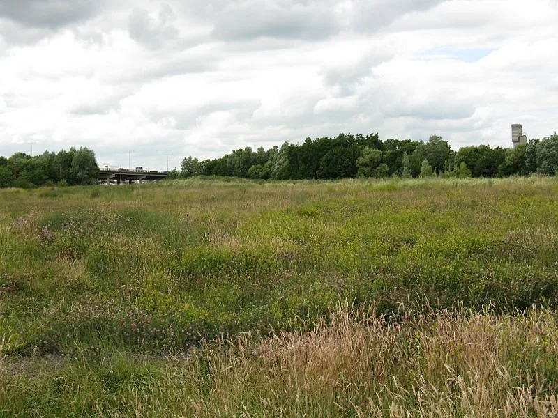
- Site of Special Scientific Interest: Teesmouth and Cleveland Coast SSSI
Designations sourced from Natural England open data under OGL v3.
From the Wikipedia article
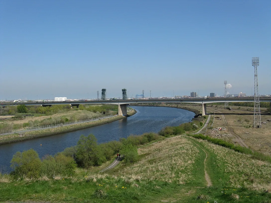
The A19 Tees Viaduct or Tees Flyover is a high level six-lane dual carriageway road bridge in the North East of England carrying the main A19 trunk road north–south across the River Tees. The bridge is located between Middlesbrough and Stockton-on-Tees just north of the A19's interchange with the A66 trunk road and carries the north–south traffic through Teesside avoiding the main towns but is also used extensively by local traffic. On the southern bank the bridge crosses the marshalling yard railway lines and the main Thornaby-Middlesbrough section of Tees Valley Line, the B6541 (Old A66/A67, Stockton Road) and the A66 road. On the northern bank the bridge crosses the Teesdale Way long-distance cycle/footpath, Lustrum Beck, a service road, footpath (disused railway line) and the main roundabout on the Portrack Interchange.
Excerpt from Wikipedia under CC BY-SA 4.0. See the source article linked in Sources below.
Background
Architecture
The viaduct is a beam or girder bridge. It has reinforced concrete piers and pier bends supporting steel-plate girder beams and a composite deck with some 200 moving parts. The viaduct is 2.9 km long and 1.95 km between abutments and was at the time the largest such bridge in the British Isles. It has 68 spans on the main north south route—the largest span being that over the river at 117 m. The bridge was designed with sufficient clearance to allow ships to pass, although the port of Stockton-on-Tees up-river was virtually redundant by then. Since the Tees Newport Bridge had its lifting deck permanently fixed in the down position in 1990, large shipping can no longer reach the Tees…
Sourced from Wikipedia under CC BY-SA 4.0.
- Coordinates
- 54.5701, -1.2725
- District
- Stockton-on-Tees
- Parish
- Stockton-on-Tees, unparished area
- Postcode
- TS18 2RR
- Parliamentary constituency
- Stockton North
- Established
- 1975
- Nearest railway station
- Thornaby — 2.2 km
- Opening
- November 1975
Sources
- osm: w777516698 (ODbL)
- wikipedia: Tees Viaduct (CC BY-SA 4.0)
- commons: A19 Tees Viaduct rom Maze Park viewing hill-2-1088.jpg (CC BY-SA 4.0)
Other places nearby
Loading nearby places…
Nearby
 📷 3
📷 3Parks · North East England
Portrack Incinerator
Portrack Incinerator — former waste and power plant in England.
 📷 4
📷 4Viewpoints · North East England
Mound
Mound is a viewpoint in the United Kingdom.
 📷 3
📷 3Forests & woodlands · North East England
Portrack Marsh, Nature Reserve
Portrack Marsh, Nature Reserve is a forest or woodland in the United Kingdom.
📷 4Forests & woodlands · North East England
Maze Park
Maze Park is a forest or woodland in the United Kingdom.
 📷 3
📷 3Historic bridges · North East England
Billingham Branch Bridge
Billingham Branch Bridge — Grade II listed building-listed bridge in england-north-east, United Kingdom.
 📷 4
📷 4Parks · North East England
Maze Park Nature Reserve
Maze Park Nature Reserve — park in Middlesbrough, United Kingdom.
Other bridges from this era
 📷 5
📷 5Historic bridges · London
Affection
Affection — Public artwork (sculpture).
.JPG?width=1200) 📷 5
📷 5Historic bridges · London
Albert Bridge
Albert Bridge is a historic bridge in the United Kingdom.
.jpg?width=1200) 📷 5
📷 5Historic bridges · London
Blue Bridge
Blue Bridge is a historic bridge in the United Kingdom.
 📷 5
📷 5Historic bridges · London
Catford Cat
Catford Cat — Public artwork (sculpture).
More bridges in this region
 📷 3
📷 3Historic bridges · North East England
Barnard Castle Bridge
Barnard Castle Bridge is a historic bridge in the United Kingdom.
 📷 3
📷 3Historic bridges · North East England
Blandswath Bridge
Blandswath Bridge is a historic bridge in the United Kingdom.
 📷 3
📷 3Historic bridges · North East England
Chapel Bridge
Chapel Bridge is a historic bridge in the United Kingdom.
 📷 3
📷 3Historic bridges · North East England
Coupland Viaduct
Coupland Viaduct is a historic bridge in the United Kingdom.
Frequently asked questions
- Where is Tees Viaduct?
- Tees Viaduct is in North-East England, United Kingdom (postcode TS18 2RR), in the parish of Stockton-on-Tees, unparished area.
- When was Tees Viaduct built?
- Built or established in 1975.
- Who owns Tees Viaduct?
- Tees Viaduct is owned by National Highways.
- Is Tees Viaduct a protected site?
- Yes — Tees Viaduct is part of the Teesmouth and Cleveland Coast SSSI Site of Special Scientific Interest.
- Is Tees Viaduct free to visit?
- Yes, Tees Viaduct is free to enter.
- How do I get to Tees Viaduct?
- The nearest railway station is Thornaby, about 2.2 km away. Drivers can navigate to postcode TS18 2RR.