Towns & cities · South West England
Tatworth
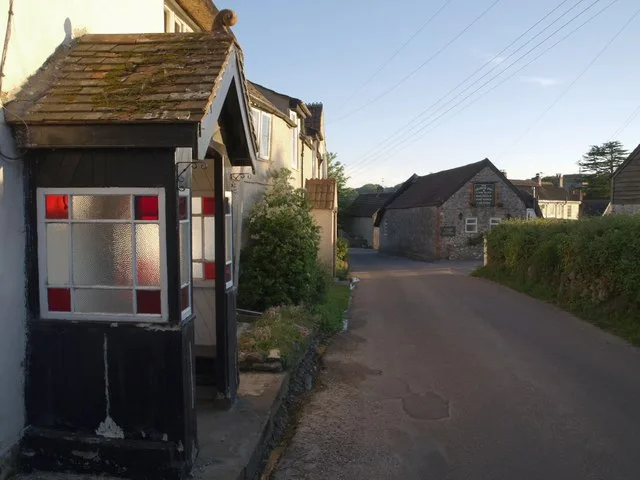
Tatworth — village in Somerset, England, UK.

Wikimedia Commons contributors — see linked file page for photographer and licence licence
Plan your visit
- Typical visit
- 3 h–6 h
- Nearest railway station
- Axminster · 8.0 km
- Free entry
- Family-friendly
- Dog-friendly
About
Tatworth is a town, city, village or settlement in the United Kingdom. Recent population estimates put it at around 2,660 people. Wikidata describes it as: "village in Somerset, England, UK". Coordinates: 50.8450°, -2.9601°.
Photo gallery
Protected designations
- Area of Outstanding Natural Beauty: Dorset
Designations sourced from Natural England open data under OGL v3.
From the Wikipedia article
Tatworth is a village 2 miles (3 km) south of Chard in the county of Somerset, England. It is within Tatworth and Forton civil parish. Tatworth is a large village, consisting of a number of smaller villages including South Chard, Perry Street and Chard Junction which are close together. The hamlet of Forton lies to the north, towards Chard; an area southwest of Forton is called White Gate.
Excerpt from Wikipedia under CC BY-SA 4.0. See the source article linked in Sources below.
Background
History
A white lias limestone Roman tessera measuring 25.7 mm x 20.18 mm x 17.75 mm and regularly cut on two faces was found in the area, and may be connected with the remains of a Roman villa or farmhouse by St Margaret's Lane. Part of this building was excavated in 1967 and pottery and paving found there are displayed in the Chard Museum. The name of the village comes from the Old English tat and worp meaning 'A cheerful farm'. In 1254, the spelling was Tattewurthe and was a sub-manor of Chard. In 1554 Thatteworh was granted to William Petre as the 'manor and park of Tatworthy' and remained in the family until 1790. Tatworth in the 1850s extended to 1552 acre and had a population of 852.
Sourced from Wikipedia under CC BY-SA 4.0.
- Coordinates
- 50.8450, -2.9601
- District
- Somerset
- Parish
- Tatworth and Forton
- Postcode
- TA20 2NZ
- Parliamentary constituency
- Yeovil
- Population
- 2,660
- Nearest railway station
- Axminster — 8 km
- Official site
- www.somersetintelligence.org.uk
Sources
- wikidata: Q601181 (CC0)
- wikipedia: Tatworth (CC BY-SA 4.0)
- commons: Tatworthchurch.jpg (CC BY-SA 4.0)
Other places nearby
Loading nearby places…
Nearby
 📷 3
📷 3Historic houses · South West England
WW2 Pill Box (Intact)
WW2 Pill Box (Intact) — a historic house in england-south-west, United Kingdom.
 Flagship📷 10
Towns & cities · South West England
Chardstock
Chardstock — village in Devon, England, UK.
 📷 5
📷 5Historic houses · South West England
WW2 Pillbox (Intact)
WW2 Pillbox (Intact) — a historic house in england-south-west, United Kingdom.
 📷 3
📷 3Memorials & monuments · South West England
Chardstock War Memorial
Chardstock War Memorial — Grade II listed building-listed memorial in england-south-west, United Kingdom.
 📷 3
📷 3Historic houses · South West England
WW2 Anti Tank Blocks
WW2 Anti Tank Blocks — a historic house in england-south-west, United Kingdom.
Campsites · South West England
Alpine Grove
Alpine Grove — a campsite in england south west.
More towns in this region
 Flagship📷 10
Towns & cities · South West England
All Saints
All Saints — village and civil parish in Devon, England, UK.
 Flagship📷 10
Towns & cities · South West England
Axmouth
Axmouth — village and civil parish in Devon, England, UK.
 ★ Iconic📷 10
Towns & cities · South West England
Beer
Beer — village and civil parish in Devon, UK.
 Flagship📷 10
Towns & cities · South West England
Branscombe
Branscombe — village and civil parish in Devon, UK.
Frequently asked questions
- Where is Tatworth?
- Tatworth is in South-West England, United Kingdom (postcode TA20 2NZ), in the parish of Tatworth and Forton.
- Is Tatworth a protected site?
- Yes — Tatworth is part of the Dorset National Landscape (AONB).
- Is Tatworth free to visit?
- Yes, Tatworth is free to enter.
- How do I get to Tatworth?
- Drivers can navigate to postcode TA20 2NZ. It sits within the Yeovil parliamentary constituency.