Viewpoints · West Midlands
Tamworth View
Also known as: Tamworth, De Cymru Newydd, Tamworth
Tamworth View is a viewpoint in the United Kingdom.

Mick Malpass — CC BY-SA 2.0 via Wikimedia Commons licence
Plan your visit
- Typical visit
- 20 min–45 min
- Best time of year
- Clear days year-round
- Nearest railway station
- Tamworth · 4.9 km
- Free entry
- Dog-friendly
About
Tamworth View is a named viewpoint in Staffordshire, the West Midlands, marked on Ordnance Survey maps for its outlook. It sits within the Tamworth parliamentary constituency. The nearest railway station is Tamworth, about 4.9 km away. Postcode area B78.
Photo gallery
From the Wikipedia article
Tamworth (/ˈtæmwəɹθ/ TAM-werth) is a major regional city and administrative centre of the north-eastern region of New South Wales, Australia. Situated on the Peel River within the local government area of the Tamworth Regional Council, it is the largest and most populated city in the region, with a population of 43,874 in 2021, making it the third largest inland city in New South Wales. Tamworth is 318 km (198 mi) from the Queensland border and is located almost midway between Brisbane and Sydney. The city is known as the "First Town of Lights", being the first place in Australia to use electric street lights in 1888. Tamworth is also famous as the "Country Music Capital of Australia" and "Australia's answer to Nashville", annually hosting the Tamworth Country Music Festival in late January; the second-biggest country music festival in the world after Nashville. The city is recognised as the National Equine Capital of Australia because of the high number of equine events held in the city and the construction of the world-class Australian Equine and Livestock Events Centre, the biggest of its kind in the Southern Hemisphere.
Excerpt from Wikipedia under CC BY-SA 4.0. See the source article linked in Sources below.
Background
History
The Kamilaroi people, from whose language comes the word "budgerigar", inhabited the area before European contact. In 1818, John Oxley passed through the Peel Valley and commented, "it would be impossible to find a finer or more luxuriant country than its waters...No place in this world can afford more advantages to the industrious settler than this extensive vale". In 1831, the first sheep stations and cattle stations were formed, and in the same year, the Australian Agricultural Company was granted a lease of 127000 ha of land at Goonoo Goonoo, south of the present location of Tamworth, extending to present-day Calala. In the 1830s, a company town began to develop on the Peel's southwest…
Visiting
Tourism is a significant industry in the Tamworth area, worth $AUD239 million annually as at December 2014, with by far the most significant draw being the annual Tamworth Country Music Festival, the biggest event of its type in Australia and the Southern Hemisphere. Other attractions include Tamworth's museums and galleries. Nearby destinations include several country towns, including Barraba, popular for birdwatching, Nundle, and Quirindi.
Sourced from Wikipedia under CC BY-SA 4.0.
- Coordinates
- 52.6294, -1.7576
- County
- Staffordshire
- District
- Lichfield
- Parish
- Hints
- Postcode
- B78 3DB
- Parliamentary constituency
- Tamworth
- Nearest railway station
- Tamworth — 4.9 km
- Official site
- www.abs.gov.au
Sources
- osm: n13619289512 (ODbL)
- wikipedia: Tamworth, New South Wales (CC BY-SA 4.0)
Other places nearby
Loading nearby places…
Nearby
 📷 3
📷 3Manor houses · West Midlands
Hints Manor
Hints Manor — Grade II listed building-listed manor in england-west-midlands, United Kingdom.
 📷 3
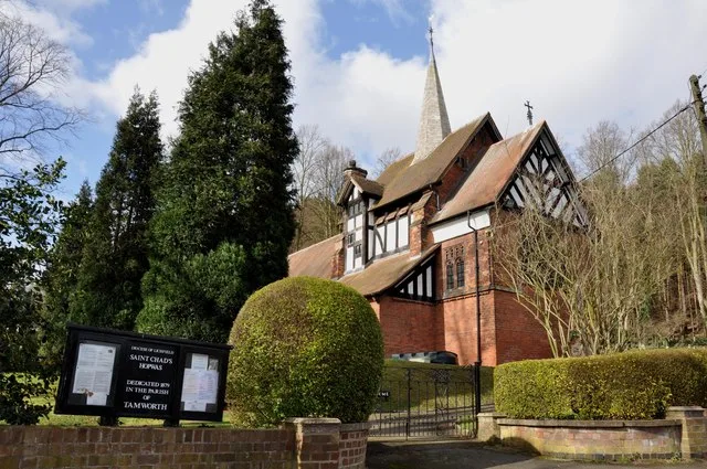
📷 3Historic churches · West Midlands
St Chad's Church, Hopwas
St Chad's Church, Hopwas — grade II listed church in Wigginton and Hopwas, Lichfield, Staffordshire, England, UK.
 📷 3
📷 3Memorials & monuments · West Midlands
Hopwas War Memorial
Hopwas War Memorial — Grade II listed building-listed memorial in england-west-midlands, United Kingdom.
 📷 3
📷 3Historic bridges · West Midlands
Dunstall Bridge (That Part In Fazeley Civil Parish)
Dunstall Bridge (That Part In Fazeley Civil Parish) — Grade II listed building-listed bridge in england-west-midlands, United Kingdom.
 📷 3
📷 3Historic houses · West Midlands
Hopwas Hays Woodhouse
Hopwas Hays Woodhouse — a historic house in england-west-midlands, United Kingdom.
 📷 3
📷 3Historic bridges · West Midlands
Hopwas Bridge
Hopwas Bridge — Grade II listed building-listed bridge in england-west-midlands, United Kingdom.
More viewpoints in this region
 📷 4
📷 4Viewpoints · West Midlands
Ambion Hill
Ambion Hill is a viewpoint in the United Kingdom.
 📷 3
📷 3Viewpoints · West Midlands
Apedale Winding Wheel
Apedale Winding Wheel is a viewpoint in the United Kingdom.
 📷 3
📷 3Viewpoints · West Midlands
Baggeridge Toposcope
Baggeridge Toposcope is a viewpoint in the United Kingdom.
 📷 3
📷 3Viewpoints · West Midlands
Barrett Bridge
Barrett Bridge is a viewpoint in the United Kingdom.
Frequently asked questions
- Where is Tamworth View?
- Tamworth View is in Staffordshire, the West Midlands, United Kingdom (postcode B78 3DB), in the parish of Hints.
- Is Tamworth View free to visit?
- Yes, Tamworth View is free to enter.
- How do I get to Tamworth View?
- The nearest railway station is Tamworth, about 4.9 km away. Drivers can navigate to postcode B78 3DB.