Mountains & hills · South Wales
Table Mountain
Also known as: Crug Hywel
Table Mountain — Named summit at 451 m.

Wikimedia Commons contributors — see linked file page for photographer and licence licence
Plan your visit
- Typical visit
- 3 h–8 h
- Best time of year
- Late spring – early autumn (May–Oct)
- Free entry
- Dog-friendly
About
Table Mountain is a named summit in the United Kingdom. Wikidata describes it as: "Named summit at 451 m.". Coordinates: 51.8792°, -3.1263°.
Photo gallery
From the Wikipedia article
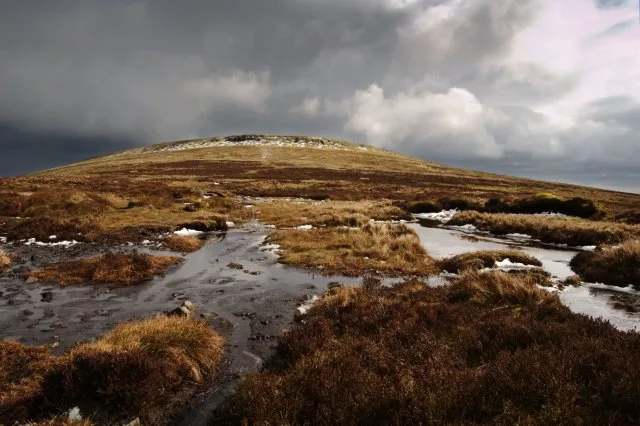
Crug Hywel is an Iron Age Celtic hillfort, with a clearly visible earth and stone ditch and rampart. Crug Hywel is approached by a couple of public footpaths across farmland from Crickhowell and Llanbedr and visited by the Beacons Way. It lies within an area designated as open country over which the public have the right to roam. The name is sometimes given to the flat-topped hill itself, which is also called Table Mountain in English. Located at the southern edge of the Black Mountains in south-east Wales, it rises to 451 m above sea level, from the southern flank of Pen Cerrig-calch (701 m), and overlooks the town of Crickhowell, whose name derives from Crug Hywel. The Welsh name Mynydd y Begwn is also used for this summit. As a result, it has been suggested that the name Crug Hywel (which means 'Hywel's mound') may originally have referred to the castle mound in Crickhowell.
Excerpt from Wikipedia under CC BY-SA 4.0. See the source article linked in Sources below.
- Coordinates
- 51.8792, -3.1263
- District
- Powys
- Parish
- Crickhowell
- Postcode
- NP8 1SP
- Parliamentary constituency
- Brecon, Radnor and Cwm Tawe
Sources
- osm: n300655709 (ODbL)
- wikipedia: Crug Hywel (CC BY-SA 4.0)
- commons: Crug Hywel across the Fields.jpg (CC BY-SA 4.0)
Other places nearby
Loading nearby places…
Nearby
Vineyards · South Wales
Crug Hywel
Crug Hywel — a UK vineyard in wales south, producing English or Welsh wine from cool-climate grape varieties.
 📷 3
📷 3Archaeological sites · South Wales
Crug Hywel Camp
Crug Hywel Camp — a archaeological in wales-south, United Kingdom.
 📷 5
📷 5Historic bridges · South Wales
Upper Cwm Bridge
Upper Cwm Bridge — Grade II listed building-listed bridge in wales-south, United Kingdom.
 📷 5
📷 5Historic bridges · South Wales
Bridge over Grwyne Fawr, Llanbedr
Bridge over Grwyne Fawr, Llanbedr — Grade II listed building-listed bridge in wales-south, United Kingdom.
Hotels · South Wales
The Manor Hotel
The Manor Hotel — a hotel in wales south.
 📷 3
📷 3Natural landmarks · South Wales
Pen Cerrig-calch
Pen Cerrig-calch — mountain (701m) in Powys.
More mountains in this region
 Flagship📷 3
Mountains & hills · South Wales
Milford Haven Waterway
Milford Haven Waterway — ria, or flooded valley, in Pembrokeshire, south-west Wales, UK.
 📷 5
📷 5Mountains & hills · South Wales
Ogof Ffynnon Ddu
Ogof Ffynnon Ddu — cave in the Upper Swansea Valley in South Wales.
 📷 3
📷 3Mountains & hills · South Wales
Abereiddi Bay
Abereiddi Bay — bay in the United Kingdom.
 📷 3
📷 3Mountains & hills · South Wales
Allt Lwyd
Allt Lwyd — Named summit at 653 m.
Frequently asked questions
- Where is Table Mountain?
- Table Mountain is in South Wales, United Kingdom (postcode NP8 1SP), in the parish of Crickhowell.
- Is Table Mountain free to visit?
- Yes, Table Mountain is free to enter.
- How do I get to Table Mountain?
- Drivers can navigate to postcode NP8 1SP. It sits within the Brecon, Radnor and Cwm Tawe parliamentary constituency.