Natural landmarks · North East England
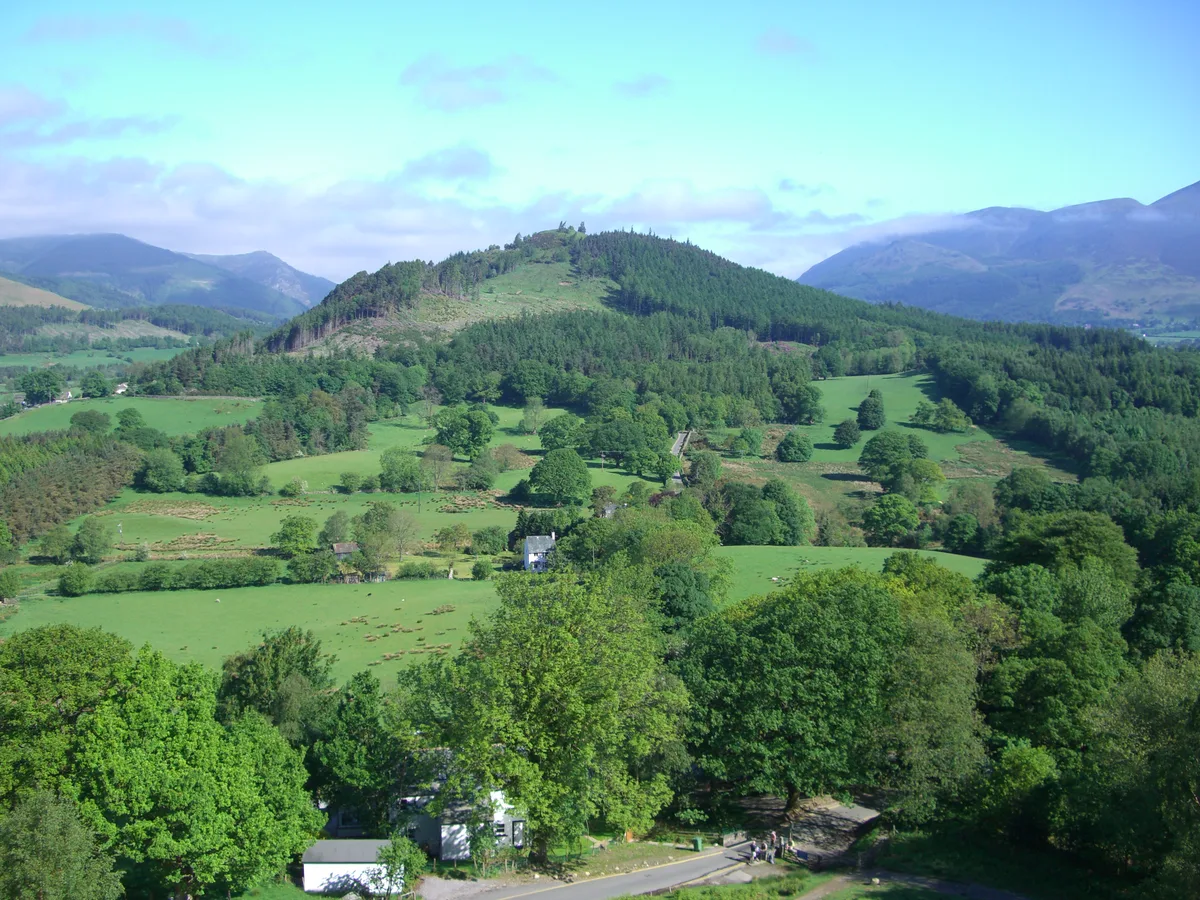
Swinside
Swinside — mountain in United Kingdom.

Wikimedia Commons contributors — see linked file page for photographer and licence licence
Plan your visit
- Typical visit
- 1 h–2 h
- Nearest railway station
- Threlkeld Quarry · 8.5 km
- Free entry
- Dog-friendly
About
Swinside is a named natural landmark in the United Kingdom. Wikidata describes it as: "mountain in United Kingdom". Coordinates: 54.5911°, -3.1730°.
Photo gallery
Protected designations
- Site of Special Scientific Interest: River Derwent and Tributaries SSSI
- Site of Special Scientific Interest: Buttermere Fells SSSI
- National Nature Reserve: BORROWDALE RAINFOREST
Designations sourced from Natural England open data under OGL v3.
From the Wikipedia article
Swinside is a hill in the northwestern area of the English Lake District. It is small, wooded and surrounded by much bigger and more popular fells, meaning it is often overlooked. Alfred Wainwright, for instance, failed to include it in his pictorial guides to fells in the Lake District. Swinside has an elevation of 244.8 m (803 ft) and a prominence of 151.9 m (498 ft), so unlike many of its grander neighbours, it is a Marilyn as a result of being surrounded by a moat of low boggy ground. Until recently it was also completely covered by trees, but a track now leads up to the summit where the trees have been felled. The land is privately owned and there is no public footpath to the summit although the owner recently allowed local residents from the nearby village of Portinscale to visit the summit on a sponsored walk. It is reported that the hill is used for quad biking trips and that permission to enter on foot can often be obtained on request.
Excerpt from Wikipedia under CC BY-SA 4.0. See the source article linked in Sources below.
- Coordinates
- 54.5911, -3.1730
- District
- Cumberland
- Parish
- Above Derwent
- Postcode
- CA12 5SP
- Parliamentary constituency
- Penrith and Solway
- Nearest railway station
- Threlkeld Quarry — 8.5 km
Sources
- wikidata: Q7658766 (CC0)
- wikipedia: Swinside (Derwent Water) (CC BY-SA 4.0)
- commons: Swinside from Lower Cat Bells 1.JPG (CC BY-SA 4.0)
Other places nearby
Loading nearby places…
Nearby
 📷 3
📷 3Mountains & hills · North East England
Swinside
Swinside — Named summit at 244.8 m.
 📷 3
📷 3Natural landmarks · North East England
Alpacaly Ever After
Alpacaly Ever After — a other in england-north-east, United Kingdom.
📷 4Gardens · North East England
Lingholm
Lingholm — a garden in england-north-east, United Kingdom.
📷 3Manor houses · North East England
The Lingholm House
The Lingholm House — a manor in england-north-east, United Kingdom.
 📷 3
📷 3Historic bridges · North East England
Stair Bridge
Stair Bridge — Grade II listed building-listed bridge in england-north-east, United Kingdom.
 📷 3
📷 3Memorials & monuments · Scottish Lowlands
Above Derwent War Memorial
Above Derwent War Memorial — Grade II listed building-listed memorial in scotland-lowlands, United Kingdom.
More natural landmarks in this region
 Flagship📷 5
Natural landmarks · North East England
Brothers Water
Brothers Water — lake in Cumbria, England, UK.
 📷 5
📷 5Natural landmarks · North East England
Angle Tarn
Angle Tarn — lake near Patterdale, Cumbria, England, United Kingdom.
 📷 3
📷 3Natural landmarks · North East England
Angletarn Pikes
Angletarn Pikes — mountain in United Kingdom.
 📷 3
📷 3Natural landmarks · North East England
Ard Crags
Ard Crags — mountain in United Kingdom.
Frequently asked questions
- Where is Swinside?
- Swinside is in North-East England, United Kingdom (postcode CA12 5SP), in the parish of Above Derwent.
- Is Swinside a protected site?
- Yes — Swinside is part of the River Derwent and Tributaries SSSI Site of Special Scientific Interest and the Buttermere Fells SSSI Site of Special Scientific Interest.
- Is Swinside free to visit?
- Yes, Swinside is free to enter.
- How do I get to Swinside?
- Drivers can navigate to postcode CA12 5SP. It sits within the Penrith and Solway parliamentary constituency.