Cemeteries · Yorkshire & the Humber
Sugar Lane Cemetery
Also known as: Sugar Land, Texas
Sugar Lane Cemetery is a cemetery in the United Kingdom.

Betty Longbottom — CC BY-SA 2.0 via Wikimedia Commons licence
Plan your visit
- Typical visit
- 30 min–1 h
- Nearest railway station
- Sandal and Agbrigg · 0.8 km
- Free entry
- Dog-friendly
About
Sugar Lane Cemetery is a named cemetery in the United Kingdom. Coordinates: 53.6702°, -1.4840°. This entry is part of The Great Britain Guide, a free, ad-free, open-data tourist directory.
Photo gallery
From the Wikipedia article
Sugar Land is the largest city in Fort Bend County, Texas, United States, located in the southwestern part of the Houston–The Woodlands–Sugar Land metropolitan area. Located about 19 miles (31 km) southwest of downtown Houston, Sugar Land is a populous suburban municipality centered around the junction of Texas State Highway 6 and Interstate 69/U.S. Route 59. Beginning in the 19th century, the present-day Sugar Land area was home to a large sugar plantation situated in the fertile floodplain of the Brazos River. Following the consolidation of local plantations into Imperial Sugar Company in 1908, Sugar Land grew steadily as a company town and incorporated as a city in 1959. Since then, Sugar Land has grown rapidly alongside other edge cities around Houston, with large-scale development of master-planned communities contributing to population swells since the 1980s. Sugar Land is one of the fastest-growing cities in Texas. The 2020 United States Census reported that the city's population had grown more than 40% in the preceding 10 years following the annexation of the Greatwood and New Territory communities in December 2017. Over the same 10-year period, the number of employed persons living in Sugar Land increased by 61%. Sugar Land is home to the headquarters of Imperial Sugar; the company's main sugar refinery and distribution center were once located in the city. The Imperial Sugar crown logo is featured in the city seal and logo.
Excerpt from Wikipedia under CC BY-SA 4.0. See the source article linked in Sources below.
- Coordinates
- 53.6702, -1.4840
- District
- Wakefield
- Parish
- Wakefield, unparished area
- Postcode
- WF1 5JB
- Parliamentary constituency
- Ossett and Denby Dale
- Nearest railway station
- Sandal and Agbrigg — 0.8 km
Sources
- osm: w5153305 (ODbL)
- wikipedia: Sugar Land, Texas (CC BY-SA 4.0)
Other places nearby
Loading nearby places…
Nearby
 📷 5
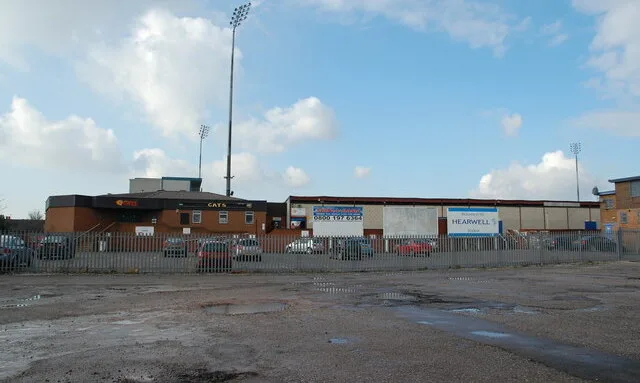
📷 5Stadiums · Yorkshire & the Humber
Belle Vue
Belle Vue — stadium in Wakefield, United Kingdom.
 📷 5
📷 5Historic churches · Yorkshire & the Humber
Masjid Zakariya
Masjid Zakariya — a church in england-yorkshire, United Kingdom.
 📷 3
📷 3Escape rooms · Yorkshire & the Humber
Escapable
Escapable — a escape room in england-yorkshire, United Kingdom.
.jpg?width=1200) 📷 3
📷 3Mills · Yorkshire & the Humber
Rutland Mill
Rutland Mill — mill in Wakefield, West Yorkshire, England, UK.
 📷 4
📷 4Public art & sculpture · Yorkshire & the Humber
Minos
Minos — a public art in england-yorkshire, United Kingdom.
 📷 5
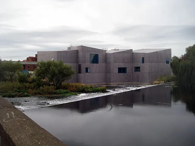
📷 5Galleries · Yorkshire & the Humber
Hepworth Wakefield
Hepworth Wakefield — art gallery in West Yorkshire, England, United Kingdom.
More cemeteries in this region
 📷 4
📷 4Cemeteries · Yorkshire & the Humber
Altofts Cemetery
Altofts Cemetery is a cemetery in the United Kingdom.
 📷 3
📷 3Cemeteries · Yorkshire & the Humber
Anlaby Tranby Lane Cemetery
Anlaby Tranby Lane Cemetery is a cemetery in the United Kingdom.
 📷 3
📷 3Cemeteries · Yorkshire & the Humber
Armley Hill Top Cemetery
Armley Hill Top Cemetery is a cemetery in the United Kingdom.
 📷 3
📷 3Cemeteries · Yorkshire & the Humber
Barmby on the Marsh Burial Ground
Barmby on the Marsh Burial Ground is a cemetery in the United Kingdom.
Frequently asked questions
- Where is Sugar Lane Cemetery?
- Sugar Lane Cemetery is in Yorkshire & the Humber, in the United Kingdom — coordinates 53.6702°, -1.4840°. The nearest railway station is Sandal and Agbrigg, around 0.8 km away.
- Is Sugar Lane Cemetery free to visit?
- Yes — admission to Sugar Lane Cemetery is free.