Abbeys & priories · London
Stratford Langthorne Abbey
Stratford Langthorne Abbey — Cistercian abbey in Stratford, London, England, UK.

Wikimedia Commons contributors — see linked file page for photographer and licence licence
Plan your visit
- Typical visit
- 45 min–1.5 h
- Nearest railway station
- Abbey Road · 0.3 km
- Family-friendly
- Limited wheelchair access
About
Stratford Langthorne Abbey is an abbey, priory, or monastic site in the United Kingdom. Records date its origin to 1135. Heritage designation: scheduled monument. Wikidata describes it as: "Cistercian abbey in Stratford, London, England, UK". Coordinates: 51.5333°, 0.0000°.
Photo gallery
Heritage listing
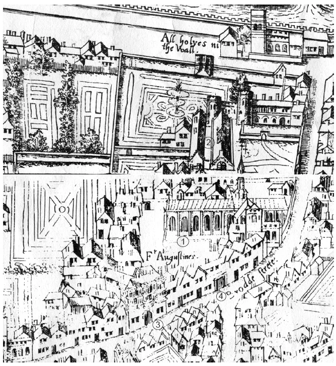
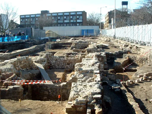
Stratford Langthorne Abbey, or the Abbey of St Mary's, Stratford Langthorne was a Cistercian monastery founded in 1135 at Stratford Langthorne — then Essex but now Stratford in the London Borough of Newham. The Abbey, also known as West Ham Abbey due to its location in the parish of West Ham, was one of the largest Cistercian abbeys in England, possessing 1,500 acres (6.07 km2) of local land, controlling over 20 manors throughout Essex. The head of the community was known as the Abbot of West Ham. The Abbey was self-sufficient for its needs and wealthy besides; some of this wealth came from the ecclesiastic mills grinding wheat for local bakers to supply bread to the City of London.
From the Historic England List Entry under OGL v3.
From the Wikipedia article
Stratford Langthorne Abbey, or the Abbey of St Mary's, Stratford Langthorne was a Cistercian monastery founded in 1135 at Stratford Langthorne — then Essex but now Stratford in the London Borough of Newham. The Abbey, also known as West Ham Abbey due to its location in the parish of West Ham, was one of the largest Cistercian abbeys in England, possessing 1,500 acres (6.07 km2) of local land, controlling over 20 manors throughout Essex. The head of the community was known as the Abbot of West Ham. The Abbey was self-sufficient for its needs and wealthy besides; some of this wealth came from the ecclesiastic mills grinding wheat for local bakers to supply bread to the City of London. This later led to competition with the Guild of Bakers, who sought powers to levy a toll on loaves entering the City at Whitechapel.
Excerpt from Wikipedia under CC BY-SA 4.0. See the source article linked in Sources below.
Background
History
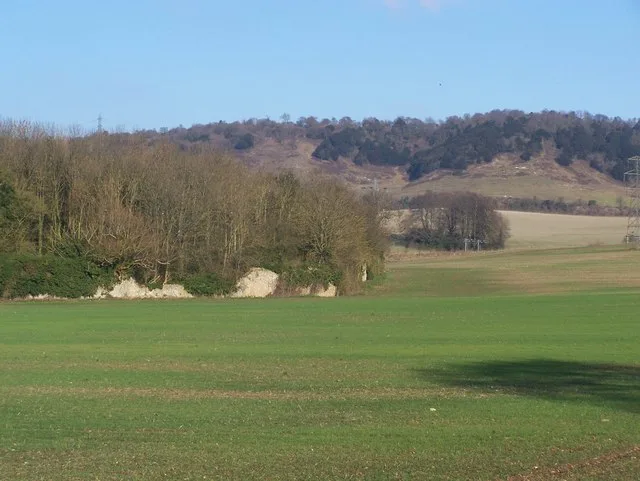
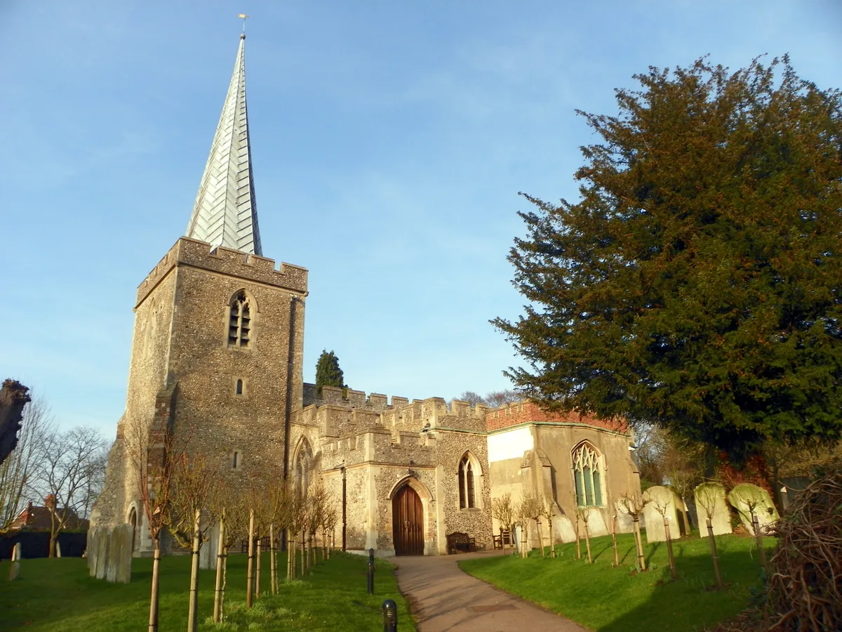
.]] The Abbey lay between the Channelsea River and Marsh Lane (Manor Road). Nothing visible remains on the site, as local landowners took away much of the stone for their own buildings, and by 1840, the North Woolwich Railway was built through the site, and factories and Stratford Wholesale Market were established on the remaining land. A stone window and a carving featuring skulls thought to have been over the door to the charnel house remain in All Saints West Ham Parish Church (dating from about 1180). The Great Gate of the abbey survived in Baker's Row until 1825. None of the abbey's buildings remain, but in the early 1990s archaeological investigations were carried out between 1993 94…
Sourced from Wikipedia under CC BY-SA 4.0.
- Coordinates
- 51.5333, 0.0000
- District
- Newham
- Parish
- Newham, unparished area
- Postcode
- E15 2GN
- Parliamentary constituency
- Stratford and Bow
- Established
- 1135
- Nearest railway station
- Abbey Road — 0.3 km
- Official site
- www.flickr.com
Sources
- wikidata: Q1349656 (CC0)
- wikipedia: Stratford Langthorne Abbey (CC BY-SA 4.0)
- commons: Stratford Langthorne - Charnel stone.jpg (CC BY-SA 4.0)
Other places nearby
Loading nearby places…
Nearby
 📷 5
📷 5Cathedrals · London
Stratford Langthorne Abbey
Stratford Langthorne Abbey is a cathedral in the United Kingdom.
 📷 5
📷 5Abbeys & priories · London
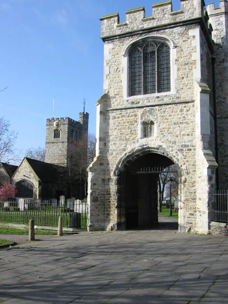
Gatehouse of Abbey of St Mary Stratford Langthorne
Gatehouse of Abbey of St Mary Stratford Langthorne — a abbey in england-london, United Kingdom.
📷 5Cathedrals · London
Stratford Langthorne Abbey (part of area within precincts), Baker's Row, West Ham
Stratford Langthorne Abbey (part of area within precincts), Baker's Row, West Ham is a cathedral in the United Kingdom.
 📷 5
📷 5Historic bridges · London
Northern Outfall Sewer Bridge Over Channelsea River
Northern Outfall Sewer Bridge Over Channelsea River — Grade II listed building-listed bridge in england-london, United Kingdom.
 📷 5
📷 5Other places · London
Snail
Snail — Public artwork (sculpture).
 📷 5
📷 5Memorials & monuments · London
Air Raid Precautions and the Fire Service
Air Raid Precautions and the Fire Service — a memorial in england-london, United Kingdom.
Other abbeys from this era
 📷 5
📷 5Abbeys & priories · London
Austin Friars
Austin Friars — former friary in London.
 📷 5
📷 5Abbeys & priories · London
Boxley Abbey
Boxley Abbey is a abbey in the United Kingdom.
 📷 5
📷 5Abbeys & priories · London
Chippenham Preceptory
Chippenham Preceptory — monastery in Cambridgeshire, England, UK.
 📷 5
📷 5Abbeys & priories · London
Church of Saint Nicholas
Church of Saint Nicholas — church in Stevenage, United Kingdom.
More abbeys in this region
 ★ Iconic📷 5
Abbeys & priories · London
Barking Abbey
Barking Abbey — building in London, England, UK.
 Flagship📷 5
Abbeys & priories · London
Bedford Abbey
Bedford Abbey is a abbey in the United Kingdom.
 📷 5
📷 5Abbeys & priories · London
Bermondsey Abbey
Bermondsey Abbey — English Benedictine monastery.
.jpg?width=1200) 📷 5
📷 5Abbeys & priories · London
Bermondsey Farmers' Market
Bermondsey Farmers' Market is a place of interest in the United Kingdom.
Frequently asked questions
- Where is Stratford Langthorne Abbey?
- Stratford Langthorne Abbey is in London, United Kingdom (postcode E15 2GN), in the parish of Newham, unparished area.
- When was Stratford Langthorne Abbey built?
- Built or established in 1135.
- Is Stratford Langthorne Abbey a listed building?
- Stratford Langthorne Abbey is officially recognised as scheduled monument listed.
- How do I get to Stratford Langthorne Abbey?
- The nearest railway station is Abbey Road, about 0.3 km away. Drivers can navigate to postcode E15 2GN.