Towns & cities · West Midlands
Stone
Also known as: Stone, Swydd Buckingham
Stone — village in Buckinghamshire, UK.

Wikimedia Commons contributors — see linked file page for photographer and licence licence
Plan your visit
- Typical visit
- 3 h–6 h
- Nearest railway station
- Aylesbury Vale Parkway · 3.0 km
- Free entry
- Family-friendly
- Dog-friendly
About
Stone is a town, city, village or settlement in the United Kingdom. Recent population estimates put it at around 2,587 people. Address: HP17. Wikidata describes it as: "village in Buckinghamshire, UK". Coordinates: 51.8044°, -0.8649°.
Photo gallery
Protected designations
- Area of Outstanding Natural Beauty: Chilterns
Designations sourced from Natural England open data under OGL v3.
From the Wikipedia article
Stone is a village in the civil parish of Stone with Bishopstone and Hartwell, in Buckinghamshire, England. It is located southwest of the town of Aylesbury, on the A418 road that links Aylesbury to Thame. As well as Stone, the parish also includes the settlements of Bishopstone and Hartwell. At the 2021 census the parish had a population of 2,698. The architect Clough Williams-Ellis designed the village hall in 1910. The original dedication stone with his name on is on the south eastern corner of the building.
Excerpt from Wikipedia under CC BY-SA 4.0. See the source article linked in Sources below.
Background
Description
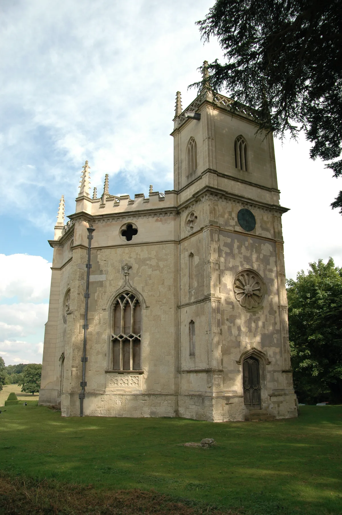
The village name is Old English in origin, and refers to a boundary stone or marker stone. In the Domesday Book of 1086 the village was recorded as Stanes. The village of Stone adjoins the village of Hartwell. The parish church is dedicated to St John the Baptist, and is dated 1273. The graveyard contains the grave of Admiral William Henry Smyth.
Sourced from Wikipedia under CC BY-SA 4.0.
- Coordinates
- 51.8044, -0.8649
- District
- Buckinghamshire
- Parish
- Stone with Bishopstone and Hartwell
- Postcode
- HP17
- Parliamentary constituency
- Mid Buckinghamshire
- Population
- 2,587
- Nearest railway station
- Aylesbury Vale Parkway — 3 km
Sources
- wikidata: Q1902612 (CC0)
- wikipedia: Stone, Buckinghamshire (CC BY-SA 4.0)
- commons: St John The Baptist, Stone.jpg (CC BY-SA 4.0)
Other places nearby
Loading nearby places…
Nearby
 📷 3
📷 3Historic churches · West Midlands
Church of St John the Baptist, Stone
Church of St John the Baptist, Stone — church in Stone, Buckinghamshire, England, UK.
 📷 3
📷 3Chapels · West Midlands
Chapel At St Johns Hospital
Chapel At St Johns Hospital — chapel in Stone with Bishopstone and Hartwell, Aylesbury Vale, Buckinghamshire, England, UK.
 📷 3
📷 3Archaeological sites · West Midlands
Burn Hill
Burn Hill — a archaeological in england-west-midlands, United Kingdom.
 📷 3
📷 3Quarries · West Midlands
Bugle Quarry
Bugle Quarry — geological Site of Special Scientific Interest in Hartwell in Buckinghamshire.
 📷 3
📷 3Follies · West Midlands
Gothic Tower
Gothic Tower — Folly or eyecatcher.
 📷 3
📷 3Historic churches · West Midlands
St Mary's Church, Hartwell
St Mary's Church, Hartwell — church in Hartwell, Buckinghamshire, England, UK.
More towns in this region
 Flagship📷 3
Towns & cities · West Midlands
Adderbury
Adderbury — village and civil parish in Cherwell district, Oxfordshire, England.
 Flagship📷 3
Towns & cities · West Midlands
Admington
Admington — village in Warwickshire, England, UK.
 Flagship📷 3
Towns & cities · West Midlands
Aldington
Aldington — village in Worcestershire, United Kingdom.
 Flagship📷 5
Towns & cities · West Midlands
Anstey
Anstey — large village in Leicestershire, England.
Frequently asked questions
- Where is Stone?
- Stone is in the West Midlands, United Kingdom (postcode HP17), in the parish of Stone with Bishopstone and Hartwell.
- Is Stone a protected site?
- Yes — Stone is part of the Chilterns National Landscape (AONB).
- Is Stone free to visit?
- Yes, Stone is free to enter.
- How do I get to Stone?
- The nearest railway station is Aylesbury Vale Parkway, about 3.0 km away. Drivers can navigate to postcode HP17.