Historic bridges · West Midlands
Stockport Viaduct
Stockport Viaduct is a historic bridge in the United Kingdom.

Wikimedia Commons contributors — see linked file page for photographer and licence licence
Plan your visit
- Typical visit
- 15 min–30 min
- Nearest railway station
- Stockport · 0.5 km
- Paid entry
- Dog-friendly
About
Stockport Viaduct is a named historic bridge in the United Kingdom. Records date its origin to 1839. Coordinates: 53.4094°, -2.1657°.
Photo gallery
From the Wikipedia article
Stockport Viaduct, alternatively known as the Edgeley Viaduct, carries the West Coast Main Line (WCML) across the valley of the River Mersey in Stockport, Greater Manchester, England (grid reference SJ89089030). It is one of the largest brick structures in the United Kingdom and a major structure of the early railway age. It is immediately north of Stockport railway station. The viaduct was designed by George W. Buck in consultation with the architect John Lowe for the Manchester and Birmingham Railway (M&BR). Work began in March 1839 and despite its scale and flooding from the Mersey, the viaduct was completed in December 1840 and services commenced the same month. Roughly 11 million bricks were used in its construction; at the time of its completion, it was the world's largest viaduct and a major feat of engineering. The viaduct is 33.85 metres (111.1 ft) high. Since March 1975, Stockport Viaduct has been a Grade II* listed structure; it remains one of the world's biggest brick structures. Several alterations have been made to the viaduct, in the late 1880s it was widened to accommodate four tracks by the London and North Western Railway (LNWR). In the 1960s, overhead catenary lines were installed by British Rail for the West Coast Main Line electrification scheme. In the second half of the 20th century, the M60 motorway was built, passing through two of the viaduct's arches between Junction 1 (A5145 road) and Junction 27 (Portwood Roundabout). The viaduct has been subject to renovation and remedial repairs over the years.
Excerpt from Wikipedia under CC BY-SA 4.0. See the source article linked in Sources below.
Background
History
Stockport Viaduct was built to carry the Manchester and Birmingham Railway across the valley of the River Mersey at Stockport. The viaduct was designed by the engineer George W. Buck in consultation with the architect John Lowe. Construction was hindered by floods in the Mersey which washed away the viaduct's centres on a couple of occasions early on in the work. On 21 December 1840, the final stone was set, marking its completion. Scaffolding and centring used to build the arches were reused in the construction of the Dane Viaduct 15 miles to the south. The viaduct comprises 22 semi-circular arches with spans of 19.2 m flanked by a pair of abutment arches of 5.5 m span. The arch rings are…
Sourced from Wikipedia under CC BY-SA 4.0.
- Coordinates
- 53.4094, -2.1657
- District
- Stockport
- Parish
- Stockport, unparished area
- Postcode
- SK4 1AR
- Parliamentary constituency
- Stockport
- Established
- 1839
- Nearest railway station
- Stockport — 0.5 km
- Opening
- {{Start date and age|1842|08|df=y|br=y}}
- Official site
- www.stockport.gov.uk
Sources
- osm: w500471206 (ODbL)
- wikipedia: Stockport Viaduct (CC BY-SA 4.0)
- commons: Stockport Viaduct in 2012.jpg (CC BY-SA 4.0)
Other places nearby
Loading nearby places…
Nearby
 📷 3
📷 3Theatres · West Midlands
The Bear Pit
The Bear Pit is a theatre in the United Kingdom.
 📷 3
📷 3Historic houses · West Midlands
213, Chestergate
213, Chestergate — Grade II listed house in Stockport, Greater Manchester, England, UK.
 📷 5
📷 5Museums · West Midlands
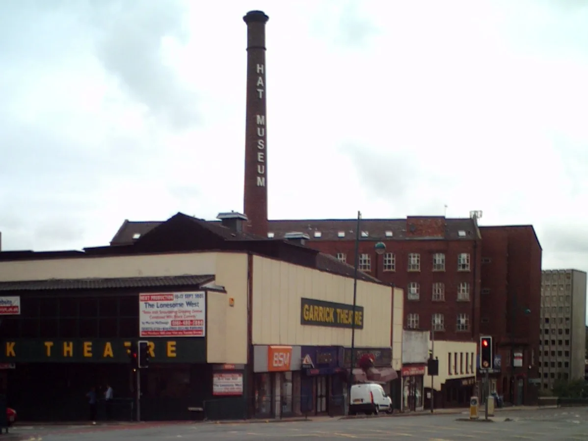
Hat Works
Hat Works — museum and former cotton mill Greater Manchester, England.
 📷 5
📷 5Theatres · West Midlands
The Plaza
The Plaza is a theatre in the United Kingdom.
 📷 3
📷 3Theatres · West Midlands
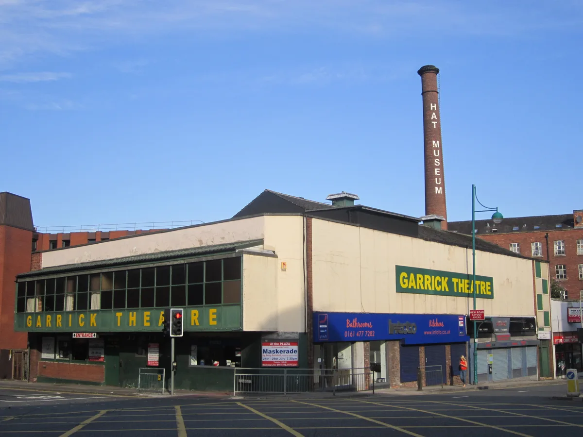
Stockport Garrick Theatre
Stockport Garrick Theatre is a theatre in the United Kingdom.
 📷 4
📷 4Historic churches · West Midlands
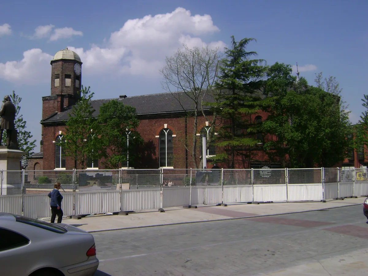
St Peter's Church, Stockport
St Peter's Church, Stockport — Grade II listed church in Stockport, UK.
Other bridges from this era
.JPG?width=1200) 📷 5
📷 5Historic bridges · London
Black Potts Railway Bridge
Black Potts Railway Bridge is a historic bridge in the United Kingdom.
 📷 5
📷 5Historic bridges · London
Blackfriars Bridge
Blackfriars Bridge is a historic bridge in the United Kingdom.
 📷 5
📷 5Historic bridges · London
Cannon Street Railway Bridge
Cannon Street Railway Bridge is a historic bridge in the United Kingdom.
 📷 5
📷 5Historic bridges · London
Digswell Viaduct
Digswell Viaduct is a historic bridge in the United Kingdom.
More bridges in this region
.jpg?width=1200) 📷 4
📷 4Historic bridges · West Midlands
Abbey Park Road
Abbey Park Road is a historic bridge in the United Kingdom.
 📷 3
📷 3Historic bridges · West Midlands
Albert Bridge
Albert Bridge is a historic bridge in the United Kingdom.
 📷 3
📷 3Historic bridges · West Midlands
Anchor Bridge
Anchor Bridge is a historic bridge in the United Kingdom.
.JPG?width=1200) 📷 5
📷 5Historic bridges · West Midlands
Appleford Railway Bridge
Appleford Railway Bridge is a historic bridge in the United Kingdom.
Frequently asked questions
- Where is Stockport Viaduct?
- Stockport Viaduct is in the West Midlands, United Kingdom (postcode SK4 1AR), in the parish of Stockport, unparished area.
- When was Stockport Viaduct built?
- Built or established in 1839.
- Who owns Stockport Viaduct?
- Stockport Viaduct is owned by Network Rail.
- How do I get to Stockport Viaduct?
- The nearest railway station is Stockport, about 0.5 km away. Drivers can navigate to postcode SK4 1AR.