Towns & cities · West Midlands
Stevington
Stevington — village and civil parish in Bedfordshire, UK.

Wikimedia Commons contributors — see linked file page for photographer and licence licence
Plan your visit
- Typical visit
- 3 h–6 h
- Nearest railway station
- Bedford · 6.3 km
- Free entry
- Family-friendly
- Dog-friendly
About
Stevington is a town, city, village or settlement in the United Kingdom. Recent population estimates put it at around 552 people. Address: MK43. Wikidata describes it as: "village and civil parish in Bedfordshire, UK". Coordinates: 52.1690°, -0.5550°.
Photo gallery
From the Wikipedia article
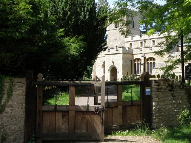
Stevington is a village and civil parish in the Borough of Bedford in northern Bedfordshire, England. It is on the River Great Ouse four to five miles northwest of Bedford. Nearby villages include Bromham, Oakley, Pavenham and Turvey. West End lies northwest of the village, and forms part of the same civil parish. The village has a fine Medieval Church as well as a number of listed buildings spanning the centuries. The first church on this site was probably a wooden building constructed during the Anglo Saxon period between 886 and 1016; this was later replaced by a stone building.
Excerpt from Wikipedia under CC BY-SA 4.0. See the source article linked in Sources below.
Background
History
The earliest surviving part of the present-day church is the lowest third of the tower which probably dates from the early 10th century. As the population and wealth of the village grew so too did the church buildings. This culminated in the fifteenth century with the raising of the church roof and the raising of a second stage to the tower. In 1872 the church was reopened after restoration amounting to £1927. The church has an associated holy well. The holy well is to the north of the church and has never been known to freeze or to fail in times of drought. In the Middle Ages various miraculous powers were ascribed to the waters, particularly in respect to curing ailments of the eyes. It…
Sourced from Wikipedia under CC BY-SA 4.0.
- Coordinates
- 52.1690, -0.5550
- District
- Bedford
- Parish
- Stevington
- Postcode
- MK43
- Parliamentary constituency
- North Bedfordshire
- Population
- 552
- Nearest railway station
- Bedford — 6.3 km
Sources
- wikidata: Q1520344 (CC0)
- wikipedia: Stevington (CC BY-SA 4.0)
- commons: Stevington village centre - geograph.org.uk - 88066.jpg (CC BY-SA 4.0)
Other places nearby
Loading nearby places…
Nearby
 📷 3
📷 3Historic churches · West Midlands
Church of St Mary, Stevington
Church of St Mary, Stevington — Grade I listed church in Stevington, Bedford, Bedfordshire, England, UK.
 📷 3
📷 3Windmills · West Midlands
Stevington Post Mill
Stevington Post Mill is a windmill in the United Kingdom.
 📷 3
📷 3Windmills · West Midlands
Stevington Windmill
Stevington Windmill — Grade II* listed building-listed windmill in england-west-midlands, United Kingdom.
 📷 4
📷 4Towns & cities · West Midlands
West End
West End — village in Bedfordshire, United Kingdom.
.jpg?width=1200) 📷 5
📷 5Towns & cities · West Midlands
Pavenham
Pavenham — village and civil parish in Bedfordshire, UK.
 📷 3
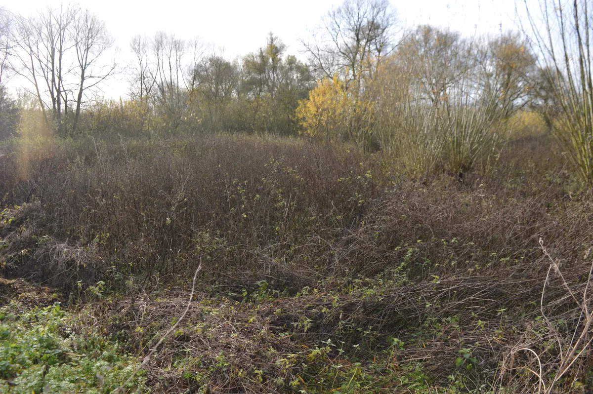
📷 3Wildlife reserves · West Midlands
Pavenham Osier Beds
Pavenham Osier Beds — nature reserve in the United Kingdom.
More towns in this region
 Flagship📷 3
Towns & cities · West Midlands
Adderbury
Adderbury — village and civil parish in Cherwell district, Oxfordshire, England.
 Flagship📷 3
Towns & cities · West Midlands
Admington
Admington — village in Warwickshire, England, UK.
 Flagship📷 3
Towns & cities · West Midlands
Aldington
Aldington — village in Worcestershire, United Kingdom.
 Flagship📷 5
Towns & cities · West Midlands
Anstey
Anstey — large village in Leicestershire, England.
Frequently asked questions
- Where is Stevington?
- Stevington is in the West Midlands, United Kingdom (postcode MK43), in the parish of Stevington.
- Is Stevington free to visit?
- Yes, Stevington is free to enter.
- How do I get to Stevington?
- The nearest railway station is Bedford, about 6.3 km away. Drivers can navigate to postcode MK43.