Natural landmarks · North West England
Steel Fell
Steel Fell — mountain in the Lake District, Cumbria, United Kingdom.

Wikimedia Commons contributors — see linked file page for photographer and licence licence
Plan your visit
- Typical visit
- 1 h–2 h
- Free entry
- Dog-friendly
About
Steel Fell is a named natural landmark in the United Kingdom. Wikidata describes it as: "mountain in the Lake District, Cumbria, United Kingdom". Coordinates: 54.4915°, -3.0528°.
Photo gallery
Protected designations
- Site of Special Scientific Interest: River Derwent and Tributaries SSSI
Designations sourced from Natural England open data under OGL v3.
From the Wikipedia article
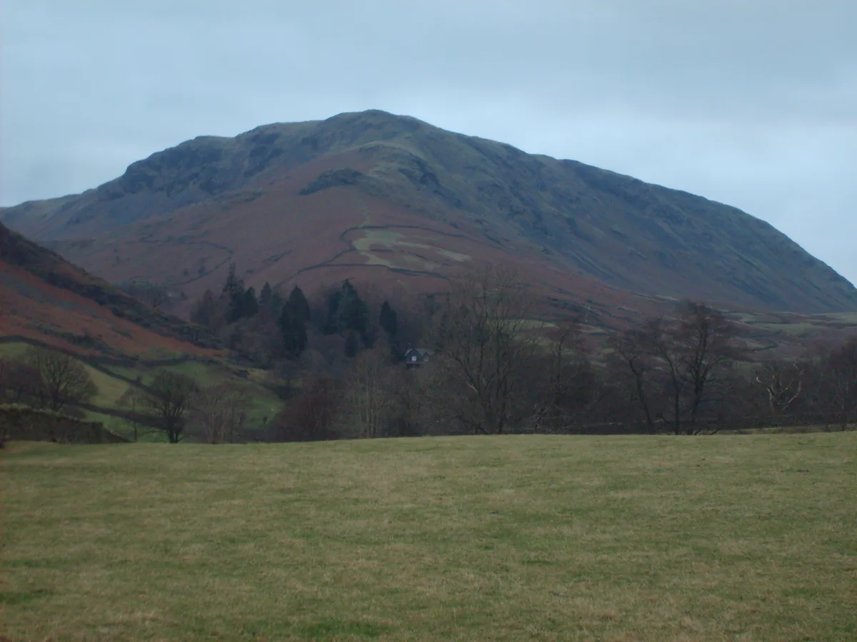
Steel Fell is a fell in the English Lake District, lying between Thirlmere and Grasmere. It is triangular in plan, the ridges running north, west and south east. Steel Fell rises to the west of the Dunmail Raise road and can be climbed from the summit, or from Grasmere and Wythburn.
Excerpt from Wikipedia under CC BY-SA 4.0. See the source article linked in Sources below.
- Coordinates
- 54.4915, -3.0528
- District
- Cumberland
- Parish
- St John's Castlerigg and Wythburn
- Postcode
- CA12 4TP
- Parliamentary constituency
- Penrith and Solway
Sources
- wikidata: Q7605671 (CC0)
- wikipedia: Steel Fell (CC BY-SA 4.0)
- commons: Steel Fell.JPG (CC BY-SA 4.0)
Other places nearby
Loading nearby places…
Nearby
 📷 3
📷 3Mountains & hills · North West England
Steel Fell
Steel Fell — Named summit at 553 m.
 📷 3
📷 3Natural landmarks · North West England
Gibson Knott
Gibson Knott — mountain in United Kingdom.
 📷 3
📷 3Natural landmarks · North West England
Calf Crag
Calf Crag — mountain in the Lake District, Cumbria, United Kingdom.
 📷 3
📷 3Mountains & hills · North West England
Calf Crag
Calf Crag — Named summit at 537 m.
 📷 3
📷 3Natural landmarks · North West England
Helm Crag
Helm Crag — mountain in United Kingdom.
 📷 3
📷 3Mountains & hills · North West England
Helm Crag
Helm Crag — Named summit at 405 m.
More natural landmarks in this region
 ★ Iconic📷 4
Natural landmarks · North West England
Coniston Water
Lake District lake — Swallows and Amazons setting and Donald Campbell water-speed history.
 📷 3
📷 3Natural landmarks · North West England
Elter Water
Elter Water — lake in the United Kingdom.
 📷 3
📷 3Natural landmarks · North West England
Esthwaite Water
Esthwaite Water — lake in the United Kingdom.
 Flagship📷 5
Natural landmarks · North West England
Semerwater
Semerwater — lake in North Yorkshire, England, UK.
Frequently asked questions
- Where is Steel Fell?
- Steel Fell is in North-West England, United Kingdom (postcode CA12 4TP), in the parish of St John's Castlerigg and Wythburn.
- Is Steel Fell a protected site?
- Yes — Steel Fell is part of the River Derwent and Tributaries SSSI Site of Special Scientific Interest.
- Is Steel Fell free to visit?
- Yes, Steel Fell is free to enter.
- How do I get to Steel Fell?
- Drivers can navigate to postcode CA12 4TP. It sits within the Penrith and Solway parliamentary constituency.