Towns & cities · South East England
Stanmer
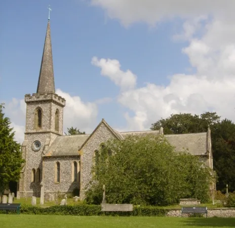
Stanmer — village on the eastern outskirts of Brighton, in East Sussex, England.

Wikimedia Commons contributors — see linked file page for photographer and licence licence
Plan your visit
- Typical visit
- 3 h–6 h
- Nearest railway station
- Falmer · 1.3 km
- Free entry
- Family-friendly
- Dog-friendly
About
Stanmer is a town, city, village or settlement in the United Kingdom. Address: BN1. Wikidata describes it as: "village on the eastern outskirts of Brighton, in East Sussex, England". Coordinates: 50.8694°, -0.1018°.
Photo gallery
Protected designations
- Area of Outstanding Natural Beauty: High Weald
Designations sourced from Natural England open data under OGL v3.
From the Wikipedia article
Stanmer is a village on the northern edge of the city of Brighton and Hove, in the ceremonial county of East Sussex, England. It was formerly a civil parish until 1952 when it was split between Brighton and Falmer.
Excerpt from Wikipedia under CC BY-SA 4.0. See the source article linked in Sources below.
Background
History
The etymological root of the name is "Stony Mere", Old English for "stone pond", referring to the sarsen stones around Stanmer village pond. The stones are not in their original situation, but have been gathered from the Downs and landscaped into the park's appearance. There have been rather inconclusive archaeological excavations at Pudding Bag Wood and Rocky Clump in the north of the park, and in Stanmer Great Wood, producing evidence of occupation from Neolithic times onwards. The village is first recorded in about 765 A.D. when (if the document is authentic) land there was granted by king Ealdwulf of Sussex to Hunlaf in order that he might found a college of secular canons at South…
Sourced from Wikipedia under CC BY-SA 4.0.
- Coordinates
- 50.8694, -0.1018
- District
- Brighton and Hove
- Parish
- Brighton and Hove, unparished area
- Postcode
- BN1
- Parliamentary constituency
- Brighton Pavilion
- Nearest railway station
- Falmer — 1.3 km
Sources
- wikidata: Q780237 (CC0)
- wikipedia: Stanmer (CC BY-SA 4.0)
- commons: Stanmer village - geograph.org.uk - 1267624.jpg (CC BY-SA 4.0)
Other places nearby
Loading nearby places…
Nearby
 Flagship📷 5
Historic houses · South East England
Stanmer House
Stanmer House — a Grade I-listed historic house in england-south-east, United Kingdom.
 📷 5
📷 5Historic churches · South East England
Stanmer Church
Stanmer Church — grade II listed church in England.
📷 5Museums · South East England
Stanmer Craft Museum
Stanmer Craft Museum — a museum in england-south-east, United Kingdom.
 Flagship📷 10
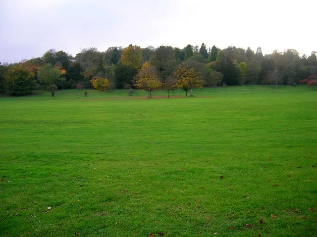
Parks · South East England
Stanmer Park
Stanmer Park — park northeast of Brighton and Hove, UK.
Vineyards · South East England
Medieval settlement at Stanmer
Medieval settlement at Stanmer — a UK vineyard in england south east, producing English or Welsh wine from cool-climate grape varieties.
 📷 5
📷 5Viewpoints · South East England
Observatory ruin
Observatory ruin is a viewpoint in the United Kingdom.
More towns in this region
 Flagship📷 10
Towns & cities · South East England
Aldermaston
Aldermaston — village and civil parish in West Berkshire in England, UK.
 Flagship📷 10
Towns & cities · South East England
Aldingbourne
Aldingbourne — village and civil parish in Arun, West Sussex, UK.
 Flagship📷 10
Towns & cities · South East England
Aldington
Aldington — village and civil parish in the Ashford District of Kent, England.
 Flagship📷 10
Towns & cities · South East England
Aldworth
Aldworth — village and civil parish in the English county of Berkshire.
Frequently asked questions
- Where is Stanmer?
- Stanmer is in South-East England, United Kingdom (postcode BN1), in the parish of Brighton and Hove, unparished area.
- Is Stanmer a protected site?
- Yes — Stanmer is part of the High Weald National Landscape (AONB).
- Is Stanmer free to visit?
- Yes, Stanmer is free to enter.
- How do I get to Stanmer?
- The nearest railway station is Falmer, about 1.3 km away. Drivers can navigate to postcode BN1.