Windmills · South West England
Standing stone 340m south of Trye Farm
Standing stone 340m south of Trye Farm — a post mill in england-south-west, United Kingdom.

David Smith — CC BY-SA 2.0 via Wikimedia Commons licence
Plan your visit
- Typical visit
- 30 min–1 h
- Free entry
- Family-friendly
- Dog-friendly
About
Standing stone 340m south of Trye Farm is a post mill located in england-south-west, United Kingdom. Catalogued from Wikidata's UK heritage register; see the linked Wikipedia article for further details on its history, architecture and visiting information.
Photo gallery
Place summary
The Standing Stone, located 340 metres south of Trye Farm in South-West England, is a prehistoric monument. It is characterised by its solitary stone structure, which reflects the region's ancient history. The site contributes to the rich archaeological landscape of the area.
AI-generated from the structured facts on this page (operator, designation, listing, era). Not a substitute for visiting.
- Coordinates
- 50.1602, -5.5582
- District
- Cornwall
- Parish
- Madron
- Postcode
- TR20 8UX
- Parliamentary constituency
- St Ives
Sources
- wikidata: Q17642595 (CC0)
Other places nearby
Loading nearby places…
Nearby
 📷 5
📷 5Hill forts · South West England
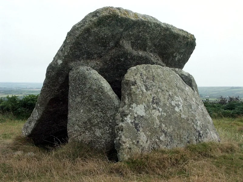
Mulfra Quoit
Mulfra Quoit — dolmen in the Cornwall region, England.
Campsites · South West England
Lower Crankan Farm
Lower Crankan Farm — a campsite in england south west.
 📷 3
📷 3Archaeological sites · South West England
Fogou
Fogou — a archaeological in england-south-west, United Kingdom.
 📷 5
📷 5Hill forts · South West England
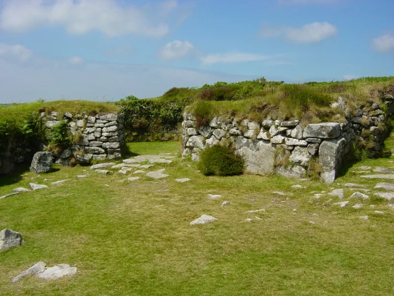
Chysauster Ancient Village
Chysauster Ancient Village — archaeological site in New Mill, Cornwall, Cornwall, England, UK.
 📷 3
📷 3Archaeological sites · South West England
Bodrifty Iron Age Village
Bodrifty Iron Age Village — a archaeological in england-south-west, United Kingdom.
 📷 3
📷 3Historic houses · South West England
Tredinnick Engine House (Ding Dong Mine)
Tredinnick Engine House (Ding Dong Mine) — a historic house in england-south-west, United Kingdom.
More windmills in this region
 📷 5
📷 5Windmills · South West England
Ashton Windmill
Ashton Windmill is a windmill in the United Kingdom.
 📷 3
📷 3Windmills · South West England
Stembridge Tower Mill
Stembridge Tower Mill is a windmill in the United Kingdom.
 📷 3
📷 3Windmills · South West England
The Old Windmill
The Old Windmill is a windmill in the United Kingdom.
 📷 4
📷 4Windmills · South West England
Paignton Windmill
Paignton Windmill — Grade II listed building-listed windmill in england-south-west, United Kingdom.
Frequently asked questions
- Where is Standing stone 340m south of Trye Farm?
- Standing stone 340m south of Trye Farm is in South-West England, United Kingdom (postcode TR20 8UX), in the parish of Madron.
- Is Standing stone 340m south of Trye Farm free to visit?
- Yes, Standing stone 340m south of Trye Farm is free to enter.
- How do I get to Standing stone 340m south of Trye Farm?
- Drivers can navigate to postcode TR20 8UX. It sits within the St Ives parliamentary constituency.